File:Atlas and zoogeography of common fishes in the Bering Sea and Northeastern Pacific - M. James Allen, Gary B. Smith (1988) (19723754823).jpg

From Wikimedia Commons, the free media repository
Jump to navigation Jump to search

Original file(2,290 × 1,512 pixels, file size: 494 KB, MIME type: image/jpeg)

Captions

Captions

Add a one-line explanation of what this file represents

Summary

[edit]
Description
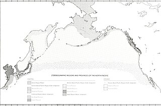
English:

Title: Atlas and zoogeography of common fishes in the Bering Sea and Northeastern Pacific / M. James Allen, Gary B. Smith
Identifier: atlaszoogeograph00alle (find matches)
Year: 1988 (1980s)
Authors: Allen, M. James; Smith, Gary B; United States. National Marine Fisheries Service
Subjects: Fishes Bering Sea Geographical distribution.
Publisher: Seattle, WA : U. S. Dept. of Commerce, National Oceanic and Atmospheric Administration, National Marine Fisheries Service ; Springfield, VA : May be obtained from U. S. Dept. of Commerce, National Technical Information Service
Contributing Library: Penn State University
Digitizing Sponsor: LYRASIS Members and Sloan Foundation

View Book Page: Book Viewer
About This Book: Catalog Entry
View All Images: All Images From Book
Click here to view book online to see this illustration in context in a browseable online version of this book.

Text Appearing Before Image:
I ' I I I
Text Appearing After Image:
- 40 00N 115 OOE 125 OOE 135 OOE 145 OOE 155 OOE 165 OOE 175 OOE 175 00* 165 OOW 155 OOW 145 OOW 135 OOW 125 OOW 115 OOW 105 OOW Figure 3 Zoogeographic provinces of the North Pacific. Three geographic regions were considered "gray areas" in terms of classification. These include the Bering Sea from Nunivak Island and Cape Olyutorski to the Bering Strait; the coast from Sitka, Alaska, to Puget Sound, Washington; and the coast from Point Con- ception, California, to Cedros Island, Baja California. Each of these regions can be classed as either of two provinces recognized by Briggs (1974): Arctic or Aleutian for the Bering Sea, Aleutian or Oregonian for the eastern Gulf of Alaska, and Oregonian (Montereyan) or San Diegan for southern California-Baja California. If the range of a species extends from the north into one of the regions (but no further south), the region was included with the northern classification and the reverse if the species range was to the south. For instance, an Arctic species extending into the Bering Sea was considered to be Arctic and an Aleutian species extending to the Bering Strait was considered to be Aleutian even though both occurred in the northern Bering Sea. Species extending into the Chukchi Sea were considered Arctic although they may not extend further north. Life zone classification scheme Life zone classification schemes divide lifestyle regions (pelagic or benthic) into depth zones with different faunas. Other divisions of habitat (such as rocky bottom, soft-bottom, or kelp bed) are not considered in these schemes. Because many physical parameters (such as light intensity, pressure, and temperature) vary directly or indirectly with depth, organisms living in one zone are often quite different from those living in contiguous zones. The most widely-used life zone classification scheme is that of Hedgpeth (1957a). This classification scheme divides the marine environment into two lifestyle regions: pelagic and benthic. The upper pelagic environment is divided into a Neritic Region above the shelf (0-200 m) and an Oceanic Region above the slope and basins. This latter region is divided into an Epipelagic Zone (0-100 m), a Mesopelagic Zone (100-1000 m), and a Bathypelagic Zone (1000-4000 m). The upper benthic environment is divided into an Intertidal Zone, a Sublittoral Zone (0-200 m), and a Bathyal Zone (200-4000 m). In addition, deep ocean (Abyssal, Abyssopelagic, and Hadal) and estuarine zones are included. Hedgpeth (1957a) suggested that the shelf could be divided into Inner and Outer Sublittoral Zones, the former extending from 0 to 100 m and the latter from 100 to 200 m. Allen (1982) described three major zones for demersal fishes on the southern California shelf. These include an Inner Shelf Zone from 0 to 20 m, and Outer Shelf Zone from 20 to 80 m, and an Upper Slope Zone from 80 to 170 m (the shelf break is at 80 m). In the Bering Sea (the broadest

Note About Images

Please note that these images are extracted from scanned page images that may have been digitally enhanced for readability - coloration and appearance of these illustrations may not perfectly resemble the original work.
Date
Source

https://www.flickr.com/photos/internetarchivebookimages/19723754823/

Author Internet Archive Book Images
Permission
(Reusing this file)
At the time of upload, the image license was automatically confirmed using the Flickr API. For more information see Flickr API detail.
Flickr tags
InfoField
  • bookid:atlaszoogeograph00alle
  • bookyear:1988
  • bookdecade:1980
  • bookcentury:1900
  • bookauthor:Allen_M_James
  • bookauthor:Smith_Gary_B
  • bookauthor:United_States_National_Marine_Fisheries_Service
  • booksubject:Fishes_Bering_Sea_Geographical_distribution_
  • bookpublisher:Seattle_WA_U_S_Dept_of_Commerce_National_Oceanic_and_Atmospheric_Administration_National_Marine_Fisheries_Service_Springfield_VA_May_be_obtained_from_U_S_Dept_of_Commerce_National_Technical_Information_Service
  • bookcontributor:Penn_State_University
  • booksponsor:LYRASIS_Members_and_Sloan_Foundation
  • bookleafnumber:11
  • bookcollection:penn_state_univ
  • bookcollection:americana
  • BHL Collection
Flickr posted date
InfoField
6 August 2015


Licensing

[edit]
This image was taken from Flickr's The Commons. The uploading organization may have various reasons for determining that no known copyright restrictions exist, such as:
  1. The copyright is in the public domain because it has expired;
  2. The copyright was injected into the public domain for other reasons, such as failure to adhere to required formalities or conditions;
  3. The institution owns the copyright but is not interested in exercising control; or
  4. The institution has legal rights sufficient to authorize others to use the work without restrictions.

More information can be found at https://flickr.com/commons/usage/.


Please add additional copyright tags to this image if more specific information about copyright status can be determined. See Commons:Licensing for more information.
This image was originally posted to Flickr by Internet Archive Book Images at https://flickr.com/photos/126377022@N07/19723754823. It was reviewed on 29 September 2015 by FlickreviewR and was confirmed to be licensed under the terms of the No known copyright restrictions.

29 September 2015

File history

Click on a date/time to view the file as it appeared at that time.

Date/TimeThumbnailDimensionsUserComment
current21:27, 29 September 2015Thumbnail for version as of 21:27, 29 September 20152,290 × 1,512 (494 KB) (talk | contribs)== {{int:filedesc}} == {{information |description={{en|1=<br> '''Title''': Atlas and zoogeography of common fishes in the Bering Sea and Northeastern Pacific / M. James Allen, Gary B. Smith<br> '''Identifier''': atlaszoogeograph00alle ([https://commons...

There are no pages that use this file.