File:Australia South Australia location map.svg
跳转到导航
跳转到搜索

此SVG文件的PNG预览的大小:516 × 599像素。 其他分辨率:207 × 240像素 | 413 × 480像素 | 661 × 768像素 | 882 × 1,024像素 | 1,763 × 2,048像素 | 1,535 × 1,783像素。
原始文件 (SVG文件,尺寸为1,535 × 1,783像素,文件大小:367 KB)
说明
说明
添加一行文字以描述该文件所表现的内容
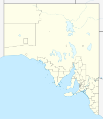
Suburbs of South Australia, Australia
摘要[编辑]
| 描述 |
Quadratische Plattkarte, N-S-Streckung 117 %. Geographische Begrenzung der Karte:
Equirectangular projection, N/S stretching 117 %. Geographic limits of the map:
|
|
| 日期 | ||
| 来源 |
自己的作品, using
|
|
| 作者 | NordNordWest | |
| 授权 (二次使用本文件) |
本文件采用知识共享署名-相同方式共享 3.0 德国许可协议授权。
 本文件采用知识共享署名-相同方式共享 3.0 德国许可协议授权。
|


|
|
文件历史
点击某个日期/时间查看对应时刻的文件。
| 日期/时间 | 缩略图 | 大小 | 用户 | 备注 | |
|---|---|---|---|---|---|
| 当前 | 2010年4月4日 (日) 22:08 | | 1,535 × 1,783(367 KB) | Chumwa(留言 | 贡献) | Reverted to version as of 20:05, 29 December 2009 |
| 2010年4月4日 (日) 21:54 |  | 1,535 × 1,783(316 KB) | Roke~commonswiki(留言 | 贡献) | local government low salience, dont appear on general use maps | |
| 2009年12月29日 (二) 20:05 |  | 1,535 × 1,783(367 KB) | NordNordWest(留言 | 贡献) | =={{int:filedesc}}== {{Information |Description= {{de|Positionskarte von South Australia, Australien}} Quadratische Plattkarte, N-S-Streckung 117 %. Geographische Begrenzung der Karte: * N: 25.6° S * S: 38.5° S |
您不可以覆盖此文件。
文件用途
以下页面使用本文件:
全域文件用途
以下其他wiki使用此文件:
- af.wikipedia.org上的用途
- ar.wikipedia.org上的用途
- ast.wikipedia.org上的用途
- azb.wikipedia.org上的用途
- ba.wikipedia.org上的用途
- be.wikipedia.org上的用途
- bg.wikipedia.org上的用途
- ceb.wikipedia.org上的用途
- de.wikipedia.org上的用途
- Adelaide
- Coober Pedy
- Klemzig
- Woomera (Australien)
- Riverland
- Goodwood (South Australia)
- Keith (Australien)
- Hahndorf (South Australia)
- Waterfall Gully
- Maralinga
- Renmark
- Naracoorte
- William Creek
- Aldgate (South Australia)
- Mount Gambier
- Murray Bridge
- Port Augusta
- Port Pirie
- Port Lincoln
- Victor Harbor
- Whyalla
- Anna Creek Station
- Tarcoola
- Melrose (South Australia)
- Cook (South Australia)
- Vorlage:Positionskarte Australien Südaustralien
- Lobethal
- Ooldea
- Flughafen Port Augusta
- Flugplatz Coober Pedy
- Angaston
- Mungeranie
- Wikipedia:Kartenwerkstatt/Positionskarten/Australien und Ozeanien
- Burra (Australien)
查看本文件的更多全域用途。