File:Balkans in 1350 according to Gustav Droysen from 19th century.jpg

Original file (1,367 × 1,268 pixels, file size: 546 KB, MIME type: image/jpeg)
Captions
Captions
Summary
[edit]
| Description |
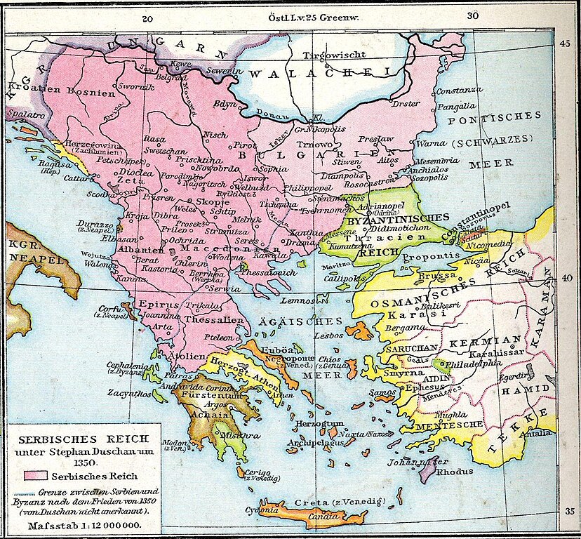
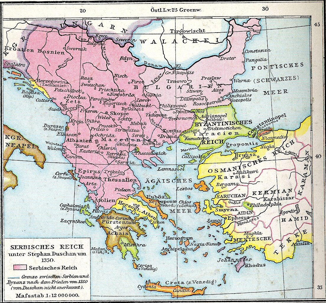
English: Map from late XIX century, representing a view about boundaries of Serbian empire during Stefan Dušan, about 1350. (Modern historiography has a stance that borders of Serbian empire were somewhat different. For the view of modern historiography, please see this map.)
Српски / srpski: Mapa iz druge polovine 19. veka, koja pokazuje gledište o granicama Srpskog carstva u doba Stefana Dušana, oko 1350. godine (Moderna istoriografija zastupa gledište da su granice Srpskog carstva bile nešto drugačije. Za prikaz gledišta moderne istoriografije, pogledati ovu mapu.)
Deutsch: Serbisches Reich |
| Date | |
| Source | Allgemeiner historischer Handatlas |
| Author | Gustav Droysen |
Licensing
[edit]
|
This work is in the public domain in its country of origin and other countries and areas where the copyright term is the author's life plus 70 years or fewer.
| |
| This file has been identified as being free of known restrictions under copyright law, including all related and neighboring rights. | |
Original upload log
[edit]
Transferred from de.wikipedia to Commons by Septembermorgen using CommonsHelper.
- 2007-10-17 15:50 Interrex 577×522× (299646 bytes) {{Information |Beschreibung = Allgemeiner historischer Handatlas |Quelle = |Urheber = Gustav Droysen |Datum = 1886 |Genehmigung = |Andere Versionen = |Anmerkungen =
- 2007-10-17 15:44 Interrex 577×522× (41312 bytes) {{Information |Beschreibung = Allgemeiner historischer Handatlas |Quelle = |Urheber = Gustav Droysen |Datum = 1886 |Genehmigung = |Andere Versionen = |Anmerkungen = }}
File history
Click on a date/time to view the file as it appeared at that time.
| Date/Time | Thumbnail | Dimensions | User | Comment | |
|---|---|---|---|---|---|
| current | 21:04, 23 September 2015 | | 1,367 × 1,268 (546 KB) | BosnaSRB RS (talk | contribs) | Карта са српског царства са већом резолуцијом. |
| 11:30, 10 July 2010 |  | 577 × 522 (293 KB) | File Upload Bot (Magnus Manske) (talk | contribs) | {{BotMoveToCommons|de.wikipedia|year={{subst:CURRENTYEAR}}|month={{subst:CURRENTMONTHNAME}}|day={{subst:CURRENTDAY}}}} {{Information |Description={{de|Serbisches Reich}} |Source=Transferred from [http://de.wikipedia.org de.wikipedia]; transferred to Comm |
You cannot overwrite this file.
File usage on Commons
The following 2 pages use this file:
- User:Sir James/Bonn/2015 September 23
- File:Balkan 1350.jpg (file redirect)
File usage on other wikis
The following other wikis use this file:
- Usage on ar.wikipedia.org
- Usage on bg.wikipedia.org
- Usage on bs.wikipedia.org
- Usage on de.wikipedia.org
- Usage on en.wikipedia.org
- Usage on et.wikipedia.org
- Usage on sh.wikipedia.org
- Usage on sr.wikipedia.org
- 19th-century maps of the Balkans
- 1886 maps
- Old maps of Serbia
- Stefan Dušan
- Maps of the Serbian Empire
- Maps of the history of Montenegro in the Middle Ages
- Maps of the history of North Macedonia in the Middle Ages
- Maps of Bosnia in the Middle Ages (without source, disputed)
- Maps of the history of Vojvodina
- Maps of the history of Syrmia
- Maps of the history of the medieval Balkans
- 1350 in Greece
- Maps showing 14th-century history
- Maps from Allgemeiner Historischer Handatlas
- Old maps of the Byzantine Empire
- Maps of the history of Greece
- Greece in the 14th century
- Maps of 14th-century Montenegro
- Maps of Zeta in the Serbian Empire