File:Baltic Sea location map.svg

Original file (SVG file, nominally 869 × 1,039 pixels, file size: 881 KB)
Captions
Captions
Summary
[edit]| Description |
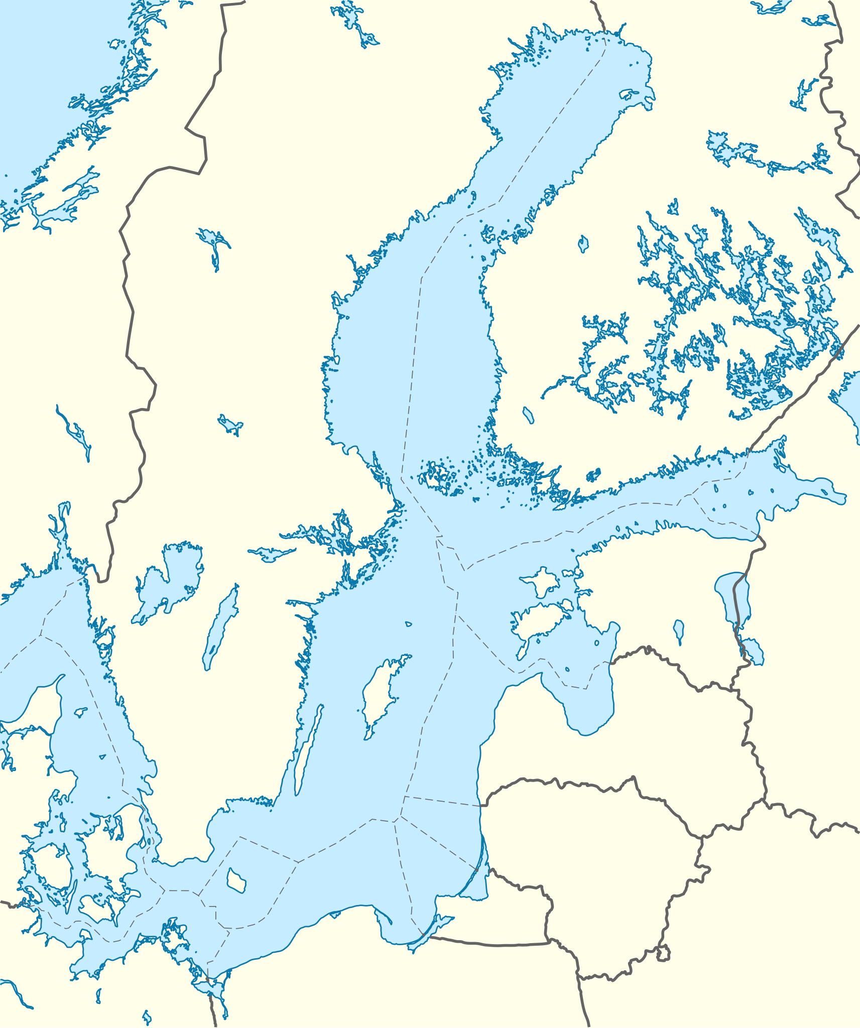
Quadratische Plattkarte, N-S-Streckung 200 %. Geographische Begrenzung der Karte:
English: Location map of the Baltic Sea
Equirectangular projection, N/S stretching 200 %. Geographic limits of the map:
|
|
| Date | ||
| Source | own work, using World Data Base II data | |
| Author | NordNordWest | |
| Permission (Reusing this file) |
This file is licensed under the Creative Commons Attribution-Share Alike 3.0 Germany license.
 This file is licensed under the Creative Commons Attribution-Share Alike 3.0 Unported license.
|


|
This map has been made or improved in the German Kartenwerkstatt (Map Lab). You can propose maps to improve as well.
|
File history
Click on a date/time to view the file as it appeared at that time.
| Date/Time | Thumbnail | Dimensions | User | Comment | |
|---|---|---|---|---|---|
| current | 18:13, 1 October 2010 | | 869 × 1,039 (881 KB) | NordNordWest (talk | contribs) | == {{int:filedesc}} == {{Information |Description= {{de|Positionskarte der Ostsee}} Quadratische Plattkarte, N-S-Streckung 200 %. Geographische Begrenzung der Karte: * N: 66.2° N * S: 53.3° N * W: 9.0° O * O: 30.6° O {{en|Location map o |
You cannot overwrite this file.
File usage
The following 2 pages use this file:
Global file usage
The following other wikis use this file:
- Usage on ab.wikipedia.org
- Usage on ar.wikipedia.org
- Usage on az.wikipedia.org
- Usage on ba.wikipedia.org
- Usage on be.wikipedia.org
- Usage on bn.wikipedia.org
- Usage on bxr.wikipedia.org
- Usage on ceb.wikipedia.org
- Usage on ce.wikipedia.org
- Usage on de.wikipedia.org
- Usage on en.wikipedia.org
- Svetlogorsk, Kaliningrad Oblast
- Vyborg Bay
- Vistula Spit
- Rakvere
- Juodkrantė
- Bagrationovsk
- Khrabrovo Airport
- Primorsk, Leningrad Oblast
- Finnish escort Aura II
- Vyborg
- Gretagrund
- Bothnian Sea National Park
- Bay of Pomerania (nature reserve)
- Stubber
- Module:Location map/data/Baltic Sea/doc
- Międzyzdroje Pier
- Kriegers Flak
- Hiiu Shoal
- Adlergrund
- Hoburg Shoal
- Module:Location map/data/Baltic Sea
- Gotland Deep
- Usage on eo.wikipedia.org
- Usage on es.wikipedia.org
- Usage on et.wikipedia.org
- Usage on fa.wikipedia.org
- Usage on fi.wikipedia.org
View more global usage of this file.