File:Bedford UK locator map.svg
پرش به ناوبری
پرش به جستجو

حجم پیشنمایش PNG این SVG file:۵۳۰ × ۵۹۹ پیکسل کیفیتهای دیگر: ۲۱۲ × ۲۴۰ پیکسل | ۴۲۵ × ۴۸۰ پیکسل | ۶۷۹ × ۷۶۸ پیکسل | ۹۰۶ × ۱٬۰۲۴ پیکسل | ۱٬۸۱۲ × ۲٬۰۴۸ پیکسل | ۱٬۱۲۰ × ۱٬۲۶۶ پیکسل.
پروندهٔ اصلی (پروندهٔ اسویجی، با ابعاد ۱٬۱۲۰ × ۱٬۲۶۶ پیکسل، اندازهٔ پرونده: ۶۷۵ کیلوبایت)
گزینهها
عنوان
شرحی یکخطی از محتوای این فایل اضافه کنید
| توضیح |
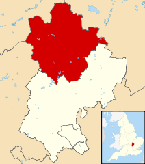
Map of Bedfordshire, UK with Bedford highlighted. Equirectangular map projection on WGS 84 datum, with N/S stretched 160% |
| تاریخ | |
| منبع |
|
| پدیدآور | Nilfanion, created using Ordnance Survey data |
| اجازهنامه (استفادهٔ مجدد از این پرونده) |
این پرونده با اجازهنامهٔ کریتیو کامانز Attribution-Share Alike 3.0 سازگار نشده منتشر شده است. انتساب: Contains Ordnance Survey data © Crown copyright and database right
|
تاریخچهٔ پرونده
روی تاریخ/زمانها کلیک کنید تا نسخهٔ مربوط به آن هنگام را ببینید.
| تاریخ/زمان | بندانگشتی | ابعاد | کاربر | توضیح | |
|---|---|---|---|---|---|
| کنونی | ۳ اوت ۲۰۱۱، ساعت ۲۲:۴۲ | | ۱٬۱۲۰ در ۱٬۲۶۶ (۶۷۵ کیلوبایت) | Nilfanion (بحث | مشارکتها) | {{Information |Description=Map of Bedfordshire, UK with Bedford highlighted. Equirectangular map projection on WGS 84 datum, with N/S stretched 160% |Source=Ordnance Survey [https://www.ord |
شما نمیتوانید این پرونده را رونویسی کنید.
کاربرد پرونده
صفحهٔ زیر از این تصویر استفاده میکند:
کاربرد سراسری پرونده
ویکیهای دیگر زیر از این پرونده استفاده میکنند:
- کاربرد در cy.wikipedia.org
- کاربرد در da.wikipedia.org
- کاربرد در en.wikipedia.org
- کاربرد در es.wikipedia.org
- کاربرد در fa.wikipedia.org
- کاربرد در fi.wikipedia.org
- کاربرد در frr.wikipedia.org
- کاربرد در fr.wikipedia.org
- Bedford (Royaume-Uni)
- Cardington (Bedfordshire)
- Kempston
- Wixams
- Bedford (district)
- Liste des paroisses civiles du Bedfordshire
- Carlton (Bedfordshire)
- Biddenham
- Modèle:Palette Bedford
- Oakley (Bedfordshire)
- Bletsoe
- Bolnhurst and Keysoe
- Colmworth
- Cople
- Wymington
- Staploe
- Stevington
- Stewartby
- Wootton (Bedfordshire)
- Willington (Bedfordshire)
- Wilden (Bedfordshire)
- Thurleigh
- Stagsden
- Sharnbrook
- Renhold
- Ravensden
- Podington
- Pertenhall
- Pavenham
- Odell (Bedfordshire)
- Milton Ernest
- Little Barford
- Little Staughton
- Harrold (Bedfordshire)
- Great Denham
- Great Barford
- Elstow
- Kempston Rural
- Knotting and Souldrop
- Dean and Shelton
- Wyboston, Chawston and Colesden
- Felmersham
- Chellington
نمایش استفادههای سراسری از این پرونده.