File:Beeston Castle - geograph.org.uk - 1566429.jpg
Jump to navigation
Jump to search
No higher resolution available.
Beeston_Castle_-_geograph.org.uk_-_1566429.jpg (640 × 480 pixels, file size: 81 KB, MIME type: image/jpeg)
Captions
Captions
Add a one-line explanation of what this file represents
Summary[edit]
| Description |
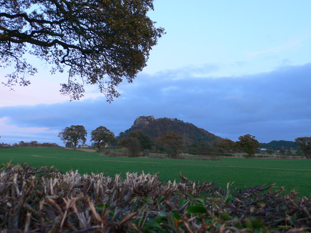
English: Beeston Castle The medieval ruins of Beeston Castle stand on a rocky summit 500ft above the Cheshire plain, offering views from the Pennines in the east to the mountains of Wales in the west. It dates from 1225 when it was built by Ranulf, the sixth Earl of Chester, and contains one of the deepest castle wells in the country. It was seized by King Henry III in 1237 and used by him and later his son, King Edward I, as a base for their campaigns against the Welsh. The castle was finally destroyed at the end of the Civil War. |
| Date | |
| Source | From geograph.org.uk |
| Author | Eirian Evans |
| Attribution (required by the license) | Eirian Evans / Beeston Castle / |
| Camera location | | View this and other nearby images on: OpenStreetMap |
|---|
_heading:90.00&language=en)
| Object location | | View this and other nearby images on: OpenStreetMap |
|---|
_heading:90.00&language=en)
Licensing[edit]

|
This image was taken from the Geograph project collection. See this photograph's page on the Geograph website for the photographer's contact details. The copyright on this image is owned by Eirian Evans and is licensed for reuse under the Creative Commons Attribution-ShareAlike 2.0 license.
|
This file is licensed under the Creative Commons Attribution-Share Alike 2.0 Generic license.
Attribution: Eirian Evans
- You are free:
- to share – to copy, distribute and transmit the work
- to remix – to adapt the work
- Under the following conditions:
- attribution – You must give appropriate credit, provide a link to the license, and indicate if changes were made. You may do so in any reasonable manner, but not in any way that suggests the licensor endorses you or your use.
- share alike – If you remix, transform, or build upon the material, you must distribute your contributions under the same or compatible license as the original.
File history
Click on a date/time to view the file as it appeared at that time.
| Date/Time | Thumbnail | Dimensions | User | Comment | |
|---|---|---|---|---|---|
| current | 16:11, 3 March 2011 | | 640 × 480 (81 KB) | GeographBot (talk | contribs) | == {{int:filedesc}} == {{Information |description={{en|1=Beeston Castle The medieval ruins of Beeston Castle stand on a rocky summit 500ft above the Cheshire plain, offering views from the Pennines in the east to the mountains of Wales in the west. It dat |
You cannot overwrite this file.
File usage on Commons
There are no pages that use this file.