File:Bere Alston station (geograph 4099860).jpg
Jump to navigation
Jump to search
Size of this preview: 800 × 527 pixels. Other resolutions: 320 × 211 pixels | 640 × 421 pixels | 1,024 × 674 pixels | 1,280 × 842 pixels | 1,720 × 1,132 pixels.
Original file (1,720 × 1,132 pixels, file size: 1.14 MB, MIME type: image/jpeg)
Captions
Captions
Add a one-line explanation of what this file represents
Summary
[edit].jpg&action=edit§ion=1)
| Description |
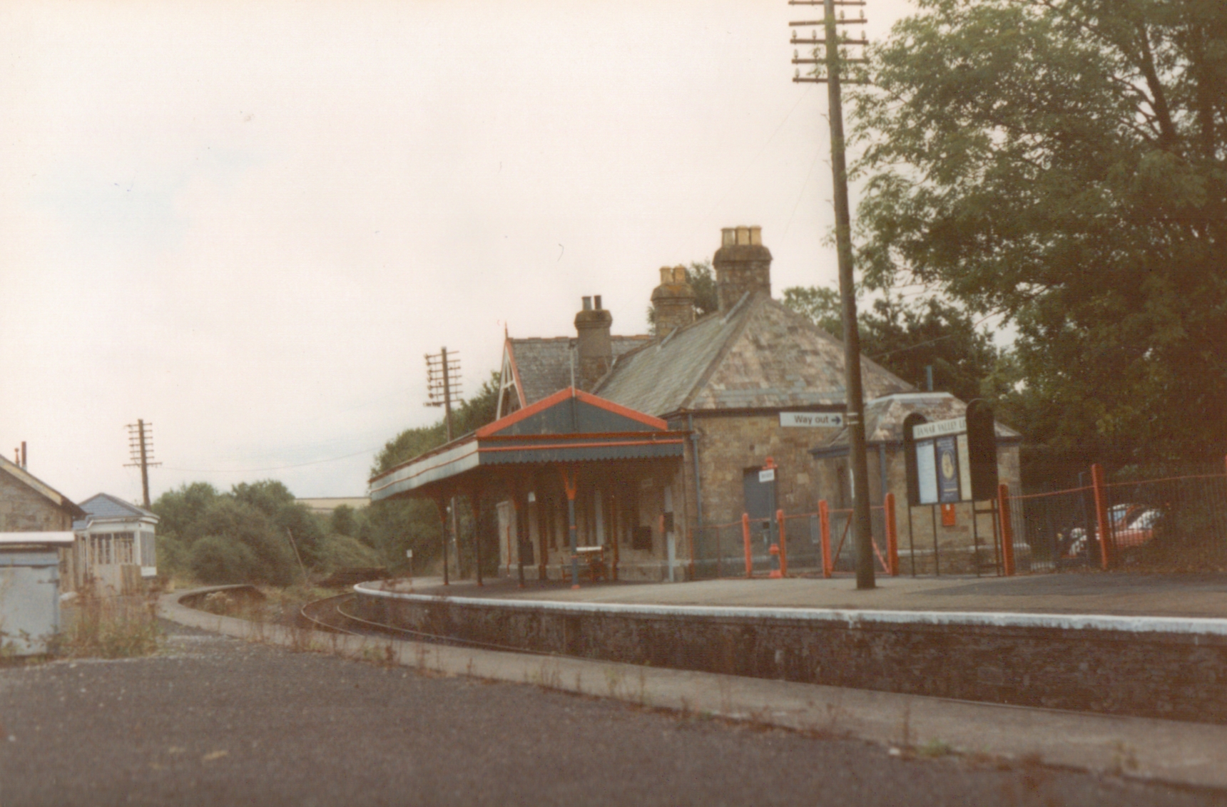
English: Bere Alston station A general view of Bere Alston station, taken from the disused up platform. The track once continued on through the station to Tavistock, Lydford and Okehampton, eventually joining the rest of the LSWR system at Cowley Bridge Junction south east of Crediton. Now the line terminates at Bere Alston, although with recent storm damage at Dawlish putting the coastal route out of action for months, there's talk of reopening this route. |
| Date | |
| Source | From geograph.org.uk |
| Author | John Winder |
| Permission (Reusing this file) |
Creative Commons Attribution Share-alike license 2.0 |
| Attribution (required by the license) | John Winder / Bere Alston station / |
| Camera location | | View this and other nearby images on: OpenStreetMap |
|---|
.jpg¶ms=050.485682_N_-004.200359_E_globe:Earth_type:camera_source:geograph-osgb36(SX44006741)_heading:112.00&language=en)
| Object location | | View this and other nearby images on: OpenStreetMap |
|---|
.jpg¶ms=050.485600_N_-004.200070_E_globe:Earth_class:object_type:object_source:geograph-osgb36(SX44026740)_heading:112.00&language=en)
Licensing
[edit].jpg&action=edit§ion=2)

|
This image was taken from the Geograph project collection. See this photograph's page on the Geograph website for the photographer's contact details. The copyright on this image is owned by John Winder and is licensed for reuse under the Creative Commons Attribution-ShareAlike 2.0 license.
|
This file is licensed under the Creative Commons Attribution-Share Alike 2.0 Generic license.
Attribution: John Winder
- You are free:
- to share – to copy, distribute and transmit the work
- to remix – to adapt the work
- Under the following conditions:
- attribution – You must give appropriate credit, provide a link to the license, and indicate if changes were made. You may do so in any reasonable manner, but not in any way that suggests the licensor endorses you or your use.
- share alike – If you remix, transform, or build upon the material, you must distribute your contributions under the same or compatible license as the original.
File history
Click on a date/time to view the file as it appeared at that time.
| Date/Time | Thumbnail | Dimensions | User | Comment | |
|---|---|---|---|---|---|
| current | 22:04, 9 January 2021 | | 1,720 × 1,132 (1.14 MB) | Lamberhurst (talk | contribs) | Transferred from geograph.co.uk using [https://tools.wmflabs.org/geograph2commons/ geograph2commons] |
You cannot overwrite this file.
File usage on Commons
The following page uses this file:
.jpg&oldid=821399959)