File:Birch woodland below Meall a' Bhròin - geograph.org.uk - 1800476.jpg
Jump to navigation
Jump to search

Size of this preview: 800 × 600 pixels. Other resolutions: 320 × 240 pixels | 640 × 480 pixels | 1,024 × 768 pixels | 1,280 × 960 pixels | 2,560 × 1,920 pixels | 2,880 × 2,160 pixels.
Original file (2,880 × 2,160 pixels, file size: 1.63 MB, MIME type: image/jpeg)
Captions
Captions
Add a one-line explanation of what this file represents
Summary
[edit]| Description |
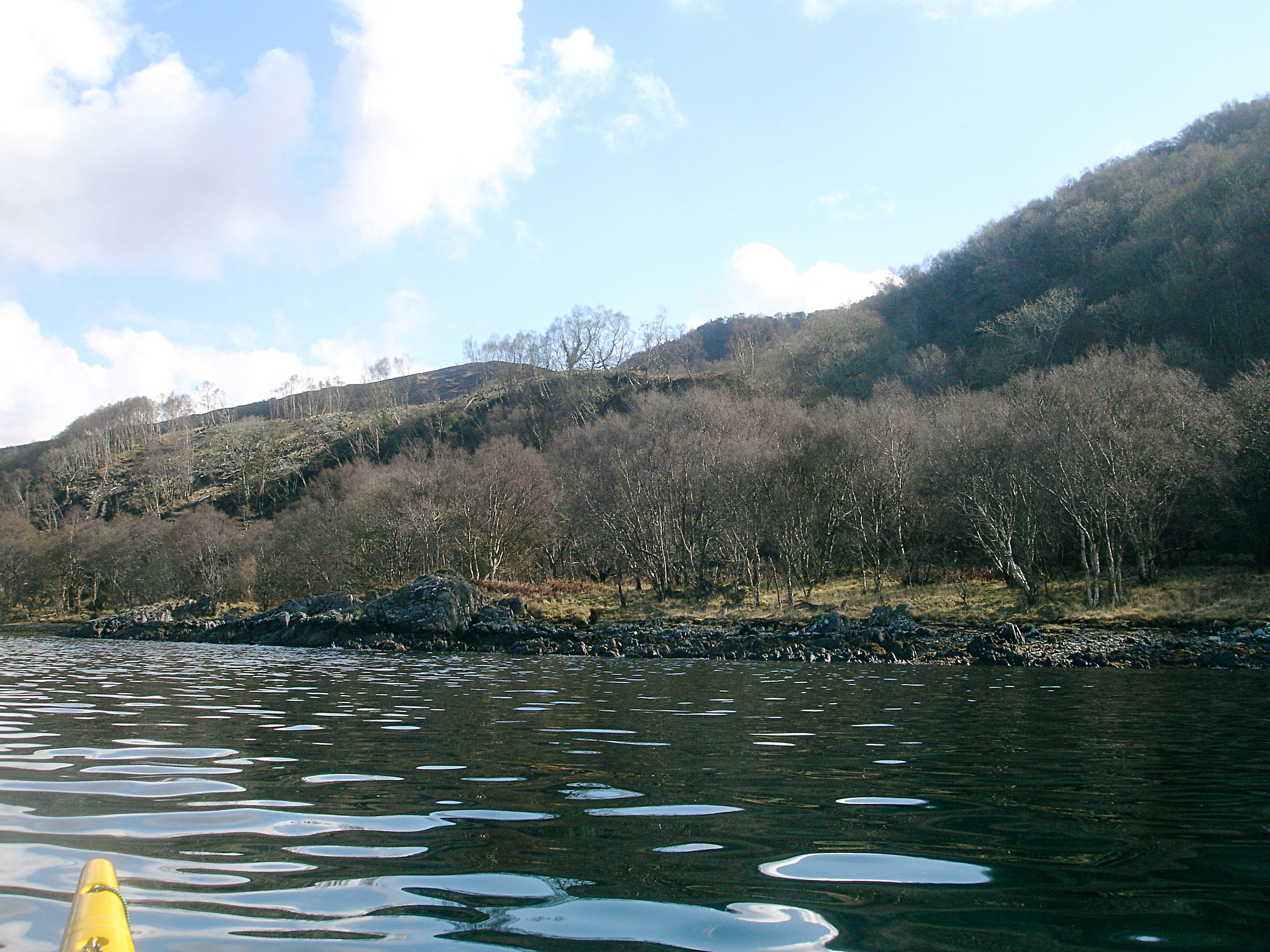
English: Birch woodland below Meall a' Bhròin Much of the south shore of Loch Sunart is wooded, being a patchwork of birch trees and shady glades. The tree cover here reaches up to about 200m on the northern slopes of Meall a' Brhòin, with an understorey that varies form grass and sedge to dense bracken. There is often, as here, a narrow band of fairly level ground leading to the shore, and a forestry track follows this along the shore from Glen Cripesdale in the west to Laudale and the paved road some way east, though it is rarely visible from the water. Just off this stretch of shore is an extensive fish farm - only small boats like sea kayaks can get close inshore here because of all the moorings and pipes. |
| Date | |
| Source | From geograph.org.uk |
| Author | Andy Waddington |
| Attribution (required by the license) | Andy Waddington / Birch woodland below Meall a' Bhròin / |
| Camera location | | View this and other nearby images on: OpenStreetMap |
|---|
| Object location | | View this and other nearby images on: OpenStreetMap |
|---|
Licensing
[edit]
|
This image was taken from the Geograph project collection. See this photograph's page on the Geograph website for the photographer's contact details. The copyright on this image is owned by Andy Waddington and is licensed for reuse under the Creative Commons Attribution-ShareAlike 2.0 license.
|
This file is licensed under the Creative Commons Attribution-Share Alike 2.0 Generic license.
Attribution: Andy Waddington
- You are free:
- to share – to copy, distribute and transmit the work
- to remix – to adapt the work
- Under the following conditions:
- attribution – You must give appropriate credit, provide a link to the license, and indicate if changes were made. You may do so in any reasonable manner, but not in any way that suggests the licensor endorses you or your use.
- share alike – If you remix, transform, or build upon the material, you must distribute your contributions under the same or compatible license as the original.

_heading:90.00&language=en)
_heading:90.00&language=en)
File history
Click on a date/time to view the file as it appeared at that time.
| Date/Time | Thumbnail | Dimensions | User | Comment | |
|---|---|---|---|---|---|
| current | 12:26, 14 March 2011 | | 2,880 × 2,160 (1.63 MB) | GeographBot (talk | contribs) | == {{int:filedesc}} == {{Information |description={{en|1=Birch woodland below Meall a' Bhròin Much of the south shore of Loch Sunart is wooded, being a patchwork of birch trees and shady glades. The tree cover here reaches up to about 200m on the norther |
You cannot overwrite this file.
File usage on Commons
There are no pages that use this file.