File:Birds eye view of Maryland and Virginia. LOC 99448466.tif
Jump to navigation
Jump to search

Size of this JPG preview of this TIF file: 702 × 599 pixels. Other resolutions: 281 × 240 pixels | 562 × 480 pixels | 900 × 768 pixels | 1,200 × 1,024 pixels | 2,399 × 2,048 pixels | 4,533 × 3,870 pixels.
Original file (4,533 × 3,870 pixels, file size: 50.19 MB, MIME type: image/tiff)
Captions
Captions
Add a one-line explanation of what this file represents
Summary
[edit]| Description |
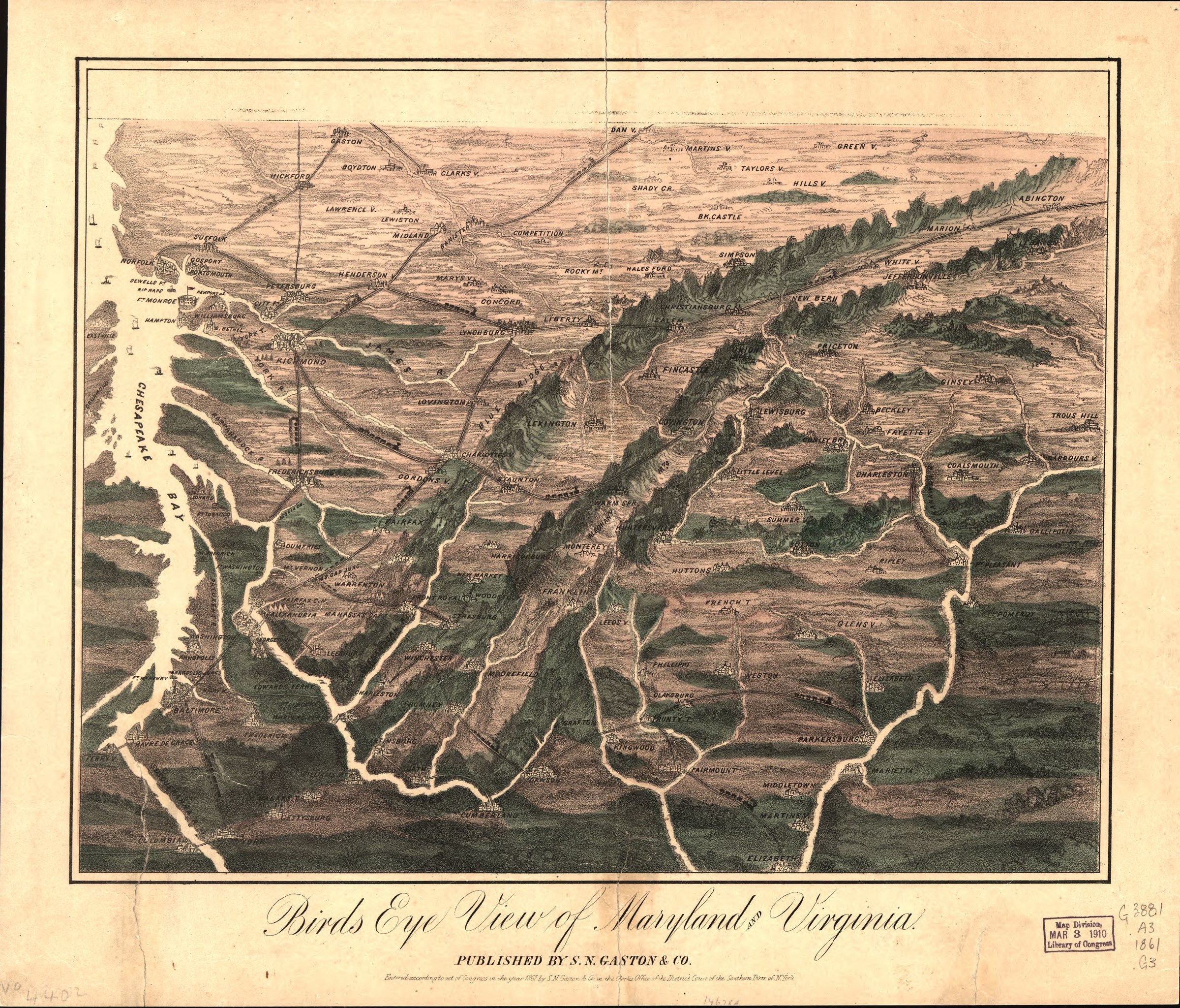
English: Not drawn to scale. LC Civil War Maps (2nd ed.), 449.5 Panoramic map looking south from southern Pennsylvania showing relief, rivers, place names, and railroads. Description derived from published bibliography. Available also through the Library of Congress web site as raster image. |
||
| Title | Birds eye view of Maryland and Virginia. | ||
| Shelf ID | G3841.A3 1861 .G3 | ||
| Date | |||
| Source | https://www.loc.gov/item/99448466/ | ||
| Author | S. N. Gaston And Company | ||
| Permission (Reusing this file) |
|
||
| Other versions |
|
||
| Location | United States · Maryland · Virginia | ||
| Part of | Military Battles And Campaigns · American Memory · Civil War Maps · Catalog · Geography And Map Division | ||
| Subject | United States · Maryland · Aerial Views · Virginia |


Licensing
[edit]|
This is a faithful photographic reproduction of a two-dimensional, public domain work of art. The work of art itself is in the public domain for the following reason:
The official position taken by the Wikimedia Foundation is that "faithful reproductions of two-dimensional public domain works of art are public domain".
This photographic reproduction is therefore also considered to be in the public domain in the United States. In other jurisdictions, re-use of this content may be restricted; see Reuse of PD-Art photographs for details. | ||||
File history
Click on a date/time to view the file as it appeared at that time.
| Date/Time | Thumbnail | Dimensions | User | Comment | |
|---|---|---|---|---|---|
| current | 09:54, 17 May 2018 |  | 4,533 × 3,870 (50.19 MB) | Fæ (talk | contribs) | LOC Maps https://www.loc.gov/item/99448466/ #1122 |
You cannot overwrite this file.
File usage on Commons
The following page uses this file: