File:Blaeu - Atlas of Scotland 1654 - INSULÆ ALBION et HIBERNIA cum minoribus adjacentibus - British Isles.jpg
跳转到导航
跳转到搜索
本预览的尺寸:710 × 599像素。 其他分辨率:284 × 240像素 | 569 × 480像素 | 910 × 768像素 | 1,213 × 1,024像素 | 2,427 × 2,048像素 | 6,083 × 5,134像素。
原始文件 (6,083 × 5,134像素,文件大小:6.91 MB,MIME类型:image/jpeg)
说明
说明
添加一行文字以描述该文件所表现的内容
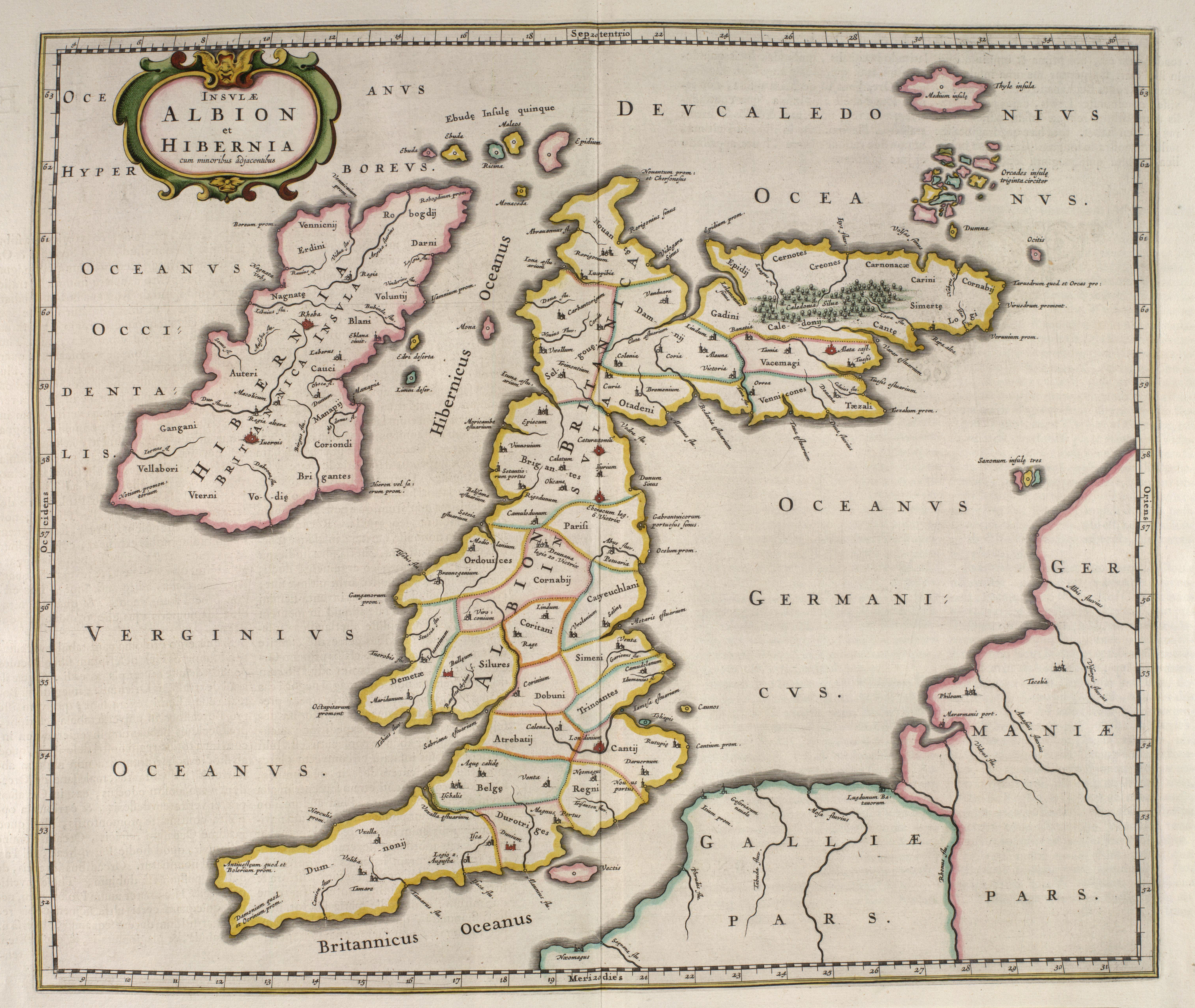
| 描述 | Ptolemy's 1st European Map: INSULAE ALBION ET HIBERNIA - Old Great Britain | |||
| 日期 | ||||
| 来源 |
|
|||
| 作者 | Blaeu | |||
| 授权 (二次使用本文件) |
Public domain (70 years post mortem auctoris) |


|
本作品在其来源国以及其他著作权期限是作者逝世后100年或以下的国家和地区属于公有领域。 | |
| 本文件已被确认为免除已知的著作权法限制(包括所有相关权利)。 | |
文件历史
点击某个日期/时间查看对应时刻的文件。
| 日期/时间 | 缩略图 | 大小 | 用户 | 备注 | |
|---|---|---|---|---|---|
| 当前 | 2007年6月17日 (日) 13:47 | | 6,083 × 5,134(6.91 MB) | Simplicius(留言 | 贡献) | {{Information |Description=INSULAE ALBION ET HIBERNIA - Old Great Britain |Source=[http://www.nls.uk/maps/early/blaeu/blaeu_maps_index.html National Library of Scotland] |Date=1654 |Author=Blaeu |Permission=Public domain (70 years post mortem auctoris |
您不可以覆盖此文件。
文件用途
以下5个页面使用本文件:
全域文件用途
以下其他wiki使用此文件:
- de.wikipedia.org上的用途
- en.wikipedia.org上的用途
- es.wikipedia.org上的用途
- fr.wikipedia.org上的用途
- it.wikipedia.org上的用途
- ja.wikibooks.org上的用途
- pl.wikipedia.org上的用途
- pt.wikipedia.org上的用途
- sl.wikipedia.org上的用途
- zh.wikipedia.org上的用途