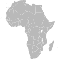
File:BlankMap-Africa.svg

元のファイル (SVG ファイル、1,000 × 1,000 ピクセル、ファイルサイズ: 184キロバイト)
キャプション
キャプション

|
このファイルは、人間が編集可能なプレーンテキスト形式で保存されています。画像の編集や二次的著作物の作成は、テキストエディタを使用した上で行って下さい。Inkscapeやその他類似のベクタグラフィックスエディタ、SVG翻訳のような自動ツールで保存又は出力された編集物をアップロードするのはお控え下さい。 |
| 解説BlankMap-Africa.svg |
Political map of Africa Detailed SVG map with grouping enabled to connect all non-contiguous parts of a country's territory for easy colouring. Smaller countries can also be represented by larger circles to show their data easier. All countries are tagged by their ISO code. A thorough description of use and other instructions can be found on the instruction page for the World map. The circles used to mark small countries have been reduced in size compared to BlankMap-World6.svg, also Gambia does not have a circle in this version. For completion, per en:Africa#Territories and regions, Madeira (pt-30), Canary Islands (es-cn), Réunion (re), Mayotte (yt) and Saint Helena (sh) have been added to the map. Ceuta and Melilla were not added since they don't exist in BlankMap-World6.svg. To make these territories transparent simply use the style .sh, .pt-30, .es-cn, .yt, .re {opacity: 0;} |
|||
| 日付 | ||||
| 原典 | Based on BlankMap-World6.svg by Canuckguy et al. | |||
| 作者 | Lokal_Profil | |||
| 許可 (ファイルの再利用) |
|
|||
| その他のバージョン |
このファイルの派生的著作物: |
|||
| SVG 開発 InfoField |
ファイルの履歴
過去の版のファイルを表示するには、その版の日時をクリックしてください。
| 日付と時刻 | サムネイル | 寸法 | 利用者 | コメント | |
|---|---|---|---|---|---|
| 現在の版 | 2020年4月29日 (水) 06:01 |  | 1,000 × 1,000 (184キロバイト) | Kaldari (トーク | 投稿記録) | Listing the actual European territories in the comments so that they aren't a mystery |
| 2011年11月8日 (火) 13:50 |  | 1,000 × 1,000 (184キロバイト) | Htonl (トーク | 投稿記録) | South Sudan has been allocated ISO code SS; change class and id correspondingly | |
| 2011年7月9日 (土) 21:38 |  | 1,000 × 1,000 (184キロバイト) | Lokal Profil (トーク | 投稿記録) | Fixed code. Essentialy reverted and readded south sudan manually | |
| 2011年7月9日 (土) 17:09 |  | 1,000 × 1,000 (185キロバイト) | Seb az86556 (トーク | 投稿記録) | +South Sudan | |
| 2010年7月18日 (日) 16:04 |  | 1,000 × 1,000 (185キロバイト) | Stephen Morley (トーク | 投稿記録) | Fixed errors that made SVG invalid | |
| 2009年9月22日 (火) 16:22 |  | 1,000 × 1,000 (185キロバイト) | Lokal Profil (トーク | 投稿記録) | Reverted to version as of 00:54, 3 April 2008; the new map contains none of the iso code and css abilities of the original | |
| 2009年9月22日 (火) 15:11 |  | 1,000 × 1,000 (352キロバイト) | NuclearVacuum (トーク | 投稿記録) | minor change | |
| 2009年9月22日 (火) 15:06 |  | 1,000 × 1,000 (352キロバイト) | NuclearVacuum (トーク | 投稿記録) | Fixed map so it shows surrounding countries as well as making the code valid | |
| 2008年4月3日 (木) 00:54 |  | 1,000 × 1,000 (185キロバイト) | Lokal Profil (トーク | 投稿記録) | reunion, saint helena, madeira and canary islands (mayotte already in) added for completion | |
| 2008年4月1日 (火) 00:21 |  | 1,000 × 1,000 (182キロバイト) | Lokal Profil (トーク | 投稿記録) | Made circles smaller, and circular. They were the right size for the world map but to big for the Africa only map |
このファイルは上書きできません。
ファイルの使用状況
以下の 20 ページがこのファイルを使用しています:
- Atlas of Africa
- User:Lokal Profil/Gallery/Map
- File:Algeria Sudan Locator (1956-2011).png
- File:BlankMap-Africa.png
- File:BlankMap-Africa2.png
- File:BlankMap-World.svg
- File:Blankmap-Africa2.png
- File:Colecciones africanas MNA.svg
- File:Gastropholis-prasina-range.svg
- File:Hydrictis maculicollis area.svg
- File:ICC Situations.svg
- File:Madagascar range map template.svg
- File:Map of CILSS.svg
- File:Miss-waldrons-red-colobus-range.svg
- File:P-Africa.svg
- File:P.mascaraniensis range.svg
- File:Triceros jacksonii distribution.png
- File:United Nations General Assembly Resolution 68-262 vote in Africa.svg
- File:Zonosaurus-quadrilineatus-range.svg
- File:הסתננות מאפריקה לישראל.svg
グローバルなファイル使用状況
以下に挙げる他のウィキがこの画像を使っています:
- af.wikipedia.org での使用状況
- Vlag van Suid-Afrika
- Vlag van Senegal
- Vlag van Mauritanië
- Vlag van Guinee-Bissau
- Vlag van Mali
- Vlag van Niger
- Vlag van Eswatini
- Vlag van Algerië
- Vlag van Namibië
- Vlag van Angola
- Vlag van Botswana
- Vlag van Benin
- Vlag van Burkina Faso
- Vlag van Burundi
- Vlag van die Comore-eilande
- Vlag van die Demokratiese Republiek die Kongo
- Vlag van Djiboeti
- Vlag van Egipte
- Vlag van Ekwatoriaal-Guinee
- Vlag van Eritrea
- Vlag van Ethiopië
- Vlag van Gaboen
- Vlag van Gambië
- Vlag van Ghana
- Vlag van Guinee
- Vlag van Ivoorkus
- Vlag van Kaap Verde
- Vlag van Kameroen
- Vlag van Kenia
- Vlae van Afrika
- Vlag van die Republiek die Kongo
- Vlag van Lesotho
- Vlag van Liberië
- Vlag van Libië
- Vlag van Madagaskar
- Vlag van Malawi
- Vlag van Marokko
- Vlag van Mauritius
- Vlag van Mosambiek
- Vlag van Nigerië
- Vlag van Rwanda
- Vlag van São Tomé en Príncipe
- Vlag van die Sentraal-Afrikaanse Republiek
- Vlag van die Seychelle-eilande
- Vlag van Sierra Leone
- Vlag van Soedan
- Vlag van Somalië
- Vlag van Tanzanië
- Vlag van Togo
- Vlag van Tsjad
このファイルのグローバル使用状況を表示する。
メタデータ
このファイルには、追加情報があります (おそらく、作成やデジタル化する際に使用したデジタルカメラやスキャナーが追加したものです)。
このファイルが元の状態から変更されている場合、修正されたファイルを完全に反映していない項目がある場合があります。
| 画像の幅 | 1000 |
|---|---|
| 画像の高さ | 1000 |