File:Bridge over the weir - geograph.org.uk - 1129200.jpg
Jump to navigation
Jump to search
No higher resolution available.
Bridge_over_the_weir_-_geograph.org.uk_-_1129200.jpg (640 × 427 pixels, file size: 120 KB, MIME type: image/jpeg)
Captions
Captions
Add a one-line explanation of what this file represents
Summary
[edit]| Description |
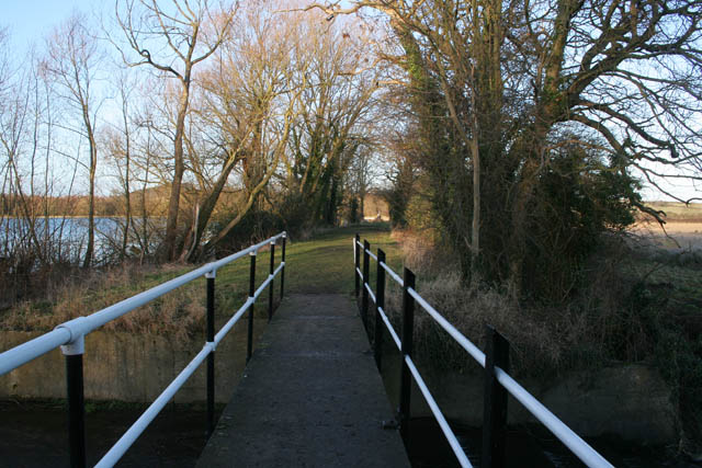
English: Bridge over the weir. View looking northwards towards the open area at the north end of the Denton Reservoir, 1129006.
This footbridge carries the public footpath over the outfall weir on the south east shore of the reservoir, see 1126988. Walking south, after the bridge, the circular footpath is tree lined, becomes quite narrow and is very shady in the summer. |
| Date | |
| Source | From geograph.org.uk |
| Author | Kate Jewell |
| Attribution (required by the license) | Kate Jewell / Bridge over the weir / |
| Camera location | | View this and other nearby images on: OpenStreetMap |
|---|
| Object location | | View this and other nearby images on: OpenStreetMap |
|---|
Licensing
[edit]
|
This image was taken from the Geograph project collection. See this photograph's page on the Geograph website for the photographer's contact details. The copyright on this image is owned by Kate Jewell and is licensed for reuse under the Creative Commons Attribution-ShareAlike 2.0 license.
|
This file is licensed under the Creative Commons Attribution-Share Alike 2.0 Generic license.
Attribution: Kate Jewell
- You are free:
- to share – to copy, distribute and transmit the work
- to remix – to adapt the work
- Under the following conditions:
- attribution – You must give appropriate credit, provide a link to the license, and indicate if changes were made. You may do so in any reasonable manner, but not in any way that suggests the licensor endorses you or your use.
- share alike – If you remix, transform, or build upon the material, you must distribute your contributions under the same or compatible license as the original.

_heading:22.00&language=en)
_heading:22.00&language=en)
File history
Click on a date/time to view the file as it appeared at that time.
| Date/Time | Thumbnail | Dimensions | User | Comment | |
|---|---|---|---|---|---|
| current | 00:00, 25 February 2011 | | 640 × 427 (120 KB) | GeographBot (talk | contribs) | == {{int:filedesc}} == {{Information |description={{en|1=Bridge over the weir View looking northwards towards the open area at the north end of the Denton Reservoir, 1129006. This footbridge carries the public footpath over the outfall weir on the so |
You cannot overwrite this file.
File usage on Commons
There are no pages that use this file.