File:C71188s5 Ant.Map Cape Adare.jpg
跳转到导航
跳转到搜索
本预览的尺寸:557 × 599像素。 其他分辨率:223 × 240像素 | 446 × 480像素 | 714 × 768像素 | 952 × 1,024像素 | 1,903 × 2,048像素 | 2,877 × 3,096像素。
原始文件 (2,877 × 3,096像素,文件大小:1.53 MB,MIME类型:image/jpeg)
说明
说明
添加一行文字以描述该文件所表现的内容
摘要[编辑]
| 描述 |
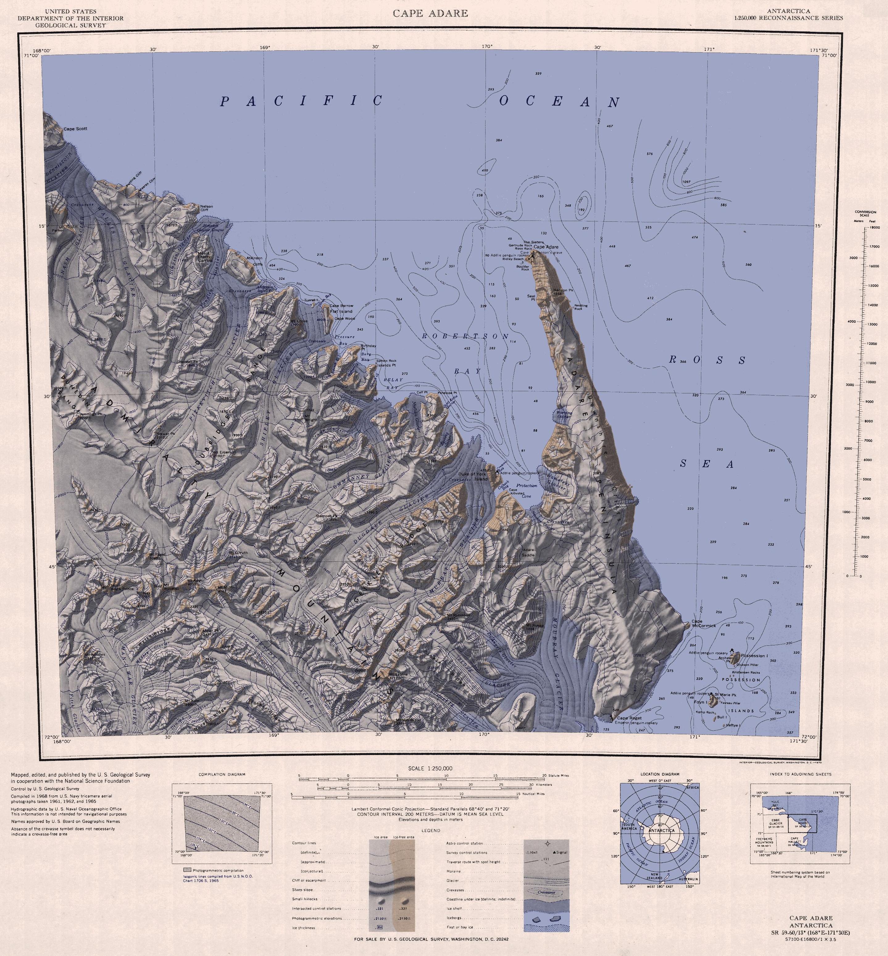
English: 1:250,000-scale topographic reconnaissance map of the Cape Adare region in Antarctica (168°E - 171°30'E, 71°S - 72°S). Mapped, edited and published by the U.S. Geological Survey in cooperation with the National Science Foundation. |
|||
| 日期 | ||||
| 来源 | http://usarc.usgs.gov/drg_dload.shtml | |||
| 作者 | United States Geological Survey | |||
| 授权 (二次使用本文件) |
|
|||
| 其他版本 |
此文件衍生的作品: |
文件历史
点击某个日期/时间查看对应时刻的文件。
| 日期/时间 | 缩略图 | 大小 | 用户 | 备注 | |
|---|---|---|---|---|---|
| 当前 | 2015年11月26日 (四) 12:47 | | 2,877 × 3,096(1.53 MB) | ValeriySh(留言 | 贡献) | Обрізка зайвого поля |
| 2005年4月3日 (日) 16:43 |  | 3,506 × 3,260(1.67 MB) | Achim Raschka(留言 | 贡献) | Map of Antarctica by the United States Antarctic Ressource Center of the US Geological Society. {{PD-US}} Copyrights and Trademarks USGS-authored or produced data and information are in the public domain. While the content of most USGS web pages is in th |
您不可以覆盖此文件。
文件用途
以下2个页面使用本文件:
全域文件用途
以下其他wiki使用此文件:
- ar.wikipedia.org上的用途
- ast.wikipedia.org上的用途
- az.wikipedia.org上的用途
- be.wikipedia.org上的用途
- bg.wikipedia.org上的用途
- ceb.wikipedia.org上的用途
- de.wikipedia.org上的用途
- el.wikipedia.org上的用途
- en.wikipedia.org上的用途
- eo.wikipedia.org上的用途
- es.wikipedia.org上的用途
- fr.wikipedia.org上的用途
- he.wikipedia.org上的用途
- id.wikipedia.org上的用途
- it.wikipedia.org上的用途
查看此文件的更多全域用途。