File:CH-24 WAC 41 North.tif
Jump to navigation
Jump to search

Size of this JPG preview of this TIF file: 800 × 299 pixels. Other resolutions: 320 × 120 pixels | 640 × 239 pixels | 1,024 × 382 pixels | 1,280 × 478 pixels | 2,560 × 956 pixels | 11,062 × 4,132 pixels.
Original file (11,062 × 4,132 pixels, file size: 43.59 MB, MIME type: image/tiff)
Captions
Captions
Add a one-line explanation of what this file represents
| Description |
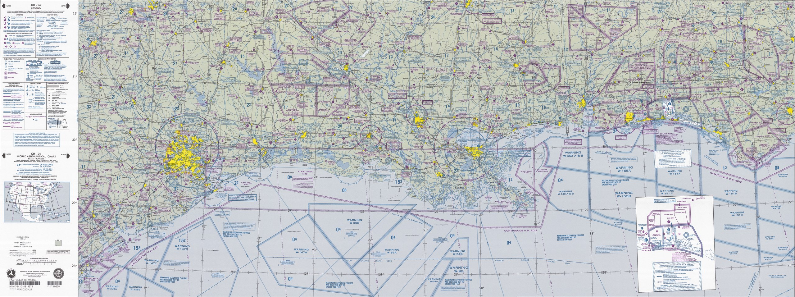
English: FAA World aeronautical chart CH 24 North, 41st edition (northern Gulf of Mexico). Note: This map is valid until 15 August 2011, for navigational purposes be sure to get the newest edition at the official FAA website |
| Date |
|
| Source | CH-24_WAC_41_North.tif in CH-23_41.zip. Note: The ZIP-File will become unavailable when the map is updated, newer editions will be available here |
| Author | US Department of Transportation, Federal Aviation Administration, National Aeronautical Navigation Services |
| Other versions |
This image or file is a work of a Federal Aviation Administration employee, taken or made as part of that person's official duties. As a work of the U.S. federal government, the image is in the public domain in the United States.
|
 |
File history
Click on a date/time to view the file as it appeared at that time.
| Date/Time | Thumbnail | Dimensions | User | Comment | |
|---|---|---|---|---|---|
| current | 15:15, 22 December 2013 | 11,062 × 4,132 (43.59 MB) | McZusatz (talk | contribs) | fixing thumb? (uploaded using chunked upload script) | |
| 10:18, 28 April 2011 | 11,062 × 4,132 (43.62 MB) | El Grafo (talk | contribs) | {{Information |Description={{en|1=FAA World aeronautical chart CH 24 North, 41st edition (northern Gulf of Mexico). <small>Note: This map is valid until {{date|2011|08|15}}, for navigational purposes be sure to get the new |
You cannot overwrite this file.
File usage on Commons
There are no pages that use this file.