File:Cairn Within the Barmkyn of Keig - geograph.org.uk - 1117119.jpg
Jump to navigation
Jump to search
No higher resolution available.
Cairn_Within_the_Barmkyn_of_Keig_-_geograph.org.uk_-_1117119.jpg (640 × 480 pixels, file size: 131 KB, MIME type: image/jpeg)
Captions
Captions
Add a one-line explanation of what this file represents
Summary
[edit]
| Description |
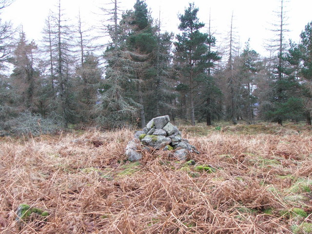
English: Cairn Within the Barmkyn of Keig Cairn of stones within the Barmkyn of Keig, the remains of a Neolithic fortified settlement. The surrounding perimeter stone wall is roughly circular in shape and approximately 30m wide. The Barmkyn sits on top of the Hill of Airlie within the Wood of North Keig. |
| Date | |
| Source | From geograph.org.uk |
| Author | Alison Mack |
| Attribution (required by the license) | Alison Mack / Cairn Within the Barmkyn of Keig / |
| Camera location | | View this and other nearby images on: OpenStreetMap |
|---|
_heading:180.00&language=en)
| Object location | | View this and other nearby images on: OpenStreetMap |
|---|
_heading:180.00&language=en)
Licensing
[edit]

|
This image was taken from the Geograph project collection. See this photograph's page on the Geograph website for the photographer's contact details. The copyright on this image is owned by Alison Mack and is licensed for reuse under the Creative Commons Attribution-ShareAlike 2.0 license.
|
This file is licensed under the Creative Commons Attribution-Share Alike 2.0 Generic license.
Attribution: Alison Mack
- You are free:
- to share – to copy, distribute and transmit the work
- to remix – to adapt the work
- Under the following conditions:
- attribution – You must give appropriate credit, provide a link to the license, and indicate if changes were made. You may do so in any reasonable manner, but not in any way that suggests the licensor endorses you or your use.
- share alike – If you remix, transform, or build upon the material, you must distribute your contributions under the same or compatible license as the original.
File history
Click on a date/time to view the file as it appeared at that time.
| Date/Time | Thumbnail | Dimensions | User | Comment | |
|---|---|---|---|---|---|
| current | 20:41, 24 February 2011 | | 640 × 480 (131 KB) | GeographBot (talk | contribs) | == {{int:filedesc}} == {{Information |description={{en|1=Cairn Within the Barmkyn of Keig Cairn of stones within the Barmkyn of Keig, the remains of a Neolithic fortified settlement. The surrounding perimeter stone wall is roughly circular in shape and a |
You cannot overwrite this file.
File usage on Commons
There are no pages that use this file.