File:Canada orientale nell' America settentrionale (IA McGillLibrary-123698-2136).pdf
Jump to navigation
Jump to search

Size of this JPG preview of this PDF file: 800 × 593 pixels. Other resolutions: 320 × 237 pixels | 640 × 474 pixels | 1,024 × 759 pixels | 1,280 × 949 pixels | 2,141 × 1,587 pixels.
Original file (2,141 × 1,587 pixels, file size: 5.75 MB, MIME type: application/pdf)
Captions
Captions
Add a one-line explanation of what this file represents
Summary[edit]
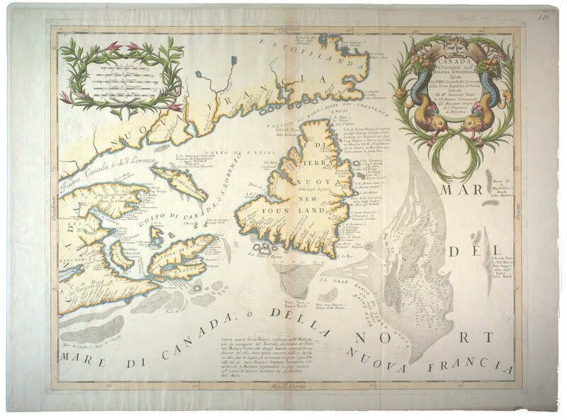
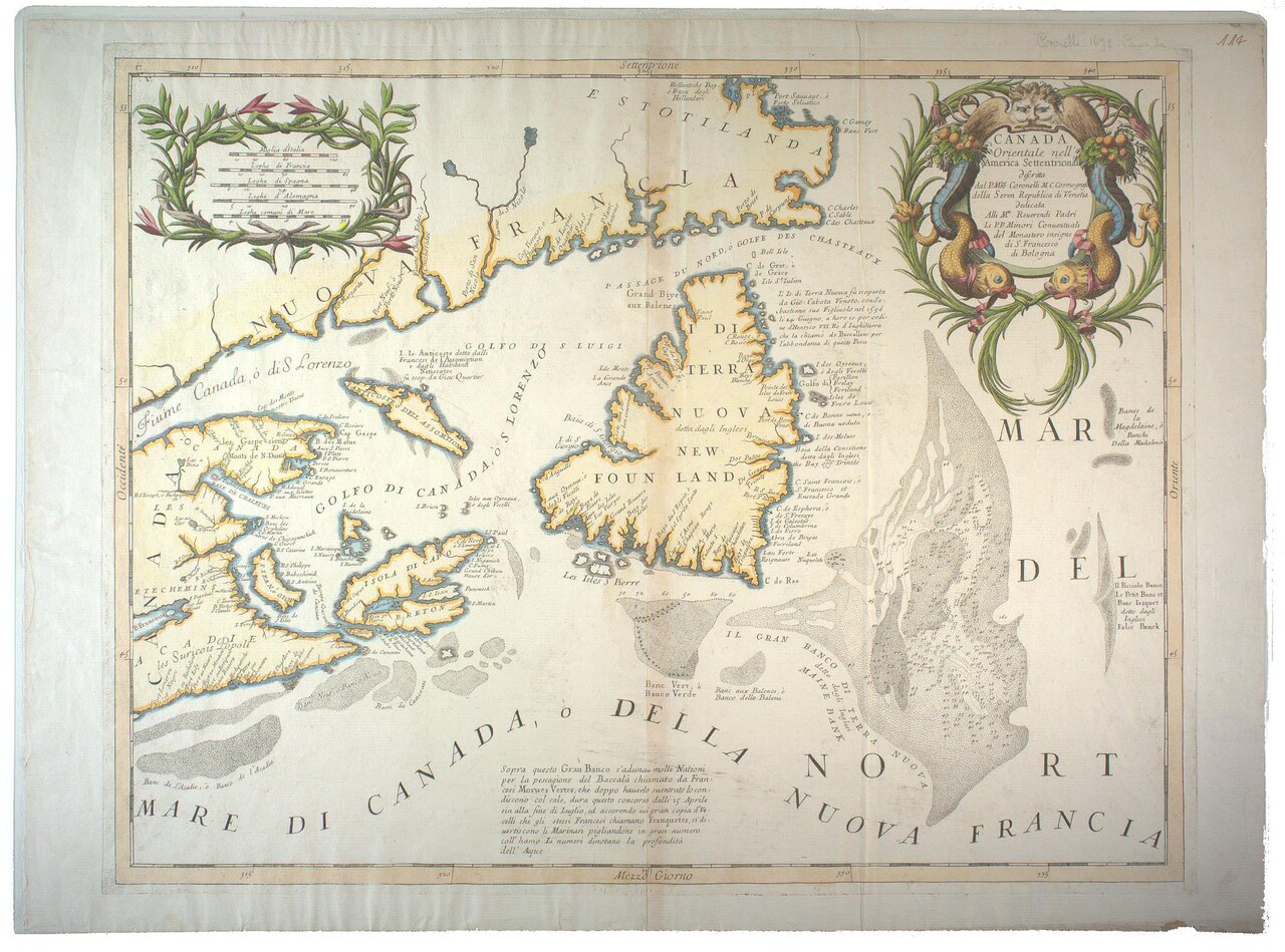
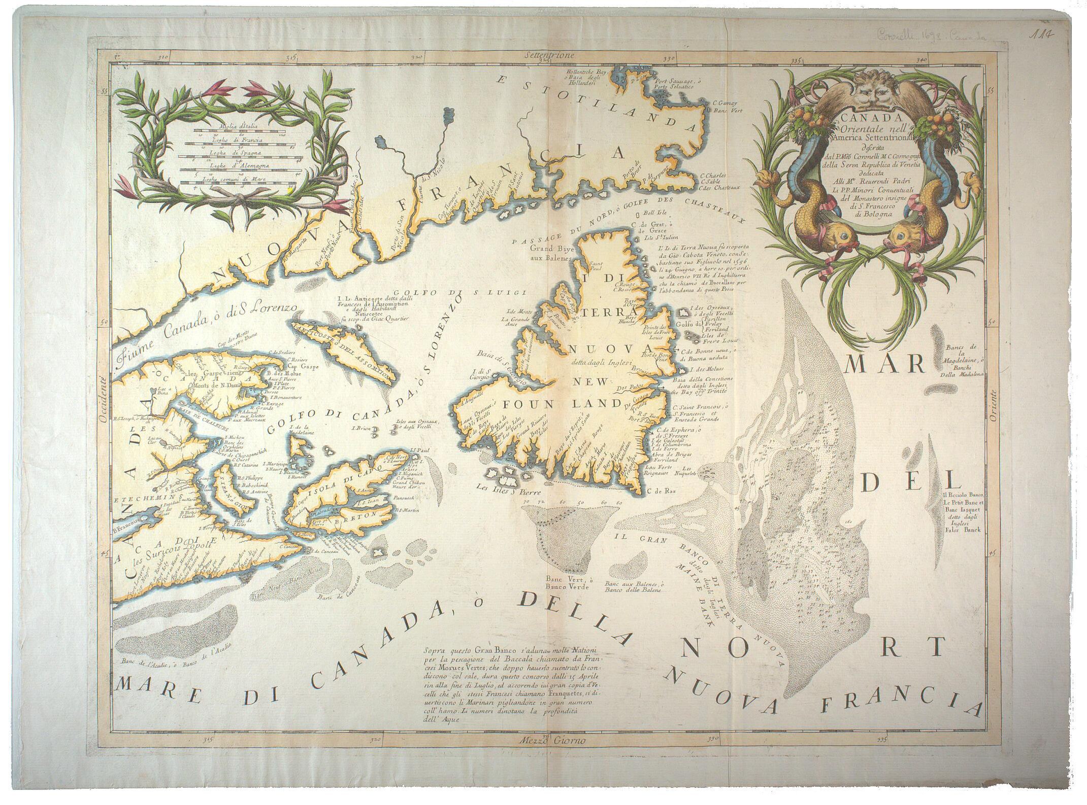
| Canada orientale nell' America settentrionale
( |
|
|---|---|
| Author |
|
| Title |
Canada orientale nell' America settentrionale |
| Publisher |
[Venice] : [Coronelli] |
| Description |
Subjects: Canada -- Maps -- Early works to 1800.; Newfoundland and Labrador -- Maps -- Early works to 1800.; Saint Lawrence, Gulf of -- Maps -- Early works to 1800.; Grand Banks of Newfoundland -- Maps -- Early works to 1800.; McGill University Library Digitized Title; Map Room |
| Language | Italian |
| Publication date | 1692 |
| Current location |
IA Collections: mcgilluniversity; mcgilluniversityrarebooks; toronto |
| Accession number |
McGillLibrary-123698-2136 |
| Source |
|
Licensing[edit]
|
This work is in the public domain in its country of origin and other countries and areas where the copyright term is the author's life plus 100 years or fewer. This work is in the public domain in the United States because it was published (or registered with the U.S. Copyright Office) before January 1, 1929. | |
| This file has been identified as being free of known restrictions under copyright law, including all related and neighboring rights. | |
File history
Click on a date/time to view the file as it appeared at that time.
| Date/Time | Thumbnail | Dimensions | User | Comment | |
|---|---|---|---|---|---|
| current | 15:31, 1 January 2021 |  | 2,141 × 1,587 (5.75 MB) | Fæ (talk | contribs) | IA Query "subject:maps date:[1000 TO 1869] " McGillLibrary-123698-2136 Category:Old maps (COM:IA books#query) (1692 #156) |
You cannot overwrite this file.
File usage on Commons
The following page uses this file: