File:Canterbury UK locator map.svg
Ir a la navegación
Ir a la búsqueda

Tamaño de esta previsualización PNG del archivo SVG: 800 × 561 píxeles. Otras resoluciones: 320 × 225 píxeles | 640 × 449 píxeles | 1024 × 719 píxeles | 1280 × 898 píxeles | 2560 × 1796 píxeles | 1425 × 1000 píxeles.
Archivo original (archivo SVG, nominalmente 1425 × 1000 píxeles, tamaño de archivo: 1,18 MB)
Leyendas
Leyendas
Añade una explicación corta acerca de lo que representa este archivo
| Descripción |
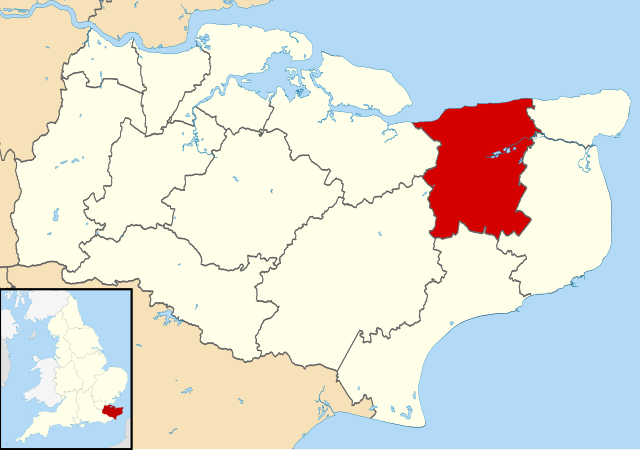
Map of Kent, UK with Canterbury highlighted. Equirectangular map projection on WGS 84 datum, with N/S stretched 160% |
| Fecha | |
| Fuente |
|
| Autor | Nilfanion, created using Ordnance Survey data |
| Permiso (Reutilización de este archivo) |
Este archivo se encuentra bajo la licencia Creative Commons Genérica de Atribución/Compartir-Igual 3.0. Atribución: Contains Ordnance Survey data © Crown copyright and database right
|
Historial del archivo
Haz clic sobre una fecha y hora para ver el archivo tal como apareció en ese momento.
| Fecha y hora | Miniatura | Dimensiones | Usuario | Comentario | |
|---|---|---|---|---|---|
| actual | 09:06 2 ago 2011 | | 1425 × 1000 (1,18 MB) | Nilfanion (discusión | contribs.) | {{Information |Description=Map of Kent, UK with Canterbury highlighted. Equirectangular map projection on WGS 84 datum, with N/S stretched 160% |Source=Ordnance Survey [https://www.ordnancesurvey. |
No puedes sobrescribir este archivo.
Usos del archivo
Las siguientes páginas usan este archivo:
- Template:City of Canterbury year
- Category:1913 in the City of Canterbury
- Category:1941 in the City of Canterbury
- Category:1944 in the City of Canterbury
- Category:1970 in the City of Canterbury
- Category:1985 in the City of Canterbury
- Category:2003 in the City of Canterbury
- Category:2004 in the City of Canterbury
- Category:2005 in the City of Canterbury
- Category:2006 in the City of Canterbury
- Category:2007 in the City of Canterbury
- Category:2008 in the City of Canterbury
- Category:2009 in the City of Canterbury
- Category:2010 in the City of Canterbury
- Category:2011 in the City of Canterbury
- Category:2012 in the City of Canterbury
- Category:2013 in the City of Canterbury
- Category:2014 in the City of Canterbury
- Category:2015 in the City of Canterbury
- Category:2016 in the City of Canterbury
- Category:2017 in the City of Canterbury
- Category:2018 in the City of Canterbury
- Category:2019 in the City of Canterbury
- Category:City of Canterbury
Uso global del archivo
Las wikis siguientes utilizan este archivo:
- Uso en ar.wikipedia.org
- Uso en azb.wikipedia.org
- Uso en br.wikipedia.org
- Uso en cy.wikipedia.org
- Uso en en.wikipedia.org
- Canterbury
- Herne Bay
- Whitstable
- Fordwich
- City of Canterbury
- Reculver
- Sturry
- Westbere
- Chartham
- Adisham
- Harbledown
- Bishopsbourne
- Herne and Broomfield
- Blean
- Barham, Kent
- Bekesbourne-with-Patrixbourne
- Upper Harbledown
- Marshside, Kent
- Chislet
- Womenswold
- Chestfield
- Hoath
- Template:Canterbury
- Bekesbourne
- Bridge, Kent
- Hackington
- Herne, Kent
- Hersden
- Patrixbourne
- Ickham and Well
- Kingston, Kent
- Littlebourne
- Lower Hardres
- Upper Hardres
- Petham
- Yorkletts
- Tankerton
- Wickhambreaux
- Thanington
- Wincheap
- Swalecliffe
- Tyler Hill, Kent
- Beltinge
- Waltham, Kent
- Rough Common
- Broad Oak, Kent
Ver más uso global de este archivo.