File:Castle Hills - geograph.org.uk - 975629.jpg
Jump to navigation
Jump to search
No higher resolution available.
Castle_Hills_-_geograph.org.uk_-_975629.jpg (640 × 427 pixels, file size: 82 KB, MIME type: image/jpeg)
Captions
Captions
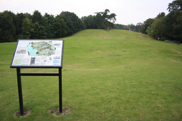
Huntingdon Castle mound
Summary
[edit]
| Description |
English: Castle Hills The display board shows that the mound was the site of a motte and bailey castle following the Norman invasion, and was used by Vikings before and in the Civil War later as a stronghold. The A14 flyover now runs perilously close to the south of the site (behind the trees on the left of this picture) |
| Date | |
| Source | From geograph.org.uk |
| Author | Duncan Grey |
| Attribution (required by the license) | Duncan Grey / Castle Hills / |
| Camera location | | View this and other nearby images on: OpenStreetMap |
|---|
_heading:270.00&language=en)
| Object location | | View this and other nearby images on: OpenStreetMap |
|---|
_heading:270.00&language=en)
Licensing
[edit]

|
This image was taken from the Geograph project collection. See this photograph's page on the Geograph website for the photographer's contact details. The copyright on this image is owned by Duncan Grey and is licensed for reuse under the Creative Commons Attribution-ShareAlike 2.0 license.
|
This file is licensed under the Creative Commons Attribution-Share Alike 2.0 Generic license.
Attribution: Duncan Grey
- You are free:
- to share – to copy, distribute and transmit the work
- to remix – to adapt the work
- Under the following conditions:
- attribution – You must give appropriate credit, provide a link to the license, and indicate if changes were made. You may do so in any reasonable manner, but not in any way that suggests the licensor endorses you or your use.
- share alike – If you remix, transform, or build upon the material, you must distribute your contributions under the same or compatible license as the original.
File history
Click on a date/time to view the file as it appeared at that time.
| Date/Time | Thumbnail | Dimensions | User | Comment | |
|---|---|---|---|---|---|
| current | 19:52, 22 February 2011 | | 640 × 427 (82 KB) | GeographBot (talk | contribs) | == {{int:filedesc}} == {{Information |description={{en|1=Castle Hills The display board shows that the mound was the site of a motte and bailey castle following the Norman invasion, and was used by Vikings before and in the Civil War later as a stronghold |
You cannot overwrite this file.
File usage on Commons
There are no pages that use this file.
File usage on other wikis
The following other wikis use this file:
- Usage on ca.wikipedia.org
- Usage on ceb.wikipedia.org
- Usage on de.wikipedia.org
- Usage on en.wikipedia.org
- Usage on it.wikipedia.org
- Usage on no.wikipedia.org
- Usage on pt.wikipedia.org
- Usage on www.wikidata.org