File:Church of St Mary the Virgin, Llanfair Kilgeddin (geograph 6846825).jpg
Jump to navigation
Jump to search
Size of this preview: 800 × 533 pixels. Other resolutions: 320 × 213 pixels | 640 × 426 pixels | 1,024 × 682 pixels | 1,280 × 853 pixels | 2,560 × 1,706 pixels | 5,179 × 3,451 pixels.
Original file (5,179 × 3,451 pixels, file size: 4.42 MB, MIME type: image/jpeg)
Captions
Captions
Add a one-line explanation of what this file represents
Summary
[edit].jpg&action=edit§ion=1)
| Description |
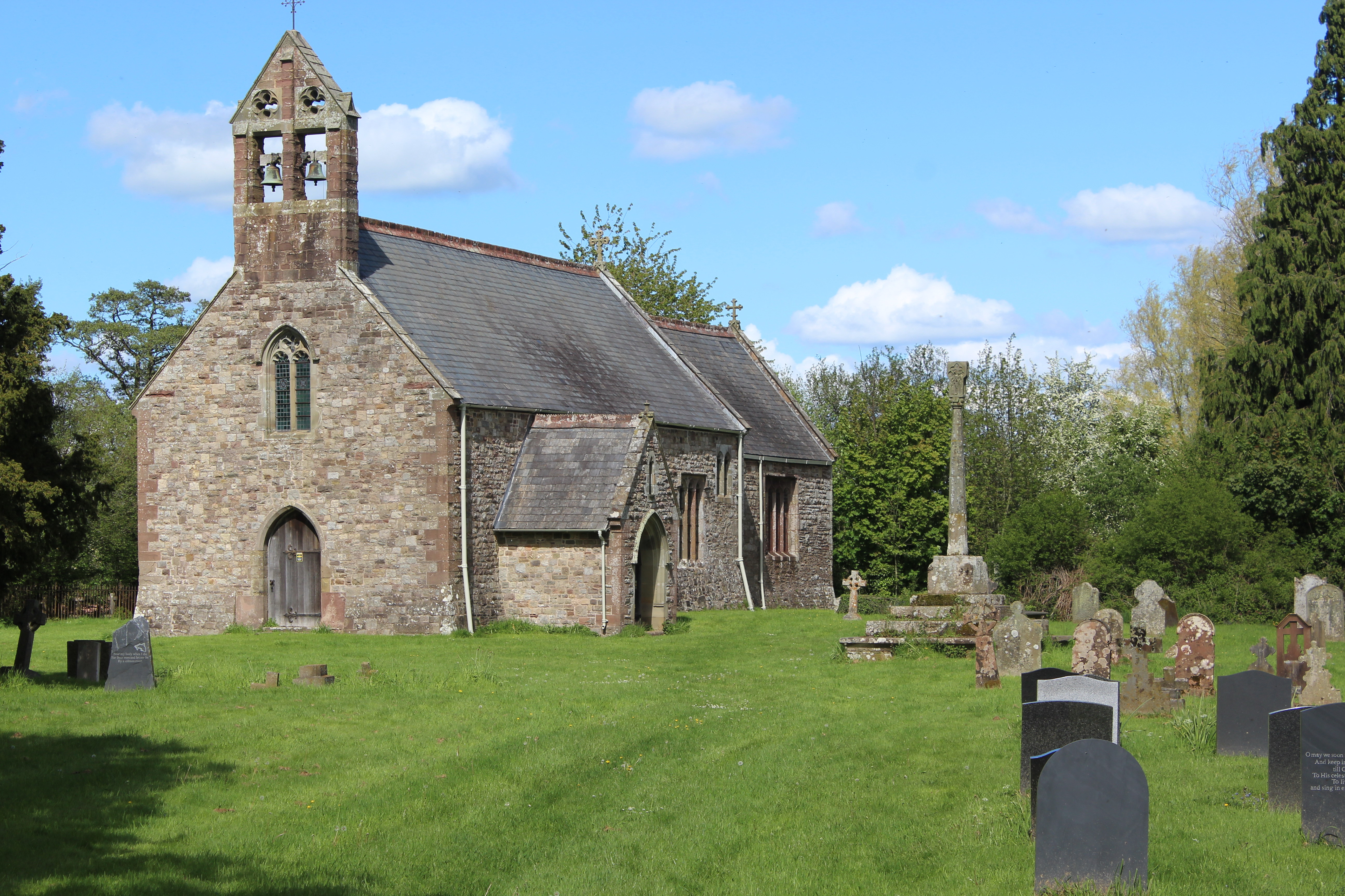
English: Church of St Mary the Virgin, Llanfair Kilgeddin. The church, in red sandstone, is medieval in origin and was largely rebuilt in the 1870s, but is now closed. The stone cross is medieval though the cross itself has been restored, a scheduled ancient monument. My great grandfather and his infant son and his parents are interred in the churchyard, but the headstone/markers have disappeared. |
| Date | |
| Source | From geograph.org.uk |
| Author | M J Roscoe |
| Permission (Reusing this file) |
Creative Commons Attribution Share-alike license 2.0 |
| Attribution (required by the license) | M J Roscoe / Church of St Mary the Virgin, Llanfair Kilgeddin / |
| Camera location | | View this and other nearby images on: OpenStreetMap |
|---|
.jpg¶ms=051.772795_N_-002.935475_E_globe:Earth_type:camera_source:geograph-osgb36(SO35550865)_heading:67.00&language=en)
| Object location | | View this and other nearby images on: OpenStreetMap |
|---|
.jpg¶ms=051.772980_N_-002.935040_E_globe:Earth_class:object_type:object_source:geograph-osgb36(SO35580867)_heading:67.00&language=en)
Licensing
[edit].jpg&action=edit§ion=2)

|
This image was taken from the Geograph project collection. See this photograph's page on the Geograph website for the photographer's contact details. The copyright on this image is owned by M J Roscoe and is licensed for reuse under the Creative Commons Attribution-ShareAlike 2.0 license.
|
This file is licensed under the Creative Commons Attribution-Share Alike 2.0 Generic license.
Attribution: M J Roscoe
- You are free:
- to share – to copy, distribute and transmit the work
- to remix – to adapt the work
- Under the following conditions:
- attribution – You must give appropriate credit, provide a link to the license, and indicate if changes were made. You may do so in any reasonable manner, but not in any way that suggests the licensor endorses you or your use.
- share alike – If you remix, transform, or build upon the material, you must distribute your contributions under the same or compatible license as the original.
File history
Click on a date/time to view the file as it appeared at that time.
| Date/Time | Thumbnail | Dimensions | User | Comment | |
|---|---|---|---|---|---|
| current | 21:19, 18 June 2021 | | 5,179 × 3,451 (4.42 MB) | Salen9 (talk | contribs) | == {{int:filedesc}} == {{Information |Description={{en|1=Church of St Mary the Virgin, Llanfair Kilgeddin}} |Source=From [https://www.geograph.org.uk/photo/6846825 geograph.org.uk] |Date=2021-05-19 |Author=[https://www.geograph.org.uk/profile/121191 M J Roscoe] |Permission=Creative Commons Attribution Share-alike license 2.0 |Other fields={{Credit line |Author=M J Roscoe |License=[https://creativecommons.org/licenses/by-sa/2.0/ CC BY-SA 2.0] |Other=''Church of St Mary the Virgin, Llanfair... |
You cannot overwrite this file.
File usage on Commons
There are no pages that use this file.
File usage on other wikis
The following other wikis use this file:
- Usage on en.wikipedia.org
.jpg&oldid=860428926)