File:Civitas S Dominici sita in Hispaniola Indiea Angliae magnitudinae ferre aequalis, ipsa urbs elagantur ab Hispanis extracta, et omnibus circumvicinis insulis iura dat RMG A6821.tiff

Original file (4,998 × 3,815 pixels, file size: 54.55 MB, MIME type: image/tiff)
Captions
Captions
Summary
[edit]| Author |
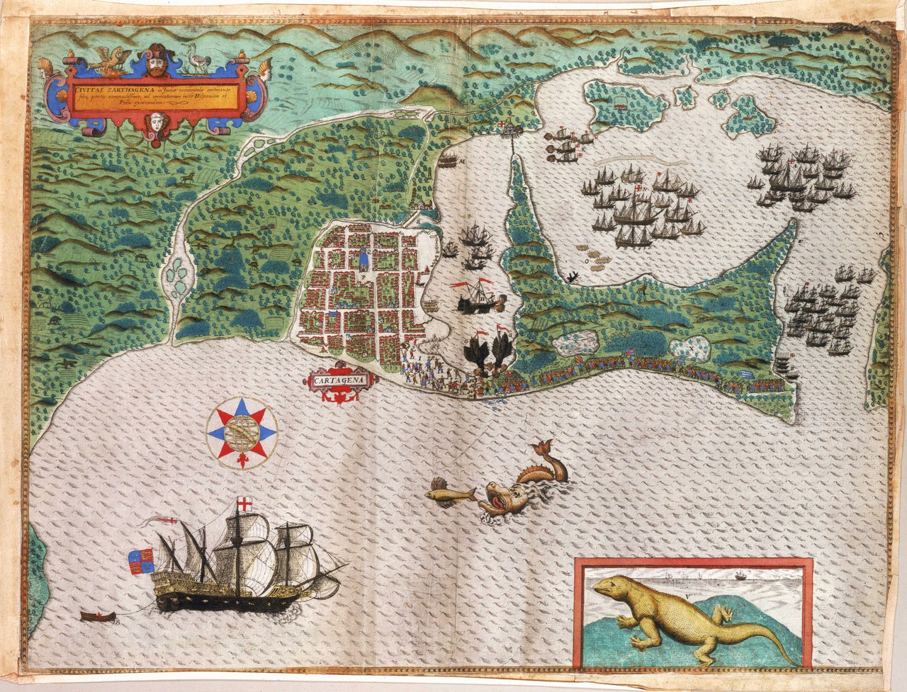
Giovanni Baptista Boazio |
| Description |
English: Civitas S Dominici sita in Hispaniola Indiea Angliae magnitudinae ferre aequalis, ipsa urbs elagantur ab Hispanis extracta, et omnibus circumvicinis insulis iura datSingle sheet. Hand col. engr. Scale: [ca. 1:5 000]. Cartographic Note: No scales. Additional Places: Santo Domingo. Contents Note: The map shows features and incidents of Drake's attack on the town and these were identified in a key, printed separately. The sea area is decorated with local wildlife including a crocodile, a flying fish and a turtle.
One of four charts drawn to accompany Walter Bigges' Expeditio Francisci Draki, published in 1588. |
| Date | 1588 |
| Dimensions | Printed area 39.5 x 53.5cm on sheet 42 x 57cm. |
| Source/Photographer | http://collections.rmg.co.uk/collections/objects/542376 |
| Permission (Reusing this file) |
The original artefact or artwork has been assessed as public domain by age, and faithful reproductions of the two dimensional work are also public domain. No permission is required for reuse for any purpose. The text of this image record has been derived from the Royal Museums Greenwich catalogue and image metadata. Individual data and facts such as date, author and title are not copyrightable, but reuse of longer descriptive text from the catalogue may not be considered fair use. Reuse of the text must be attributed to the "National Maritime Museum, Greenwich, London" and a Creative Commons CC-BY-NC-SA-3.0 license may apply if not rewritten. Refer to Royal Museums Greenwich copyright. |
| Other versions |
|
| Identifier | id number: PBC4053(2) undefined: 33BOAZ01,245:8 |
| Collection | Charts and maps |


Licensing
[edit]|
This is a faithful photographic reproduction of a two-dimensional, public domain work of art. The work of art itself is in the public domain for the following reason:
The official position taken by the Wikimedia Foundation is that "faithful reproductions of two-dimensional public domain works of art are public domain".
This photographic reproduction is therefore also considered to be in the public domain in the United States. In other jurisdictions, re-use of this content may be restricted; see Reuse of PD-Art photographs for details. | ||||
File history
Click on a date/time to view the file as it appeared at that time.
| Date/Time | Thumbnail | Dimensions | User | Comment | |
|---|---|---|---|---|---|
| current | 22:05, 20 August 2017 |  | 4,998 × 3,815 (54.55 MB) | Fæ (talk | contribs) | Royal Museums Greenwich Charts and maps, http://collections.rmg.co.uk/collections/objects/542376 |
You cannot overwrite this file.
File usage on Commons
The following 3 pages use this file:
- File:Civitas S Dominici sita in Hispaniola Indiea Angliae magnitudinae ferre aequalis, ipsa urbs elagantur ab Hispanis extracta, et omnibus circumvicinis insulis iura dat RMG A6820.tiff
- File:Civitas S Dominici sita in Hispaniola Indiea Angliae magnitudinae ferre aequalis, ipsa urbs elagantur ab Hispanis extracta, et omnibus circumvicinis insulis iura dat RMG A6821.tiff
- File:Civitas S Dominici sita in Hispaniola Indiea Angliae magnitudinae ferre aequalis, ipsa urbs elagantur ab Hispanis extracta, et omnibus circumvicinis insulis iura dat RMG F8033.tiff