File:Claydon station site geograph-3308721-by-Ben-Brooksbank.jpg
Jump to navigation
Jump to search
Size of this preview: 800 × 470 pixels. Other resolutions: 320 × 188 pixels | 640 × 376 pixels | 1,024 × 602 pixels | 1,280 × 752 pixels | 2,394 × 1,407 pixels.
Original file (2,394 × 1,407 pixels, file size: 2.95 MB, MIME type: image/jpeg)
Captions
Captions
Add a one-line explanation of what this file represents
Summary
[edit]
| Description |
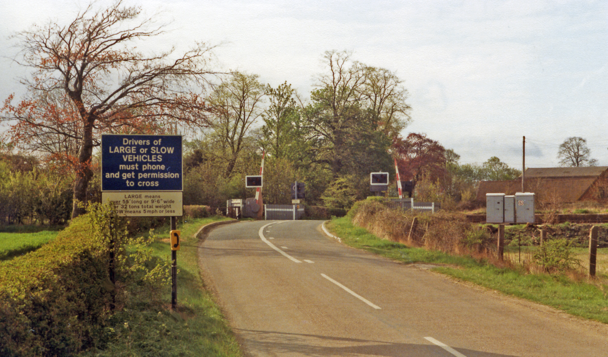
English: Approaching the level-crossing at the site of Claydon station, 1984. Viewed NW, the remnant of the ex-LNWR Bletchley - Oxford line crosses from right to left. The station and line were closed from 1/1/68, but a siding to Claydon was left from the Calvert Loop off the ex-GCR main line. The line was later reopened between Oxford and Bicester, while Bicester - Bletchley is likely to be reopened soon. Note the prominent Warning Sign, which dates from the infamous Hixon Crossing smash in 1968. |
| Date | |
| Source | From geograph.org.uk |
| Author | Ben Brooksbank |
| Permission (Reusing this file) |
Creative Commons Attribution Share-alike license 2.0 |
| Attribution (required by the license) | Ben Brooksbank / Approaching the level-crossing at the site of Claydon station, 1984 / |
| Camera location | | View this and other nearby images on: OpenStreetMap |
|---|
Licensing
[edit]

|
This image was taken from the Geograph project collection. See this photograph's page on the Geograph website for the photographer's contact details. The copyright on this image is owned by Ben Brooksbank and is licensed for reuse under the Creative Commons Attribution-ShareAlike 2.0 license.
|
This file is licensed under the Creative Commons Attribution-Share Alike 2.0 Generic license.
Attribution: Ben Brooksbank
- You are free:
- to share – to copy, distribute and transmit the work
- to remix – to adapt the work
- Under the following conditions:
- attribution – You must give appropriate credit, provide a link to the license, and indicate if changes were made. You may do so in any reasonable manner, but not in any way that suggests the licensor endorses you or your use.
- share alike – If you remix, transform, or build upon the material, you must distribute your contributions under the same or compatible license as the original.
File history
Click on a date/time to view the file as it appeared at that time.
| Date/Time | Thumbnail | Dimensions | User | Comment | |
|---|---|---|---|---|---|
| current | 11:10, 3 February 2013 | | 2,394 × 1,407 (2.95 MB) | Chevin (talk | contribs) | == {{int:filedesc}} == {{Information |Description={{en|1='''Approaching the level-crossing at the site of Claydon station, 1984.'''<br/> Viewed NW, the remnant of the ex-LNWR Bletchley - Oxford line crosses from right to left. The station and line were... |
You cannot overwrite this file.
File usage on Commons
The following page uses this file: