File:Cliffs at Black Rock - geograph.org.uk - 1117129.jpg
Jump to navigation
Jump to search
No higher resolution available.
Cliffs_at_Black_Rock_-_geograph.org.uk_-_1117129.jpg (640 × 480 pixels, file size: 118 KB, MIME type: image/jpeg)
Captions
Captions
Add a one-line explanation of what this file represents
Summary
[edit]
| Description |
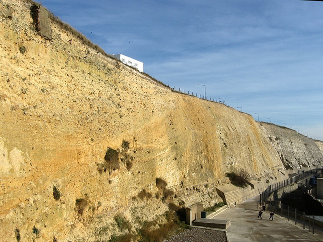
English: Cliffs at Black Rock Taken from the footpath that travels down the cliff face next to the Marina entrance. Below is the Undercliff Walk constructed in the 1930s to prevent erosion which was problematic here, 75 feet alone went in the 19th century causing the main cliff top road to Rottingdean to be diverted via Roedean. A geologically important site to containing a raised beach, a 45 foot layer of Coombe rock and the curves of the layers of solid chalk. Fossils found here include that of whales, mammoths, woolly rhinos and hippopotamuses. |
| Date | |
| Source | From geograph.org.uk |
| Author | Simon Carey |
| Attribution (required by the license) | Simon Carey / Cliffs at Black Rock / |
| Camera location | | View this and other nearby images on: OpenStreetMap |
|---|
_heading:90.00&language=en)
| Object location | | View this and other nearby images on: OpenStreetMap |
|---|
_heading:90.00&language=en)
Licensing
[edit]

|
This image was taken from the Geograph project collection. See this photograph's page on the Geograph website for the photographer's contact details. The copyright on this image is owned by Simon Carey and is licensed for reuse under the Creative Commons Attribution-ShareAlike 2.0 license.
|
This file is licensed under the Creative Commons Attribution-Share Alike 2.0 Generic license.
Attribution: Simon Carey
- You are free:
- to share – to copy, distribute and transmit the work
- to remix – to adapt the work
- Under the following conditions:
- attribution – You must give appropriate credit, provide a link to the license, and indicate if changes were made. You may do so in any reasonable manner, but not in any way that suggests the licensor endorses you or your use.
- share alike – If you remix, transform, or build upon the material, you must distribute your contributions under the same or compatible license as the original.
File history
Click on a date/time to view the file as it appeared at that time.
| Date/Time | Thumbnail | Dimensions | User | Comment | |
|---|---|---|---|---|---|
| current | 20:46, 24 February 2011 | | 640 × 480 (118 KB) | GeographBot (talk | contribs) | == {{int:filedesc}} == {{Information |description={{en|1=Cliffs at Black Rock Taken from the footpath that travels down the cliff face next to the Marina entrance. Below is the Undercliff Walk constructed in the 1930s to prevent erosion which was problema |
You cannot overwrite this file.
File usage on Commons
There are no pages that use this file.