File:Clitheroe town centre - geograph.org.uk - 74167.jpg
Jump to navigation
Jump to search
Size of this preview: 450 × 600 pixels. Other resolutions: 180 × 240 pixels | 480 × 640 pixels.
Original file (480 × 640 pixels, file size: 172 KB, MIME type: image/jpeg)
Captions
Captions
Add a one-line explanation of what this file represents
Summary
[edit]
| Description |
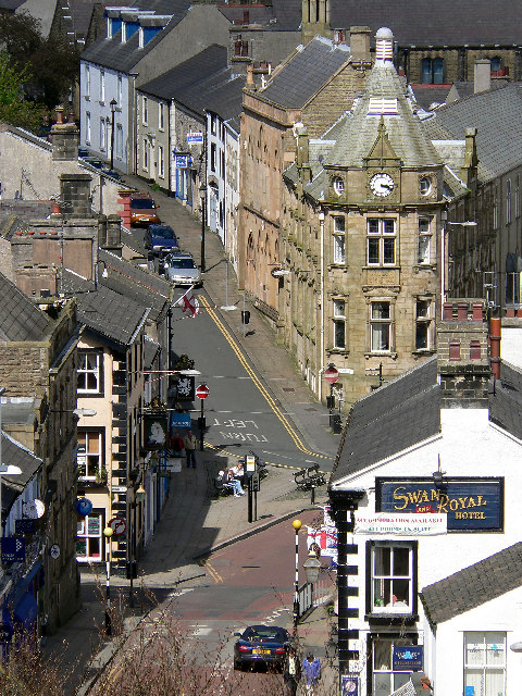
English: Clitheroe town centre. Photographed from clitheroe castle. |
| Date | |
| Source | From geograph.org.uk |
| Author | Jon Royle |
| Attribution (required by the license) | Jon Royle / Clitheroe town centre / |
| Camera location | | View this and other nearby images on: OpenStreetMap |
|---|
_&language=en)
| Object location | | View this and other nearby images on: OpenStreetMap |
|---|
_&language=en)
Licensing
[edit]

|
This image was taken from the Geograph project collection. See this photograph's page on the Geograph website for the photographer's contact details. The copyright on this image is owned by Jon Royle and is licensed for reuse under the Creative Commons Attribution-ShareAlike 2.0 license.
|
This file is licensed under the Creative Commons Attribution-Share Alike 2.0 Generic license.
Attribution: Jon Royle
- You are free:
- to share – to copy, distribute and transmit the work
- to remix – to adapt the work
- Under the following conditions:
- attribution – You must give appropriate credit, provide a link to the license, and indicate if changes were made. You may do so in any reasonable manner, but not in any way that suggests the licensor endorses you or your use.
- share alike – If you remix, transform, or build upon the material, you must distribute your contributions under the same or compatible license as the original.
File history
Click on a date/time to view the file as it appeared at that time.
| Date/Time | Thumbnail | Dimensions | User | Comment | |
|---|---|---|---|---|---|
| current | 14:18, 30 January 2010 | | 480 × 640 (172 KB) | GeographBot (talk | contribs) | == {{int:filedesc}} == {{Information |description={{en|1=Clitheroe town centre. Photographed from clitheroe castle.}} |date=2005-05-08 |source=From [http://www.geograph.org.uk/photo/74167 geograph.org.uk] |author=[http://www.geograph.org.uk/profile/3169 J |
You cannot overwrite this file.
File usage on Commons
The following 49 pages use this file:
- Category:Alumni by school in Lancashire
- Category:Archaeological sites in Lancashire
- Category:Bridges in Lancashire
- Category:Bus stations in Lancashire
- Category:Canals in Lancashire
- Category:Cemeteries in Lancashire
- Category:Clitheroe
- Category:Deaths in Lancashire
- Category:Forests in Lancashire
- Category:Geography of Lancashire
- Category:Hospitals in Lancashire
- Category:Lancashire
- Category:Lancashire in the 17th century
- Category:Lancashire in the 1830s
- Category:Lancashire in the 1840s
- Category:Lancashire in the 1850s
- Category:Lancashire in the 1860s
- Category:Lancashire in the 1880s
- Category:Lancashire in the 1890s
- Category:Lancashire in the 18th century
- Category:Lancashire in the 1900s
- Category:Lancashire in the 1910s
- Category:Lancashire in the 1920s
- Category:Lancashire in the 1930s
- Category:Lancashire in the 1940s
- Category:Lancashire in the 1950s
- Category:Lancashire in the 1960s
- Category:Lancashire in the 1970s
- Category:Lancashire in the 1980s
- Category:Lancashire in the 1990s
- Category:Lancashire in the 19th century
- Category:Lancashire in the 2000s
- Category:Lancashire in the 2010s
- Category:Lancashire in the 20th century
- Category:Lancashire in the 21st century
- Category:Maps of Lancashire
- Category:People of Lancashire
- Category:Populated places in Lancashire
- Category:Prisons in Lancashire
- Category:Rail transport in Lancashire
- Category:Railway viaducts in Lancashire
- Category:Rivers of Lancashire
- Category:Roads in Lancashire
- Category:Sports in Lancashire
- Category:Towers in Lancashire
- Category:Views of Lancashire
- Category:Villages in Lancashire
- Category:Visitor attractions in Lancashire
- Category:Windmills in Lancashire
File usage on other wikis
The following other wikis use this file:
- Usage on ar.wikipedia.org
- Usage on arz.wikipedia.org
- Usage on ast.wikipedia.org
- Usage on azb.wikipedia.org
- Usage on az.wikipedia.org
- Usage on ban.wikipedia.org
- Usage on be.wikipedia.org
- Usage on br.wikipedia.org
- Usage on ca.wikipedia.org
- Usage on ceb.wikipedia.org
- Usage on cy.wikipedia.org
- Usage on de.wikipedia.org
- Usage on de.wikivoyage.org
- Usage on en.wikipedia.org
- Usage on en.wikivoyage.org
- Usage on eo.wikipedia.org
- Usage on es.wikipedia.org
- Usage on eu.wikipedia.org
- Usage on fa.wikipedia.org
- Usage on ga.wikipedia.org
- Usage on gl.wikipedia.org
- Usage on he.wikipedia.org
- Usage on hu.wikipedia.org
- Usage on hy.wikipedia.org
- Usage on ia.wikipedia.org
- Usage on id.wikipedia.org
- Usage on ku.wikipedia.org
- Usage on lld.wikipedia.org
- Usage on nn.wikipedia.org
- Usage on no.wikipedia.org
- Usage on os.wikipedia.org
- Usage on ro.wikipedia.org
- Usage on ru.wikipedia.org
- Usage on sr.wikipedia.org
- Usage on tg.wikipedia.org
- Usage on tr.wikipedia.org
- Usage on www.wikidata.org
- Usage on zh-yue.wikipedia.org
- Usage on zh.wikipedia.org