File:Collingbourne station site geograph-3294934-by-Ben-Brooksbank.jpg
Jump to navigation
Jump to search
Size of this preview: 800 × 502 pixels. Other resolutions: 320 × 201 pixels | 640 × 402 pixels | 1,024 × 643 pixels | 1,280 × 804 pixels | 2,395 × 1,504 pixels.
Original file (2,395 × 1,504 pixels, file size: 3.37 MB, MIME type: image/jpeg)
Captions
Captions
Add a one-line explanation of what this file represents
Summary
[edit]
| Description |
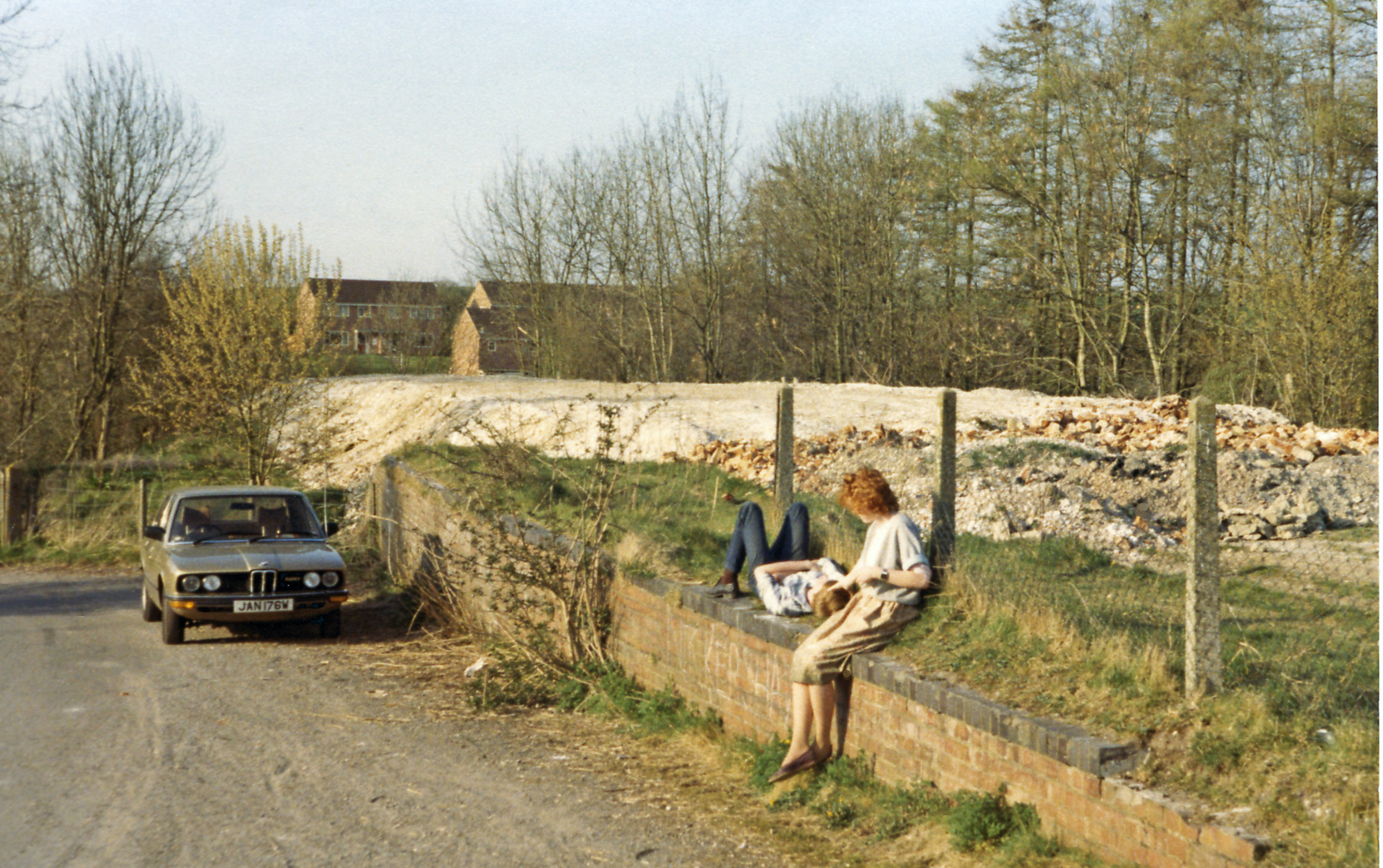
English: Remains of Collingbourne station, M&SWJR, 1984. View northward on the former Midland & South Western Junction Railway (latterly GWR), towards Savernake, Marlborough, Swindon and Cheltenham. This line, which closed entirely (except its southern end, Ludgershall - Andover Junction) from 11/9/61. All that remains is a wall/platform - with my teenage offspring lolling on it. In the two World Wars there were many large Camps and Depots in this Salisbury Plain area and some still remain, partly explaining why the line, which was vital in wartime, is still open as far as Ludgershall. |
| Date | |
| Source | From geograph.org.uk |
| Author | Ben Brooksbank |
| Permission (Reusing this file) |
Creative Commons Attribution Share-alike license 2.0 |
| Attribution (required by the license) | Ben Brooksbank / Remains of Collingbourne station, M&SWJR, 1984 / |
| Camera location | | View this and other nearby images on: OpenStreetMap |
|---|
Licensing
[edit]

|
This image was taken from the Geograph project collection. See this photograph's page on the Geograph website for the photographer's contact details. The copyright on this image is owned by Ben Brooksbank and is licensed for reuse under the Creative Commons Attribution-ShareAlike 2.0 license.
|
This file is licensed under the Creative Commons Attribution-Share Alike 2.0 Generic license.
Attribution: Ben Brooksbank
- You are free:
- to share – to copy, distribute and transmit the work
- to remix – to adapt the work
- Under the following conditions:
- attribution – You must give appropriate credit, provide a link to the license, and indicate if changes were made. You may do so in any reasonable manner, but not in any way that suggests the licensor endorses you or your use.
- share alike – If you remix, transform, or build upon the material, you must distribute your contributions under the same or compatible license as the original.
File history
Click on a date/time to view the file as it appeared at that time.
| Date/Time | Thumbnail | Dimensions | User | Comment | |
|---|---|---|---|---|---|
| current | 11:50, 15 February 2013 | | 2,395 × 1,504 (3.37 MB) | Chevin (talk | contribs) | == {{int:filedesc}} == {{Information |Description={{en|1='''Remains of Collingbourne station, M&SWJR, 1984.'''<br/> View northward on the former Midland & South Western Junction Railway (latterly GWR), towards Savernake, Marlborough, Swindon and Chelte... |
You cannot overwrite this file.
File usage on Commons
The following page uses this file:
File usage on other wikis
The following other wikis use this file:
- Usage on en.wikipedia.org
- Usage on www.wikidata.org