File:Countryside around Burrow from the air - geograph.org.uk - 1388719.jpg
Jump to navigation
Jump to search
No higher resolution available.
Countryside_around_Burrow_from_the_air_-_geograph.org.uk_-_1388719.jpg (640 × 480 pixels, file size: 84 KB, MIME type: image/jpeg)
Captions
Captions
Add a one-line explanation of what this file represents
Summary
[edit]
| Description |
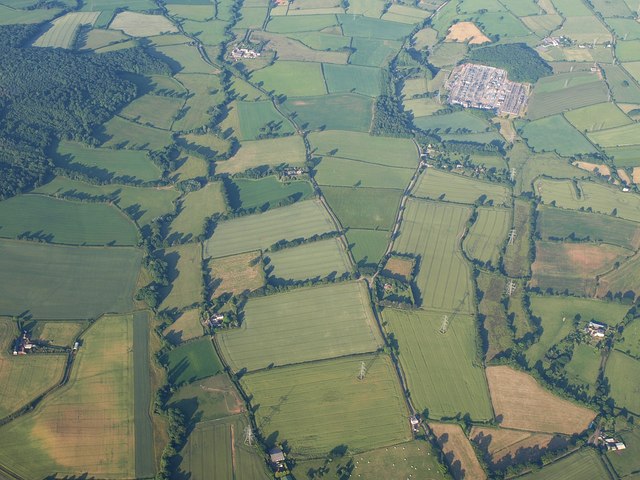
English: Countryside around Burrow from the air. The River Clyst crosses the left half of the image towards the camera; the further part of this course, running below Ashclyst Forest, is in SY0098. Until it reaches a level with Chillacombe Farm (lower left), it is in SX9998.
The fork in the road is at Forches Head. Above right is Exeter electricity substation - see 1388690. Seen from a hot air balloon. |
| Date | |
| Source | From geograph.org.uk |
| Author | Derek Harper |
| Attribution (required by the license) | Derek Harper / Countryside around Burrow from the air / |
| Camera location | | View this and other nearby images on: OpenStreetMap |
|---|
_heading:67.00&language=en)
| Object location | | View this and other nearby images on: OpenStreetMap |
|---|
_heading:67.00&language=en)
Licensing
[edit]

|
This image was taken from the Geograph project collection. See this photograph's page on the Geograph website for the photographer's contact details. The copyright on this image is owned by Derek Harper and is licensed for reuse under the Creative Commons Attribution-ShareAlike 2.0 license.
|
This file is licensed under the Creative Commons Attribution-Share Alike 2.0 Generic license.
Attribution: Derek Harper
- You are free:
- to share – to copy, distribute and transmit the work
- to remix – to adapt the work
- Under the following conditions:
- attribution – You must give appropriate credit, provide a link to the license, and indicate if changes were made. You may do so in any reasonable manner, but not in any way that suggests the licensor endorses you or your use.
- share alike – If you remix, transform, or build upon the material, you must distribute your contributions under the same or compatible license as the original.
File history
Click on a date/time to view the file as it appeared at that time.
| Date/Time | Thumbnail | Dimensions | User | Comment | |
|---|---|---|---|---|---|
| current | 18:07, 28 February 2011 | | 640 × 480 (84 KB) | GeographBot (talk | contribs) | == {{int:filedesc}} == {{Information |description={{en|1=Countryside around Burrow from the air The River Clyst crosses the left half of the image towards the camera; the further part of this course, running below Ashclyst Forest, is in SY0098. Until |
You cannot overwrite this file.
File usage on Commons
There are no pages that use this file.