File:Cran Brook - geograph.org.uk - 717583.jpg
Jump to navigation
Jump to search
No higher resolution available.
Cran_Brook_-_geograph.org.uk_-_717583.jpg (640 × 360 pixels, file size: 109 KB, MIME type: image/jpeg)
Captions
Captions
Add a one-line explanation of what this file represents
Summary
[edit]
| Description |
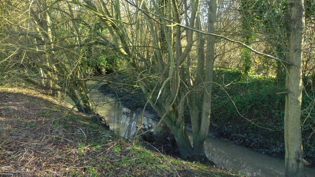
English: Cran Brook The Cran Brook, a tributary of the River Blythe which gives its name to the Cranmore area of Shirley. Rising somewhere near Our Lady of the Wayside church in Stratford Road, Shirley, it has been progressively culverted since the early 1950s. Running next to the Highlands Road industrial estate, in the pas tit has been poullted by discharges from factories. One of Solihull's 'lost' streams like the Streetsbrook, the remaining visible section runs through public open space leading into Hillfield Park. |
| Date | |
| Source | From geograph.org.uk |
| Author | Robin Jones |
| Attribution (required by the license) | Robin Jones / Cran Brook / |
| Camera location | | View this and other nearby images on: OpenStreetMap |
|---|
_heading:90.00&language=en)
| Object location | | View this and other nearby images on: OpenStreetMap |
|---|
_heading:90.00&language=en)
Licensing
[edit]

|
This image was taken from the Geograph project collection. See this photograph's page on the Geograph website for the photographer's contact details. The copyright on this image is owned by Robin Jones and is licensed for reuse under the Creative Commons Attribution-ShareAlike 2.0 license.
|
This file is licensed under the Creative Commons Attribution-Share Alike 2.0 Generic license.
Attribution: Robin Jones
- You are free:
- to share – to copy, distribute and transmit the work
- to remix – to adapt the work
- Under the following conditions:
- attribution – You must give appropriate credit, provide a link to the license, and indicate if changes were made. You may do so in any reasonable manner, but not in any way that suggests the licensor endorses you or your use.
- share alike – If you remix, transform, or build upon the material, you must distribute your contributions under the same or compatible license as the original.
File history
Click on a date/time to view the file as it appeared at that time.
| Date/Time | Thumbnail | Dimensions | User | Comment | |
|---|---|---|---|---|---|
| current | 01:03, 19 February 2011 | | 640 × 360 (109 KB) | GeographBot (talk | contribs) | == {{int:filedesc}} == {{Information |description={{en|1=Cran Brook The Cran Brook, a tributary of the River Blythe which gives its name to the Cranmore area of Shirley. Rising somewhere near Our Lady of the Wayside church in Stratford Road, Shirley, it h |
You cannot overwrite this file.
File usage on Commons
There are no pages that use this file.