File:Crosshill railway station in 2008.jpg
Jump to navigation
Jump to search
No higher resolution available.
Crosshill_railway_station_in_2008.jpg (640 × 480 pixels, file size: 99 KB, MIME type: image/jpeg)
Captions
Captions
Add a one-line explanation of what this file represents
Summary
[edit]
| Camera location | | View this and other nearby images on: OpenStreetMap |
|---|
| Description |
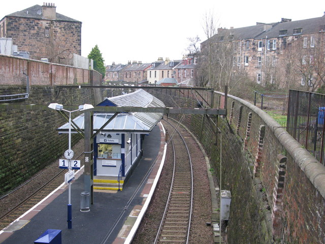
Original description: Crosshill Railway Station Crosshill is the station between Queen's Park and Mount Florida on the Cathcart Circle Line out of Glasgow Central. It is also on the route leading towards the Newton and Neilston branch lines. |
| Date | |
| Source | From geograph.org.uk |
| Author | G Laird |
| Permission (Reusing this file) |
Creative Commons Attribution Share-alike license 2.0 |
| Attribution (required by the license) | G Laird / Crosshill Railway Station / |
Licensing
[edit]

|
This image was taken from the Geograph project collection. See this photograph's page on the Geograph website for the photographer's contact details. The copyright on this image is owned by G Laird and is licensed for reuse under the Creative Commons Attribution-ShareAlike 2.0 license.
|
This file is licensed under the Creative Commons Attribution-Share Alike 2.0 Generic license.
Attribution: G Laird
- You are free:
- to share – to copy, distribute and transmit the work
- to remix – to adapt the work
- Under the following conditions:
- attribution – You must give appropriate credit, provide a link to the license, and indicate if changes were made. You may do so in any reasonable manner, but not in any way that suggests the licensor endorses you or your use.
- share alike – If you remix, transform, or build upon the material, you must distribute your contributions under the same or compatible license as the original.
File history
Click on a date/time to view the file as it appeared at that time.
| Date/Time | Thumbnail | Dimensions | User | Comment | |
|---|---|---|---|---|---|
| current | 10:05, 27 December 2008 | | 640 × 480 (99 KB) | Edward (talk | contribs) | ==Summary== {{Location dec|55.833298|-4.256014|heading:292}} {{Information |Description=w:Crosshill railway station Original description: '''Crosshill Railway Station''' Crosshill is the station between Queen's Park and Mount Florida on the Cathca |
You cannot overwrite this file.
File usage on Commons
The following page uses this file:
File usage on other wikis
The following other wikis use this file:
- Usage on en.wikipedia.org
- Usage on nl.wikipedia.org
- Usage on sco.wikipedia.org
- Usage on www.wikidata.org