File:Dùn Colbost - geograph.org.uk - 1399364.jpg
Dùn_Colbost_-_geograph.org.uk_-_1399364.jpg (640 × 480 pixels, file size: 120 KB, MIME type: image/jpeg)
Captions
Captions
Summary
[edit]
| Description |
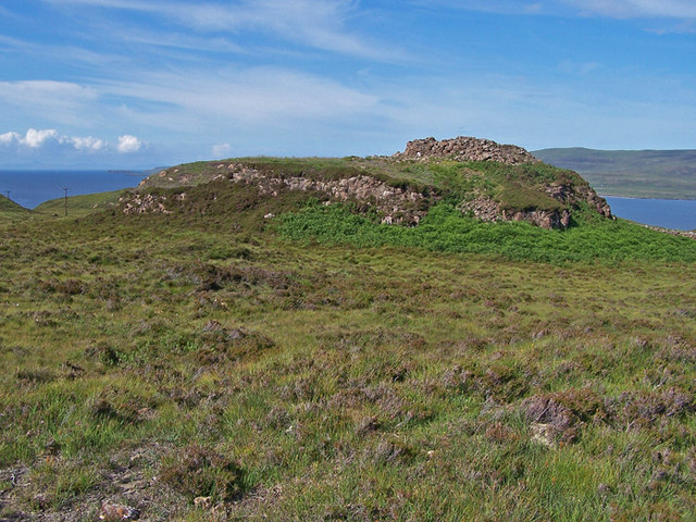
English: Dùn Colbost This broch has been extensively investigated with records of excavations to be found at the Highland Environmental Record website - http://her.highland.gov.uk/SingleResult.aspx?uid=MHG4840 .
To quote from the website - Brochs are round, tower-like houses, their monumental size intended to display the wealth and status of the agricultural communities who lived in them. They were occupied in the later Iron Age and are common in the north and west of Scotland. Dun Colbost stands on the end of a rocky knoll overlooking Loch Dunvegan in Skye. Directly opposite, a short distance across the narrow sea loch, is another broch, Dun Fiadhairt. Its position, controlling both land and sea, suggests that Dun Colbost was indeed intended to dominate the surrounding landscape. The walls of the broch itself are in a ruinous condition, but excavation within the curving enclosure wall surrounding the tower, has revealed paved surfaces, drains and hearths, although no definite evidence for buildings. |
| Date | |
| Source | From geograph.org.uk |
| Author | Richard Dorrell |
| Attribution (required by the license) | Richard Dorrell / Dùn Colbost / |
| Camera location | | View this and other nearby images on: OpenStreetMap |
|---|
_heading:45.00&language=en)
| Object location | | View this and other nearby images on: OpenStreetMap |
|---|
_heading:45.00&language=en)
Licensing
[edit]

|
This image was taken from the Geograph project collection. See this photograph's page on the Geograph website for the photographer's contact details. The copyright on this image is owned by Richard Dorrell and is licensed for reuse under the Creative Commons Attribution-ShareAlike 2.0 license.
|
- You are free:
- to share – to copy, distribute and transmit the work
- to remix – to adapt the work
- Under the following conditions:
- attribution – You must give appropriate credit, provide a link to the license, and indicate if changes were made. You may do so in any reasonable manner, but not in any way that suggests the licensor endorses you or your use.
- share alike – If you remix, transform, or build upon the material, you must distribute your contributions under the same or compatible license as the original.
File history
Click on a date/time to view the file as it appeared at that time.
| Date/Time | Thumbnail | Dimensions | User | Comment | |
|---|---|---|---|---|---|
| current | 21:46, 28 February 2011 | | 640 × 480 (120 KB) | GeographBot (talk | contribs) | == {{int:filedesc}} == {{Information |description={{en|1=Dùn Colbost This broch has been extensively investigated with records of excavations to be found at the Highland Environmental Record website - http://her.highland.gov.uk/SingleResult.aspx?uid=MHG4 |
You cannot overwrite this file.
File usage on Commons
There are no pages that use this file.
File usage on other wikis
The following other wikis use this file:
- Usage on www.wikidata.org