File:DETAIL VIEW OF SOUTH KEYSTONE PORTAL, VIEW NORTH - Pittsburgh and Steubenville Extension Railroad Tunnel, Between Fifth and Sixth Streets, East of Grant Street, Pittsburgh, HAER PA,2-PITBU,60-2.tif
Jump to navigation
Jump to search

Size of this JPG preview of this TIF file: 757 × 600 pixels. Other resolutions: 303 × 240 pixels | 606 × 480 pixels | 969 × 768 pixels | 1,280 × 1,015 pixels | 2,560 × 2,029 pixels | 5,000 × 3,963 pixels.
Original file (5,000 × 3,963 pixels, file size: 18.9 MB, MIME type: image/tiff)
Captions
Captions
Add a one-line explanation of what this file represents
Summary[edit]
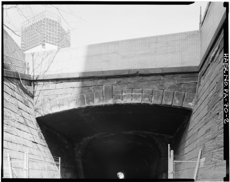
| DETAIL VIEW OF SOUTH KEYSTONE PORTAL, VIEW NORTH - Pittsburgh and Steubenville Extension Railroad Tunnel, Between Fifth and Sixth Streets, East of Grant Street, Pittsburgh, Allegheny County, PA | ||||
|---|---|---|---|---|
| Title |
DETAIL VIEW OF SOUTH KEYSTONE PORTAL, VIEW NORTH - Pittsburgh and Steubenville Extension Railroad Tunnel, Between Fifth and Sixth Streets, East of Grant Street, Pittsburgh, Allegheny County, PA |
|||
| Description |
Pennsylvania Railroad; Pittsburgh Light Rail Transit System; Penn Central Transportation Corporation; Port Authority of Allegheny County; Port Authority of Allegheny County, sponsor; Navratil, Henry, photographer; Yearby, Jean P, historian |
|||
| Depicted place | Pennsylvania; Allegheny County; Pittsburgh | |||
| Date | Documentation compiled after 1968 | |||
| Dimensions | 4 x 5 in. | |||
| Current location |
Library of Congress Prints and Photographs Division Washington, D.C. 20540 USA http://hdl.loc.gov/loc.pnp/pp.print |
|||
| Accession number |
HAER PA,2-PITBU,60-2 |
|||
| Credit line |
|
|||
| Notes |
|
|||
| Source | https://www.loc.gov/pictures/item/pa1632.photos.133085p | |||
| Permission (Reusing this file) |
|
|||

| Object location | | View this and other nearby images on: OpenStreetMap |
|---|
File history
Click on a date/time to view the file as it appeared at that time.
| Date/Time | Thumbnail | Dimensions | User | Comment | |
|---|---|---|---|---|---|
| current | 14:22, 30 July 2014 |  | 5,000 × 3,963 (18.9 MB) | Fæ (talk | contribs) | GWToolset: Creating mediafile for Fæ. HABS 30 July 2014 (2901:3000) |
You cannot overwrite this file.
File usage on Commons
The following page uses this file: