File:Deck view, east approach; intersection of Carroll Road at left; Interstate Highway 5 viaduct in background; view to southwest; 90mm lens - Carroll Overhead Bridge, Altamont Pass HAER CAL,1-LIVMO.V,1-8.tif
Jump to navigation
Jump to search

Size of this JPG preview of this TIF file: 758 × 600 pixels. Other resolutions: 303 × 240 pixels | 607 × 480 pixels | 971 × 768 pixels | 1,280 × 1,013 pixels | 2,560 × 2,025 pixels | 5,100 × 4,035 pixels.
Original file (5,100 × 4,035 pixels, file size: 19.63 MB, MIME type: image/tiff)
Captions
Captions
Add a one-line explanation of what this file represents
Summary
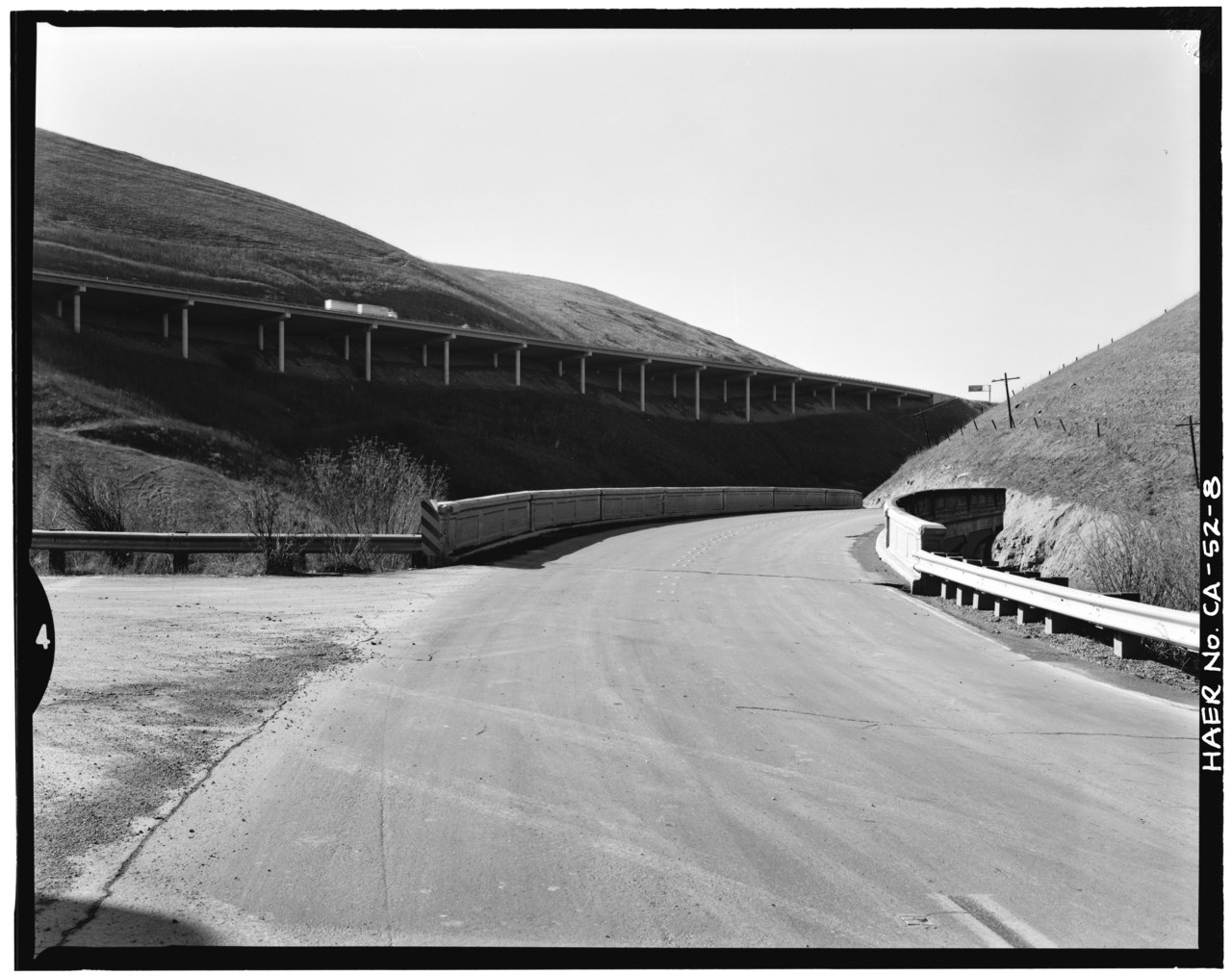
[edit]| Deck view, east approach; intersection of Carroll Road at left; Interstate Highway 5 viaduct in background; view to southwest; 90mm lens - Carroll Overhead Bridge, Altamont Pass Road, Livermore, Alameda County, CA | ||||
|---|---|---|---|---|
| Photographer |
Andersen, Ed Related names:
|
|||
| Title |
Deck view, east approach; intersection of Carroll Road at left; Interstate Highway 5 viaduct in background; view to southwest; 90mm lens - Carroll Overhead Bridge, Altamont Pass Road, Livermore, Alameda County, CA |
|||
| Depicted place | California; Alameda County; Livermore | |||
| Date | 1987 | |||
| Dimensions | 4 x 5 in. | |||
| Current location |
Library of Congress Prints and Photographs Division Washington, D.C. 20540 USA http://hdl.loc.gov/loc.pnp/pp.print |
|||
| Accession number |
HAER CAL,1-LIVMO.V,1-8 |
|||
| Credit line |
|
|||
| Notes |
|
|||
| Source | https://www.loc.gov/pictures/item/ca1451.photos.020564p | |||
| Permission (Reusing this file) |
|
|||

| Object location | | View this and other nearby images on: OpenStreetMap |
|---|
File history
Click on a date/time to view the file as it appeared at that time.
| Date/Time | Thumbnail | Dimensions | User | Comment | |
|---|---|---|---|---|---|
| current | 06:33, 3 July 2014 |  | 5,100 × 4,035 (19.63 MB) | Fæ (talk | contribs) | GWToolset: Creating mediafile for Fæ. HABS batch upload 2 July 2014 (301:400) |
You cannot overwrite this file.
File usage on Commons
The following page uses this file: