File:Denmark Street in 2010, by Martin Addison, geograph.org.uk 1957933.jpg
跳转到导航
跳转到搜索
本预览的尺寸:406 × 599像素。 其他分辨率:163 × 240像素 | 325 × 480像素 | 521 × 768像素 | 1,085 × 1,600像素。
原始文件 (1,085 × 1,600像素,文件大小:562 KB,MIME类型:image/jpeg)
说明
说明
添加一行文字以描述该文件所表现的内容
摘要
[编辑]| 描述 |
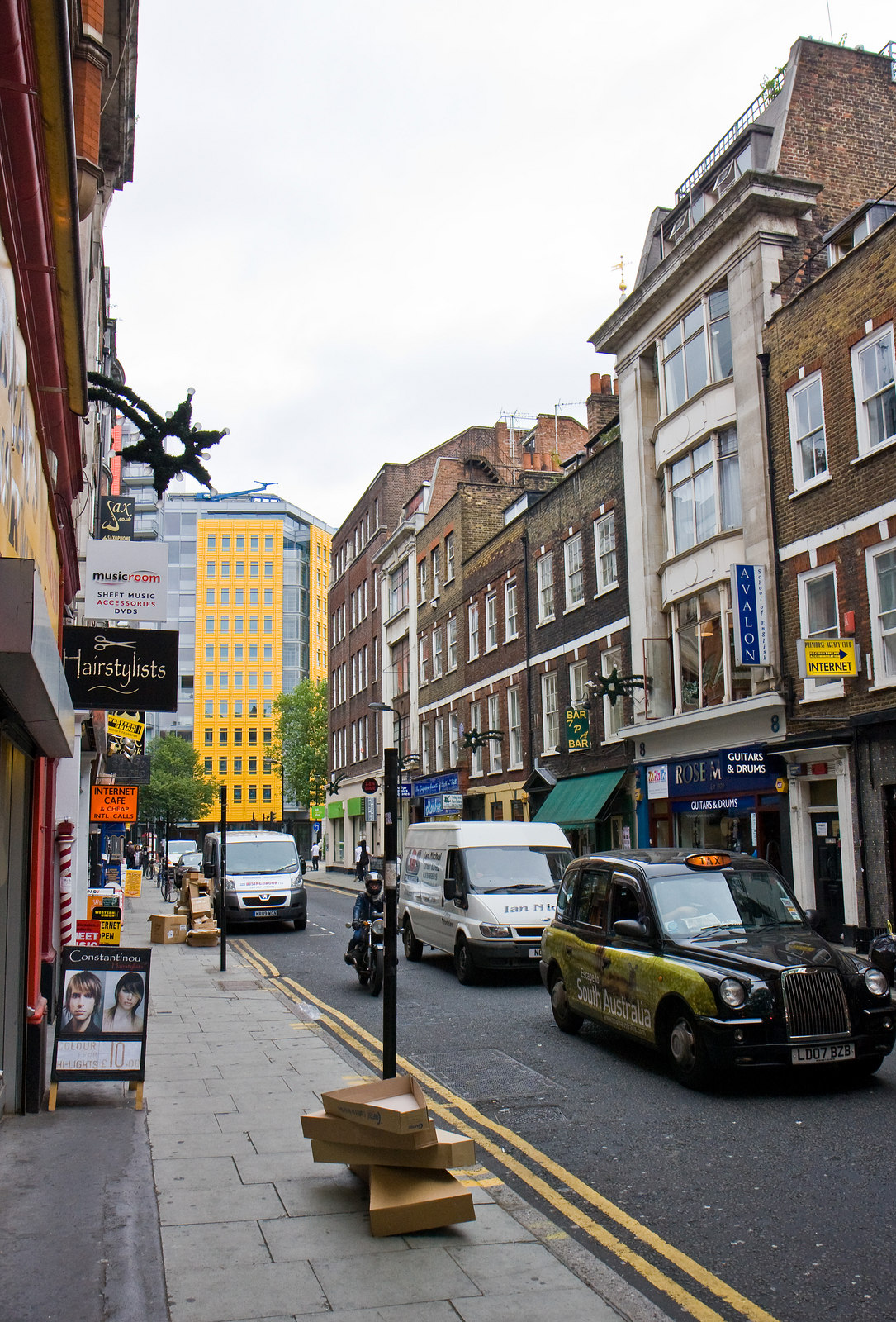
English: ;Denmark Street
This short road connecting St. Giles High Street with Charing Cross Road lies at the heart of London's music centre. Many of the shops sell instruments and sheet music. The cardboard boxes in the foreground provide evidence of a recent delivery of guitars. The bright yellow building at the end of the street is part of the Central St. Giles development. |
||
| 日期 | |||
| 来源 |
本文件采用知识共享署名-相同方式共享 2.0 通用许可协议授权。 署名: Martin Addison
|
||
| 作者 | Geograph: Martin Addison | ||
| 其他版本 |
|
||
| 署名 (由许可协议要求) | Martin Addison / Denmark Street / | ||


| 相机位置 | | 在以下服务上查看本图像和附近其他图像: OpenStreetMap |
|---|
许可协议
[编辑]
本文件采用知识共享署名-相同方式共享 2.0 通用许可协议授权。
- 您可以自由地:
- 共享 – 复制、发行并传播本作品
- 修改 – 改编作品
- 惟须遵守下列条件:
- 署名 – 您必须对作品进行署名,提供授权条款的链接,并说明是否对原始内容进行了更改。您可以用任何合理的方式来署名,但不得以任何方式表明许可人认可您或您的使用。
- 相同方式共享 – 如果您再混合、转换或者基于本作品进行创作,您必须以与原先许可协议相同或相兼容的许可协议分发您贡献的作品。
文件历史
点击某个日期/时间查看对应时刻的文件。
| 日期/时间 | 缩略图 | 大小 | 用户 | 备注 | |
|---|---|---|---|---|---|
| 当前 | 2017年9月10日 (日) 11:53 | | 1,085 × 1,600(562 KB) | Geograph Update Bot(留言 | 贡献) | Higher-resolution version from Geograph. |
| 2013年7月26日 (五) 02:06 |  | 434 × 640(106 KB) | Clusternote(留言 | 贡献) | User created page with UploadWizard |
您不可以覆盖此文件。
文件用途
以下9个页面使用本文件:
- File:Denmark Street, London, view from Charing Cross Road.jpg
- File:Denmark Street, London, view from St Giles High Street end.jpg
- File:Denmark Street - Chris Bryant's Musical Instruments.jpg
- File:Denmark Street in 2010, by Martin Addison, geograph.org.uk 1957933.jpg
- File:Denmark Street in 2010, viewed from its junction with Charing Cross Road, by David Dixon, geograph.org.uk 1665474.jpg
- File:Denmark Street in 2011, view across its junction with Charing Cross Road, from Manette Street, by Derek Harper, gegraph.org.uk 2392600.jpg
- File:Denmarkst.jpg
- File:The Intrepid Fox and Central Saint Giles, viewed from Denmark Street, by Robert Lamb, geograph.org.uk 2471863.jpg
- Category:Denmark Street
全域文件用途
以下其他wiki使用此文件:
- ca.wikipedia.org上的用途
- en.wikipedia.org上的用途
- fa.wikipedia.org上的用途
- fi.wikipedia.org上的用途
- fr.wikipedia.org上的用途
- it.wikipedia.org上的用途
- lv.wikipedia.org上的用途
- no.wikipedia.org上的用途
- www.wikidata.org上的用途
- zh.wikipedia.org上的用途