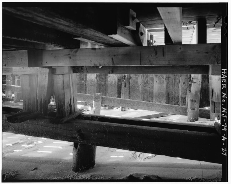
File:Detail of wharf A timber framing, showing piers and pier caps or plates stepping down for a sloped launching deck, now built-up for a flat deck, interior of sheet steel bulkhead HAER NJ,13-HIGH,1A-27.tif
Jump to navigation
Jump to search
Size of this JPG preview of this TIF file: 755 × 599 pixels. Other resolutions: 302 × 240 pixels | 605 × 480 pixels | 968 × 768 pixels | 1,280 × 1,016 pixels | 2,560 × 2,032 pixels | 5,000 × 3,969 pixels.
Original file (5,000 × 3,969 pixels, file size: 18.93 MB, MIME type: image/tiff)
Captions
Captions
Add a one-line explanation of what this file represents
Summary[edit]
| Photographer |
Usher, Aaron |
|||
| Title |
Detail of wharf A timber framing, showing piers and pier caps or plates stepping down for a sloped launching deck, now built-up for a flat deck, interior of sheet steel bulkhead is visible at wharf edge - U.S. Coast Guard Sandy Hook Station, Western Docking Structure, West of intersection of Canfield Road and Hartshorne Drive, Highlands, Monmouth County, NJ |
|||
| Depicted place | New Jersey; Monmouth County; Highlands | |||
| Date | 1992 | |||
| Dimensions | 4 x 5 in. | |||
| Current location |
Library of Congress Prints and Photographs Division Washington, D.C. 20540 USA http://hdl.loc.gov/loc.pnp/pp.print |
|||
| Accession number |
HAER NJ,13-HIGH,1A-27 |
|||
| Credit line |
|
|||
| Notes |
|
|||
| Source | https://www.loc.gov/pictures/item/nj1263.photos.347142p | |||
| Permission (Reusing this file) |
|

| Object location | | View this and other nearby images on: OpenStreetMap |
|---|
File history
Click on a date/time to view the file as it appeared at that time.
| Date/Time | Thumbnail | Dimensions | User | Comment | |
|---|---|---|---|---|---|
| current | 18:51, 28 July 2014 |  | 5,000 × 3,969 (18.93 MB) | Fæ (talk | contribs) | GWToolset: Creating mediafile for Fæ. HABS 24 July 2014 (2301:2600) |
You cannot overwrite this file.
File usage on Commons
The following page uses this file: