File:Dismantled railway near River Earn, Dalchonzie, Perthshire - geograph.org.uk - 1578236.jpg
Jump to navigation
Jump to search
No higher resolution available.
Dismantled_railway_near_River_Earn,_Dalchonzie,_Perthshire_-_geograph.org.uk_-_1578236.jpg (640 × 480 pixels, file size: 137 KB, MIME type: image/jpeg)
Captions
Captions
Add a one-line explanation of what this file represents
Summary[edit]
| Description |
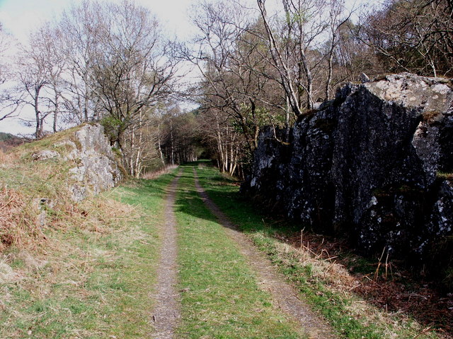
English: Dismantled railway near River Earn, Dalchonzie, Perthshire The railway which once connected Loch Earn, and beyond, with Perth was a victim of the Beeching cuts in the 1960s. The old track has been removed to provide a delightful path for walkers along parts of the route from Comrie to St Fillans, thus avoiding the busy main road and revealing parts of the river not visible from the roadway. |
| Date | |
| Source | From geograph.org.uk |
| Author | Anthony O'Neil |
| Attribution (required by the license) | Anthony O'Neil / Dismantled railway near River Earn, Dalchonzie, Perthshire / |
| Camera location | | View this and other nearby images on: OpenStreetMap |
|---|
| Object location | | View this and other nearby images on: OpenStreetMap |
|---|
Licensing[edit]

|
This image was taken from the Geograph project collection. See this photograph's page on the Geograph website for the photographer's contact details. The copyright on this image is owned by Anthony O'Neil and is licensed for reuse under the Creative Commons Attribution-ShareAlike 2.0 license.
|
This file is licensed under the Creative Commons Attribution-Share Alike 2.0 Generic license.
Attribution: Anthony O'Neil
- You are free:
- to share – to copy, distribute and transmit the work
- to remix – to adapt the work
- Under the following conditions:
- attribution – You must give appropriate credit, provide a link to the license, and indicate if changes were made. You may do so in any reasonable manner, but not in any way that suggests the licensor endorses you or your use.
- share alike – If you remix, transform, or build upon the material, you must distribute your contributions under the same or compatible license as the original.

_heading:270.00&language=en)
_heading:270.00&language=en)
File history
Click on a date/time to view the file as it appeared at that time.
| Date/Time | Thumbnail | Dimensions | User | Comment | |
|---|---|---|---|---|---|
| current | 20:09, 3 March 2011 | | 640 × 480 (137 KB) | GeographBot (talk | contribs) | == {{int:filedesc}} == {{Information |description={{en|1=Dismantled railway near River Earn, Dalchonzie, Perthshire The railway which once connected Loch Earn, and beyond, with Perth was a victim of the Beeching cuts in the 1960s. The old track has been |
You cannot overwrite this file.
File usage on Commons
There are no pages that use this file.