File:Durham station geograph-3849917-by-Ben-Brooksbank.jpg
Jump to navigation
Jump to search

Size of this preview: 800 × 437 pixels. Other resolutions: 320 × 175 pixels | 640 × 349 pixels | 1,024 × 559 pixels | 1,280 × 699 pixels | 2,349 × 1,282 pixels.
Original file (2,349 × 1,282 pixels, file size: 3.05 MB, MIME type: image/jpeg)
Captions
Captions
Add a one-line explanation of what this file represents
Summary
[edit]
| Description |
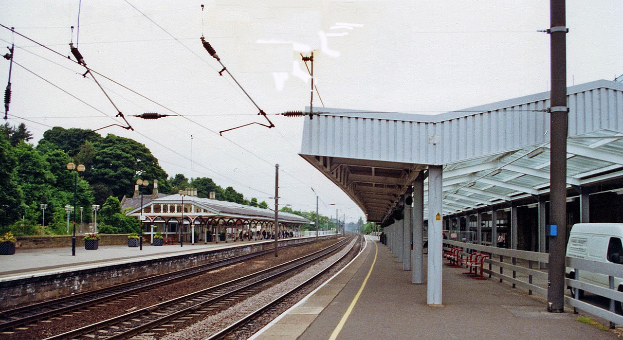
English: Durham station, ECML 2000. View NE on the Up platform, towards Newcastle-on-Tyne and Edinburgh: ex-NER section of the East Coast Main Line, electrified in 1990. Durham had been a busy junction station, for until 5/39 there were branch services to Blackhill via Lanchester, until 10/51 to Waterhouses and until 4/5/64 to/from Bishop Auckland/Sunderland, goods traffic on these branches continuing until the decline of the coal-mines. |
| Date | |
| Source | From geograph.org.uk |
| Author | Ben Brooksbank |
| Permission (Reusing this file) |
Creative Commons Attribution Share-alike license 2.0 |
| Attribution (required by the license) | Ben Brooksbank / Durham station, ECML 2000 / |
| Camera location | | View this and other nearby images on: OpenStreetMap |
|---|
Licensing
[edit]

|
This image was taken from the Geograph project collection. See this photograph's page on the Geograph website for the photographer's contact details. The copyright on this image is owned by Ben Brooksbank and is licensed for reuse under the Creative Commons Attribution-ShareAlike 2.0 license.
|
This file is licensed under the Creative Commons Attribution-Share Alike 2.0 Generic license.
Attribution: Ben Brooksbank
- You are free:
- to share – to copy, distribute and transmit the work
- to remix – to adapt the work
- Under the following conditions:
- attribution – You must give appropriate credit, provide a link to the license, and indicate if changes were made. You may do so in any reasonable manner, but not in any way that suggests the licensor endorses you or your use.
- share alike – If you remix, transform, or build upon the material, you must distribute your contributions under the same or compatible license as the original.
File history
Click on a date/time to view the file as it appeared at that time.
| Date/Time | Thumbnail | Dimensions | User | Comment | |
|---|---|---|---|---|---|
| current | 09:43, 12 March 2014 | | 2,349 × 1,282 (3.05 MB) | Chevin (talk | contribs) | == {{int:filedesc}} == {{Information |Description={{en|1='''Durham station, ECML 2000.'''<br/> View NE on the Up platform, towards Newcastle-on-Tyne and Edinburgh: ex-NER section of the East Coast Main Line, electrified in 1990. Durham had been a busy... |
You cannot overwrite this file.
File usage on Commons
The following page uses this file: