File:ELEVATION VIEW FROM EAST OF 12 PARKWAY (APARTMENT BUILDING). - Old Greenbelt, Crescent Road and Southway, Greenbelt, Prince George's County, MD HABS MD-1217-13.tif
Original file (5,305 × 3,856 pixels, file size: 19.51 MB, MIME type: image/tiff)
Captions
Captions
Summary
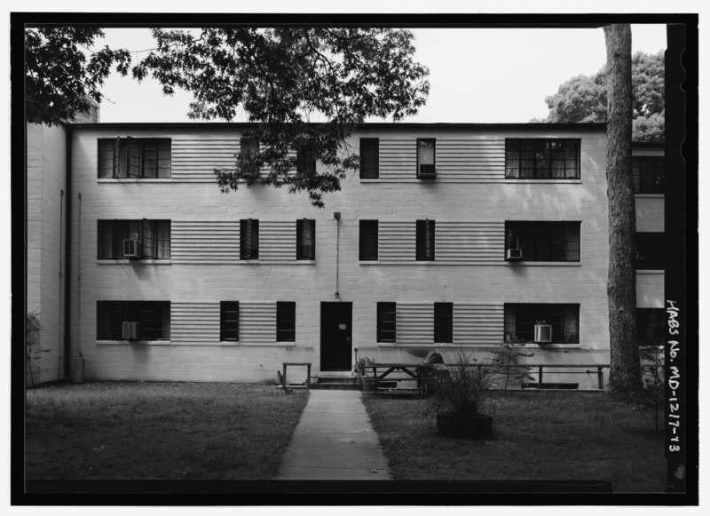
[edit]| ELEVATION VIEW FROM EAST OF 12 PARKWAY (APARTMENT BUILDING). - Old Greenbelt, Crescent Road and Southway, Greenbelt, Prince George's County, MD | ||||
|---|---|---|---|---|
| Photographer |
Rosenthal, James W. |
|||
| Title |
ELEVATION VIEW FROM EAST OF 12 PARKWAY (APARTMENT BUILDING). - Old Greenbelt, Crescent Road and Southway, Greenbelt, Prince George's County, MD |
|||
| Depicted place | Maryland; Prince George's County; Greenbelt | |||
| Date | Documentation compiled after 1933; 2005 | |||
| Dimensions | 5 x 7 in. | |||
| Current location |
Library of Congress Prints and Photographs Division Washington, D.C. 20540 USA http://hdl.loc.gov/loc.pnp/pp.print |
|||
| Accession number |
HABS MD-1217-13 |
|||
| Credit line |
|
|||
| Notes |
Franklin Roosevelt's victory in the 1932 presidential election initiated sweeping changes in the federal government to combat the economic depression of the 1930s. Among Roosevelt's advisors was Columbia University economics professor Rexford Tugwell, who had a particular interest in promoting economic recovery in the agricultural sector. Having been named assistant secretary of agriculture and then undersecretary of agriculture, Tugwell masterminded the formation of the Resettlement Administration, dedicated to moving families from substandard urban and rural locations to new, planned communities. The Resettlement Administration included the Suburban Resettlement Division, which was concerned with moving low- and moderate-income young families from cities to new suburban towns. Economics was a primary concern of this effort, anticipating that the low cost of outlying land would make new communities more affordable. This greenbelt town program utilized Garden City planning principles, first promoted in the United Kingdom by Ebenezer Howard and taken up by American planners, architects, and intellectuals including Henry Wright, Clarence Stein, and Lewis Mumford. Garden City ideals featured the prominent inclusion of parks and green space to augment the density of clustered, multi-family housing and emphasized planned integration of residential, commercial, recreational, and industrial uses throughout the city. Greenbelt, chartered by the state of Maryland in 1937, was the most prominent and complete town in the United States planned along these principles. Construction of the original section of Greenbelt, Maryland from 1936 to 1938 provided work for thousands of unemployed laborers, as was characteristic of many New Deal programs. The town was an innovative combination of superblocks (neighborhood units with groups of row houses and apartments intersected by pedestrian walkways through communal green space), a central grouping of commercial and recreational structures, and segregated circulation patterns for pedestrian and automotive uses between the residential and commercial zones. In addition, the federal government promoted cooperative enterprises and associations in Greenbelt as a way to foster affordability and an enduring sense of community. This original section of Greenbelt established a precedent in housing form and in planning that strongly influenced subsequent development. In anticipation of World War II, the federal government developed 1000 new units of row housing for defense workers in an adjacent section of the federally-owned land. These houses were developed into another neighborhood unit of superblocks with curving, picturesque streets grouped around a later elementary school. Old Greenbelt represents a successful example of a planned community, federal intervention into the housing market, and creation of an enduring community spirit through careful social planning.
|
|||
| References |
|
|||
| Source | https://www.loc.gov/pictures/item/md1701.photos.217531p | |||
| Permission (Reusing this file) |
|
|||

| Object location | | View this and other nearby images on: OpenStreetMap |
|---|
File history
Click on a date/time to view the file as it appeared at that time.
| Date/Time | Thumbnail | Dimensions | User | Comment | |
|---|---|---|---|---|---|
| current | 22:14, 28 July 2014 |  | 5,305 × 3,856 (19.51 MB) | Fæ (talk | contribs) | GWToolset: Creating mediafile for Fæ. HABS 21 July 2014 (1601:1800) |
You cannot overwrite this file.
File usage on Commons
The following page uses this file: