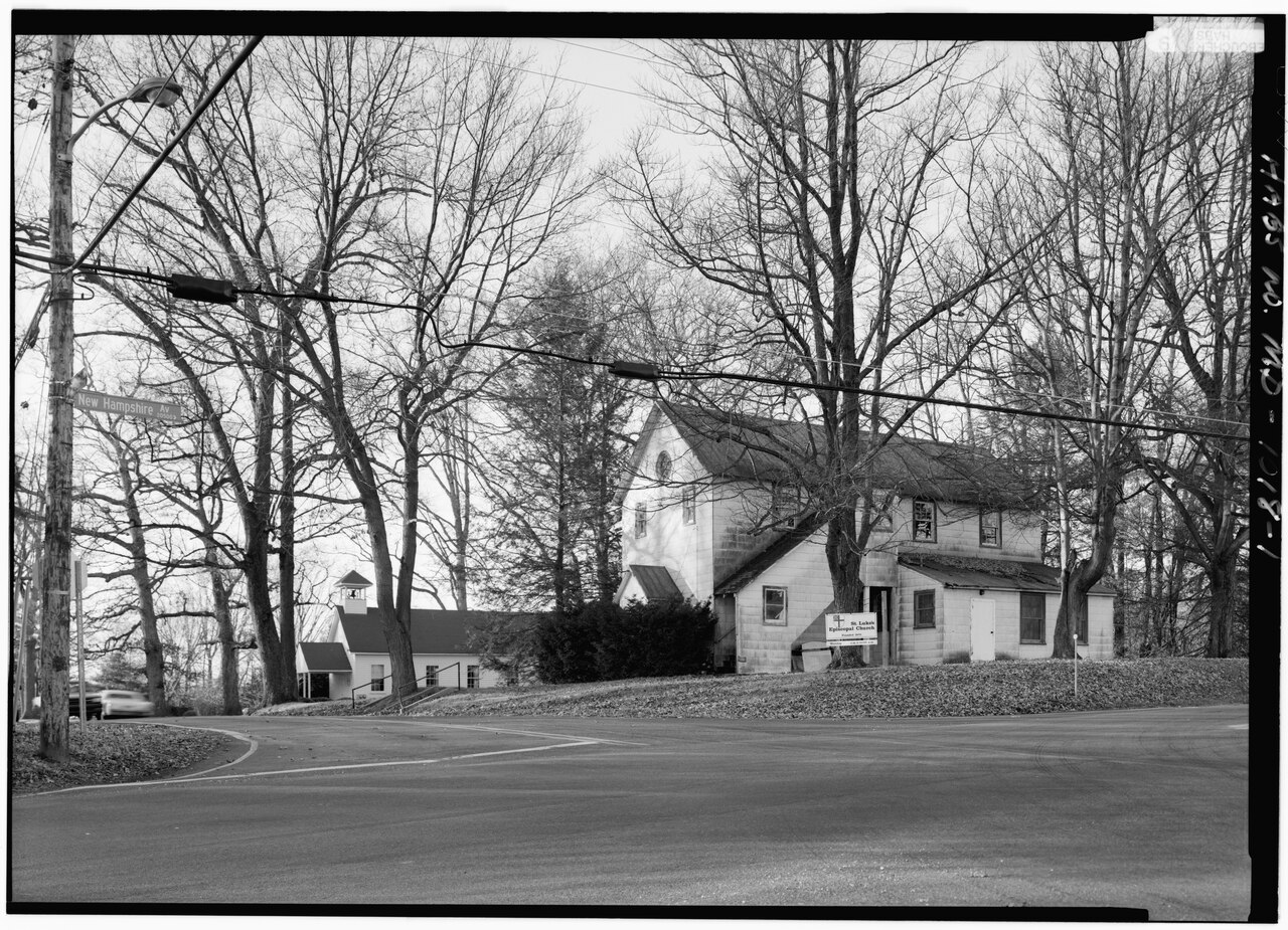
File:ENVIRONMENTAL SETTING FROM SOUTH EAST CORNER OF BRIGHTON DAM ROAD AND NEW HAMPSHIRE AVENUE, SHOWING SOUTH (FRONT) AND EAST SIDE, WITH ST. LUKE'S EPISCOPAL CHURCH IN BACKGROUND - HABS MD,16-BRI,1-1.tif
Jump to navigation
Jump to search

Size of this JPG preview of this TIF file: 800 × 578 pixels. Other resolutions: 320 × 231 pixels | 640 × 463 pixels | 1,024 × 740 pixels | 1,280 × 925 pixels | 2,560 × 1,851 pixels | 5,000 × 3,615 pixels.
Original file (5,000 × 3,615 pixels, file size: 17.24 MB, MIME type: image/tiff)
Captions
Captions
Add a one-line explanation of what this file represents
Summary
[edit]| Title |
ENVIRONMENTAL SETTING FROM SOUTH EAST CORNER OF BRIGHTON DAM ROAD AND NEW HAMPSHIRE AVENUE, SHOWING SOUTH (FRONT) AND EAST SIDE, WITH ST. LUKE'S EPISCOPAL CHURCH IN BACKGROUND - Brighton Grange Hall, 263 Brighton Dam Road at New Hampshire Avenue, Brighton, Montgomery County, MD |
|||
| Description |
Patrons of Husbandry; Boucher, Jack E, photographer; Lavoie, Catherine C, historian |
|||
| Depicted place | Maryland; Montgomery County; Brighton | |||
| Date | Documentation compiled after 1933 | |||
| Dimensions | 5 x 7 in. | |||
| Current location |
Library of Congress Prints and Photographs Division Washington, D.C. 20540 USA http://hdl.loc.gov/loc.pnp/pp.print |
|||
| Accession number |
HABS MD,16-BRI,1-1 |
|||
| Credit line |
|
|||
| Notes |
|
|||
| Source | https://www.loc.gov/pictures/item/md1237.photos.082346p | |||
| Permission (Reusing this file) |
|

| Object location | | View this and other nearby images on: OpenStreetMap |
|---|
File history
Click on a date/time to view the file as it appeared at that time.
| Date/Time | Thumbnail | Dimensions | User | Comment | |
|---|---|---|---|---|---|
| current | 18:48, 28 July 2014 |  | 5,000 × 3,615 (17.24 MB) | Fæ (talk | contribs) | GWToolset: Creating mediafile for Fæ. HABS 21 July 2014 (1601:1800) |
You cannot overwrite this file.
File usage on Commons
The following 2 pages use this file:
File usage on other wikis
The following other wikis use this file:
- Usage on www.wikidata.org