File:East Riding of Yorkshire UK location map.svg
Zur Navigation springen
Zur Suche springen

Größe der PNG-Vorschau dieser SVG-Datei: 772 × 600 Pixel. Weitere Auflösungen: 309 × 240 Pixel | 618 × 480 Pixel | 989 × 768 Pixel | 1.280 × 994 Pixel | 2.560 × 1.989 Pixel | 1.425 × 1.107 Pixel.
Originaldatei (SVG-Datei, Basisgröße: 1.425 × 1.107 Pixel, Dateigröße: 1,33 MB)
Bildtexte
Kurzbeschreibungen
Ergänze eine einzeilige Erklärung, was diese Datei darstellt.
| Beschreibung |
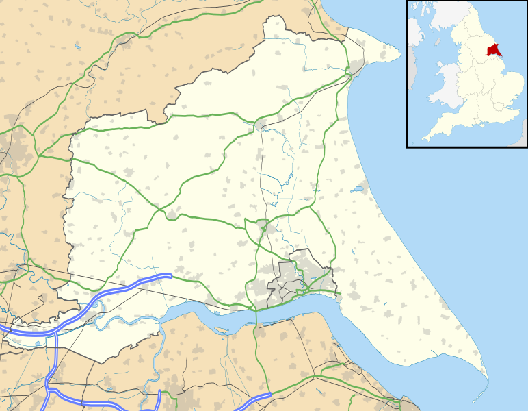
Map of the East Riding of Yorkshire, UK with the following information shown:
Equirectangular map projection on WGS 84 datum, with N/S stretched 165% Geographic limits:
|
| Datum | |
| Quelle |
|
| Urheber | Nilfanion, created using Ordnance Survey data |
| Genehmigung (Weiternutzung dieser Datei) |
Diese Datei ist unter der Creative-Commons-Lizenz „Namensnennung – Weitergabe unter gleichen Bedingungen 3.0 nicht portiert“ lizenziert. Namensnennung: Contains Ordnance Survey data © Crown copyright and database right
|
| Andere Versionen | File:East Riding of Yorkshire UK district map (blank).svg - Blank map |
.svg)
Dateiversionen
Klicke auf einen Zeitpunkt, um diese Version zu laden.
| Version vom | Vorschaubild | Maße | Benutzer | Kommentar | |
|---|---|---|---|---|---|
| aktuell | 18:48, 26. Sep. 2010 | | 1.425 × 1.107 (1,33 MB) | Nilfanion (Diskussion | Beiträge) | {{Information |Description=Map of the East Riding of Yorkshire, UK with the following information shown: *Administrative borders *Coastline, lakes and rivers *Roads and railways *Urban areas Equirectangular map projection o |
Du kannst diese Datei nicht überschreiben.
Dateiverwendung
Die folgende Seite verwendet diese Datei:
Globale Dateiverwendung
Die nachfolgenden anderen Wikis verwenden diese Datei:
- Verwendung auf ar.wikipedia.org
- Verwendung auf bg.wikipedia.org
- Verwendung auf ceb.wikipedia.org
- Verwendung auf en.wikipedia.org
- Spurn
- Beverley
- East Riding of Yorkshire
- Everingham
- Goole
- Pocklington
- Bridlington
- Hornsea
- Haltemprice
- Goodmanham
- Driffield
- Wetwang
- Boothferry
- Stamford Bridge, East Riding of Yorkshire
- Bempton Cliffs
- Withernsea
- RAF Leconfield
- Fort Paull
- Market Weighton
- Hedon
- Hessle
- Millington, East Riding of Yorkshire
- Airmyn
- Flamborough
- List of civil parishes in the East Riding of Yorkshire
- Easington, East Riding of Yorkshire
- Wold Newton, East Riding of Yorkshire
- Burton Constable Hall
- Cottingham, East Riding of Yorkshire
- Arram
- Ferens Art Gallery
- Bridlington Priory
- Tibthorpe
- Wawne
- Langtoft, East Riding of Yorkshire
- Skelton, East Riding of Yorkshire
- Bilton, East Riding of Yorkshire
- Leven, East Riding of Yorkshire
- Burton Agnes
- Holme-on-Spalding-Moor
- Roos
- Middleton on the Wolds
- Howden
- Rudston
- Bishop Burton
- Sewerby
- Carnaby, East Riding of Yorkshire
Weitere globale Verwendungen dieser Datei anschauen.