File:Eglin Air Force Base, Hangar No. 1, 505 Choctawhatchee Avenue, Valparaiso, Okaloosa County, FL HABS FLA,46-VALP,V,1A- (sheet 3 of 6).tif
Jump to navigation
Jump to search

Size of this JPG preview of this TIF file: 737 × 600 pixels. Other resolutions: 295 × 240 pixels | 590 × 480 pixels | 944 × 768 pixels | 1,258 × 1,024 pixels | 2,517 × 2,048 pixels | 17,709 × 14,411 pixels.
Original file (17,709 × 14,411 pixels, file size: 296 KB, MIME type: image/tiff)
Captions
Captions
Add a one-line explanation of what this file represents
Summary
[edit]| Warning | The original file is very high-resolution. It might not load properly or could cause your browser to freeze when opened at full size. |
|---|
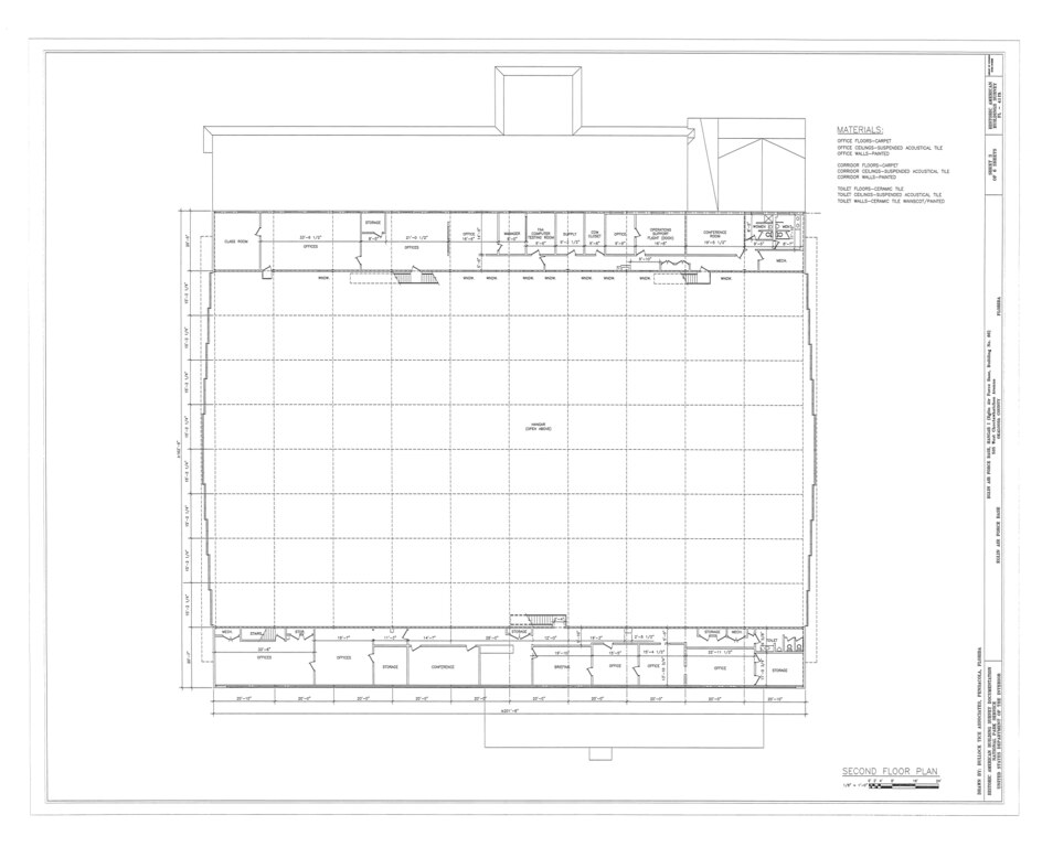
| HABS FLA,46-VALP,V,1A- (sheet 3 of 6) - Eglin Air Force Base, Hangar No. 1, 505 Choctawhatchee Avenue, Valparaiso, Okaloosa County, FL | ||||
|---|---|---|---|---|
| Photographer |
Related names:
|
|||
| Title |
HABS FLA,46-VALP,V,1A- (sheet 3 of 6) - Eglin Air Force Base, Hangar No. 1, 505 Choctawhatchee Avenue, Valparaiso, Okaloosa County, FL |
|||
| Depicted place | Florida; Okaloosa County; Valparaiso | |||
| Date | Documentation compiled after 1933 | |||
| Dimensions | 34 x 44 in. (E size) | |||
| Current location |
Library of Congress Prints and Photographs Division Washington, D.C. 20540 USA http://hdl.loc.gov/loc.pnp/pp.print |
|||
| Accession number |
HABS FLA,46-VALP,V,1A- (sheet 3 of 6) |
|||
| Credit line |
|
|||
| Notes |
|
|||
| Source | https://www.loc.gov/pictures/item/fl0426.sheet.00003a | |||
| Permission (Reusing this file) |
|
|||
| Other versions |
.png) .png) .png) .png) .png) |
|||

| Object location | | View this and other nearby images on: OpenStreetMap |
|---|
File history
Click on a date/time to view the file as it appeared at that time.
| Date/Time | Thumbnail | Dimensions | User | Comment | |
|---|---|---|---|---|---|
| current | 09:46, 12 July 2014 |  | 17,709 × 14,411 (296 KB) | Fæ (talk | contribs) | GWToolset: Creating mediafile for Fæ. HABS 09 July 2014 (801:1000) |
You cannot overwrite this file.
File usage on Commons
The following 2 pages use this file:
- File:- Eglin Air Force Base, Hangar No. 1, 505 Choctawhatchee Avenue, Valparaiso, Okaloosa County, FL HABS FLA,46-VALP,V,1A- (sheet 3 of 6).tif (file redirect)
- File:Eglin Air Force Base, Hangar No. 1, 505 Choctawhatchee Avenue, Valparaiso, Okaloosa County, FL HABS FLA,46-VALP,V,1A- (sheet 3 of 6).tif