File:Emin Pasha map.jpg
Jump to navigation
Jump to search

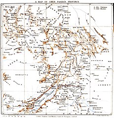
Size of this preview: 578 × 599 pixels. Other resolutions: 231 × 240 pixels | 463 × 480 pixels | 741 × 768 pixels | 987 × 1,024 pixels | 1,678 × 1,740 pixels.
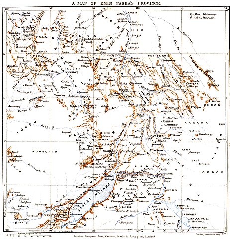
Original file (1,678 × 1,740 pixels, file size: 2.71 MB, MIME type: image/jpeg)
Captions
Captions
Add a one-line explanation of what this file represents
Summary
[edit]
| Description |
Map of Emin Pasha's domain |
|||||||||
| Date | ||||||||||
| Source | Emin Pasha and the rebellion at the equator; a story of nine months' experience in the last of the Soudan provinces | |||||||||
| Creator |
Arthur Jermy Mounteney Jephson (1859–1908) |
|||||||||
| Geotemporal data | ||||||||||
| Bounding box |
|
|||||||||
| Georeferencing | ||||||||||
Licensing
[edit]
|
This work is in the public domain in its country of origin and other countries and areas where the copyright term is the author's life plus 100 years or fewer. This work is in the public domain in the United States because it was published (or registered with the U.S. Copyright Office) before January 1, 1929. | |
| This file has been identified as being free of known restrictions under copyright law, including all related and neighboring rights. | |
File history
Click on a date/time to view the file as it appeared at that time.
| Date/Time | Thumbnail | Dimensions | User | Comment | |
|---|---|---|---|---|---|
| current | 05:59, 15 May 2020 | | 1,678 × 1,740 (2.71 MB) | Shyamal (talk | contribs) | {{Map |Description=Map of Emin Pasha's domain |Source=[https://archive.org/details/eminpasharebelli00arth/page/n31/mode/1up Emin Pasha and the rebellion at the equator; a story of nine months' experience in the last of the Soudan provinces] |Date=1890 |Author=Arthur Jermy Mounteney Jephson (1859–1908) |Permission= |other_versions= }} Category:Emin Pasha in central Africa |
You cannot overwrite this file.
File usage on Commons
There are no pages that use this file.