File:Essex UK location map.svg
跳转到导航
跳转到搜索

此SVG文件的PNG预览的大小:749 × 600像素。 其他分辨率:300 × 240像素 | 600 × 480像素 | 959 × 768像素 | 1,279 × 1,024像素 | 2,558 × 2,048像素 | 1,425 × 1,141像素。
原始文件 (SVG文件,尺寸为1,425 × 1,141像素,文件大小:2.52 MB)
说明
说明
添加一行文字以描述该文件所表现的内容
| 描述 |
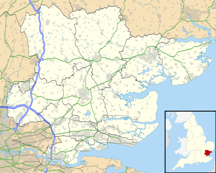
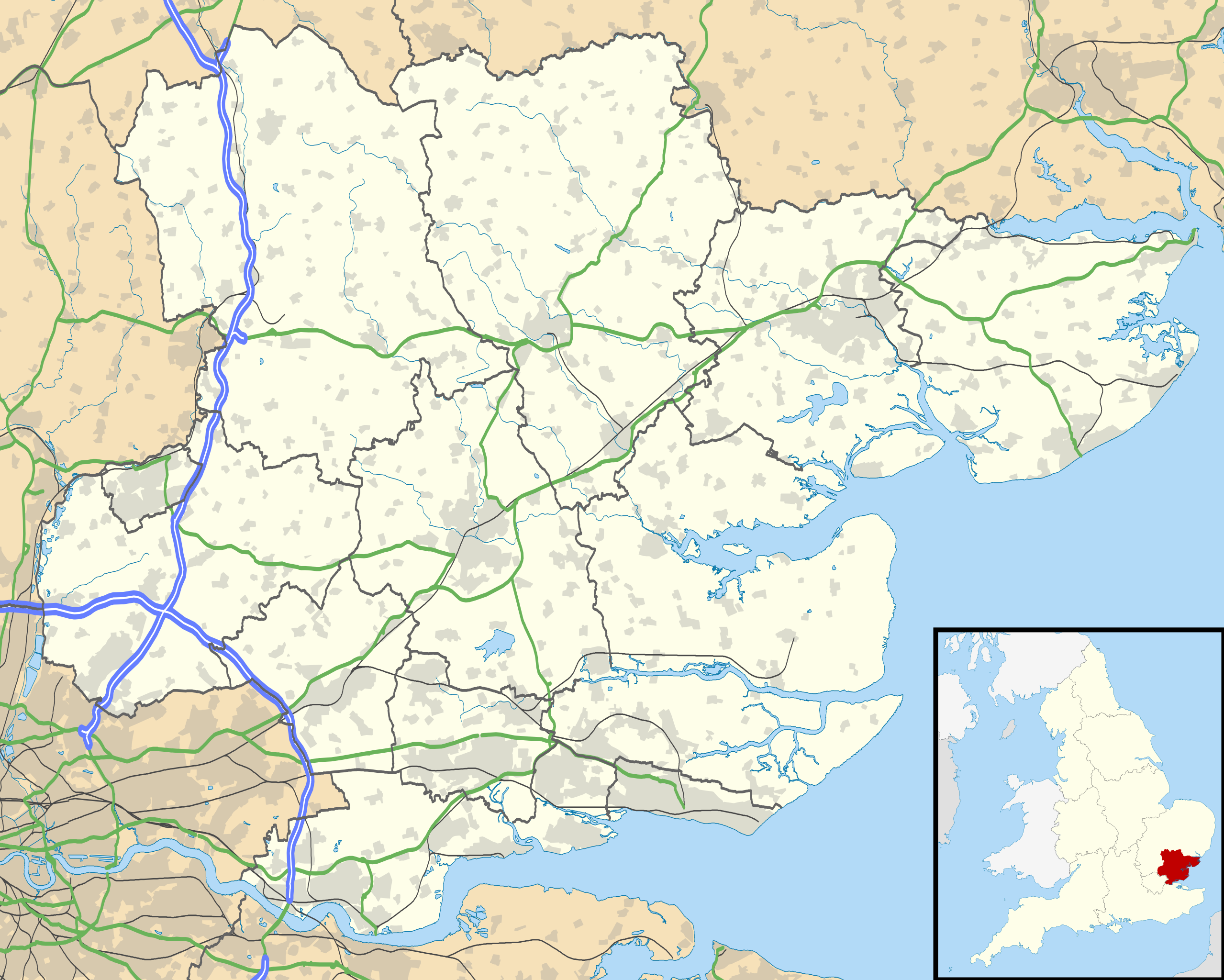
Map of Essex, UK with the following information shown:
Equirectangular map projection on WGS 84 datum, with N/S stretched 160% Geographic limits:
|
| 日期 | |
| 来源 |
|
| 作者 | Nilfanion, created using Ordnance Survey data |
| 授权 (二次使用本文件) |
本文件采用知识共享署名-相同方式共享 3.0 未本地化版本许可协议授权。 署名: Contains Ordnance Survey data © Crown copyright and database right
|
| 其他版本 | File:Essex UK district map (blank).svg - Blank map |
.svg)
文件历史
点击某个日期/时间查看对应时刻的文件。
| 日期/时间 | 缩略图 | 大小 | 用户 | 备注 | |
|---|---|---|---|---|---|
| 当前 | 2010年9月26日 (日) 18:52 | | 1,425 × 1,141(2.52 MB) | Nilfanion(留言 | 贡献) | {{Information |Description=Map of Essex, UK with the following information shown: *Administrative borders *Coastline, lakes and rivers *Roads and railways *Urban areas Equirectangular map projection on WGS 84 datum, with N/S stretched 160% G |
您不可以覆盖此文件。
文件用途
全域文件用途
以下其他wiki使用此文件:
- af.wikipedia.org上的用途
- Noak Bridge
- Chigwell
- Billericay
- Wickford
- Basildon
- Harlow
- Takeley
- Copford
- Pitsea
- Chelmsford
- Southend-on-Sea
- Clacton-on-Sea
- Rochford
- Stanford-le-Hope
- Saffron Walden
- Thaxted
- Brightlingsea
- Burnham-on-Crouch
- Chalkwell
- Wivenhoe
- Dovercourt
- Frinton-on-Sea
- Manningtree
- Walton-on-the-Naze
- Westcliff-on-Sea
- Ingatestone
- Southminster
- Witham
- Coggeshall
- Hadleigh
- Southchurch
- Halstead
- Lughawe Londen-Stansted
- Lughawe Londen-Southend
- ar.wikipedia.org上的用途
- arz.wikipedia.org上的用途
- bg.wikipedia.org上的用途
- bn.wikipedia.org上的用途
- ca.wikipedia.org上的用途
- ceb.wikipedia.org上的用途
- de.wikipedia.org上的用途
- el.wikipedia.org上的用途
- en.wikipedia.org上的用途
查看此文件的更多全域用途。