File:Essex UK locator map 2010.svg
Pāriet uz navigāciju
Pāriet uz meklēšanu

Size of this PNG preview of this SVG file: 494 × 600 pikseļi. Citi izmēri: 198 × 240 pikseļi | 395 × 480 pikseļi | 633 × 768 pikseļi | 843 × 1 024 pikseļi | 1 687 × 2 048 pikseļi | 1 108 × 1 345 pikseļi.
Sākotnējais fails (SVG fails, definētais izmērs 1 108 × 1 345 pikseļi, faila izmērs: 302 KB)
Captions
Captions
Pievieno vienas rindiņas aprakstu, ko šis fails attēlo
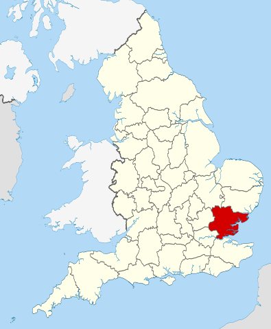
Location of the ceremonial county of Essex within England
Kopsavilkums[labot šo sadaļu]
| Apraksts | Location of the ceremonial county of Essex within England. |
| Datums | |
| Avots |
National Geospatial-Intelligence Agency
|
| Autors | Nilfanion |
| SVG veidošana |
Licence[labot šo sadaļu]
Es, šī darba autortiesību īpašnieks, publicēju to saskaņā ar šīm licencēm:
Šis fails tiek izplatīts saskaņā ar licences Creative Commons Atsauce-Līdzīgi Noteikumi 3.0 Vispārējiem noteikumiem.
- Jūs varat brīvi:
- koplietot – kopēt, izplatīt un pārraidīt darbu
- remiksēt – pielāgot darbu
- Saskaņā ar šādiem nosacījumiem:
- atsaucoties – Tev ir jānorāda autors, saite uz licenci un to, vai veiktas kādas izmaiņas. To var darīt jebkādā saprātīgā veidā, bet ne tādā, kas norādītu, ka licencētājs atbalsta tevi vai veidu, kā tu izmanto šo darbu.
- nemainot licenci – Ja tu miksē, pārveido vai izmanto materiālu, tev savs devums jāpublicē ar to pašu vai saderīgu licenci kā oriģināls.

|
Ir dota atļauja kopēt, izplatīt un/vai pārveidot šo dokumentu saskaņā ar GNU brīvās dokumentācijas licences, versijas 1.2 vai jebkuras vēlākas versijas, ko publiskojis Brīvās programmatūras fonds nosacījumiem; bez nemainīgajām sadaļā, priekšējā un aizmugurēja'vāka tekstiem. Licences kopija ir iekļauta sadaļā ar nosaukumu GNU brīvās dokumentācijas licence. |
Jūs varat izvēlēties licenci pēc jūsu vēlmes.

|
This is one of the images forming part of the Valued image set: Locator maps of the Ceremonial counties of England on Wikimedia Commons. The image set has been assessed under the valued image set criteria and is considered the most valued set on Commons within the scope:
Locator maps of the Ceremonial counties of England
You can see its nomination at Commons:Valued image candidates/Locator maps of English ceremonial counties. |
Faila hronoloģija
Uzklikšķini uz datums/laiks kolonnā esošās saites, lai apskatītos, kā šis fails izskatījās tad.
| Datums/Laiks | Attēls | Izmēri | Dalībnieks | Komentārs | |
|---|---|---|---|---|---|
| tagadējais | 2010. gada 23. novembris, plkst. 22.36 | | 1 108 × 1 345 (302 KB) | Nilfanion (diskusija | devums) | == Summary == {{Information |Description=Location of the ceremonial county of Essex within England. |Source=Ordnance Survey [https://www.ordnancesurvey.co.uk/opendatadownload/products.html OpenData]: *County boundaries an |
Šo failu nevar pārrakstīt.
Faila lietojums
Šo failu izmanto šajās 42 lapās:
- Valued image set: Locator maps of the Ceremonial counties of England
- Commons:Valued image candidates/Locator maps of English ceremonial counties
- File:East Anglia UK Locator Map.svg
- Category:Airports in Essex
- Category:Almshouses in Essex
- Category:Archaeological sites in Essex
- Category:Architecture of Essex
- Category:Births in Essex
- Category:Bridges in Essex
- Category:Canals in Essex
- Category:Cemeteries in Essex
- Category:Deaths in Essex
- Category:Disused railway stations in Essex
- Category:Essex
- Category:Essex in the 1940s
- Category:Essex in the 1950s
- Category:Essex in the 1960s
- Category:Essex in the 1970s
- Category:Essex in the 1980s
- Category:Essex in the 1990s
- Category:Essex in the 19th century
- Category:Essex in the 2000s
- Category:Essex in the 2010s
- Category:Essex in the 2020s
- Category:Essex in the 20th century
- Category:Essex in the 21st century
- Category:Geography of Essex
- Category:Hospitals in Essex
- Category:Local government in Essex
- Category:Maps of Essex
- Category:Meadows in Essex
- Category:Piers in Essex
- Category:Populated places in Essex
- Category:Rail transport in Essex
- Category:Railway stations in Essex
- Category:Rivers of Essex
- Category:Roads in Essex
- Category:Sports in Essex
- Category:Transport infrastructure in Essex
- Category:Villages in Essex
- Category:Visitor attractions in Essex
- Category:Windmills in Essex
Globālais faila lietojums
Šīs Vikipēdijas izmanto šo failu:
- Izmantojums af.wikipedia.org
- Izmantojums an.wikipedia.org
- Izmantojums arz.wikipedia.org
- Izmantojums ast.wikipedia.org
- Izmantojums be-tarask.wikipedia.org
- Izmantojums be.wikipedia.org
- Izmantojums bg.wikipedia.org
- Izmantojums bn.wikipedia.org
- Izmantojums br.wikipedia.org
- Izmantojums ca.wikipedia.org
- Izmantojums ceb.wikipedia.org
- Izmantojums cs.wikipedia.org
- Izmantojums dag.wikipedia.org
- Izmantojums el.wikipedia.org
- Izmantojums en.wikipedia.org
- Debden, Uttlesford
- Stour Estuary RSPB reserve
- Point Clear
- Ugley
- Takeley
- Saffron Walden Rural District
- Wivenhoe Park
- Steeple, Essex
- Chignall Smealy
- Prittlewell Square
- River Roding
- New England Island
- Potton Island
- Marks Tey
- Lawford
- Fingringhoe
- Hadstock
- Duddenhoe End
- Essex girl
- Tolleshunt Knights
- Nounsley
- Benfleet Urban District
- Canvey Island Urban District
- Rochford Rural District
- Abberton, Essex
- Template:Essex-geo-stub
- River Brain
- Bradfield, Essex
- Childerditch
- Great Warley
- Stondon Massey
- Ingrave
- Little Warley
- Abbess, Beauchamp and Berners Roding
- Alphamstone
Skatīt šī faila pilno globālo izmantojumu.