File:Europe map Napoleon 1811.png
跳转到导航
跳转到搜索
没有更高的分辨率。
Europe_map_Napoleon_1811.png (415 × 397像素,文件大小:62 KB,MIME类型:image/png)
说明
说明
添加一行文字以描述该文件所表现的内容


|
File:Europe map Napoleon 1811.svg是此文件的矢量版本。 如果此文件质量不低于原点阵图,就应该将这个PNG格式文件替换为此文件。
File:Europe map Napoleon 1811.png → File:Europe map Napoleon 1811.svg
更多信息请参阅Help:SVG/zh。 |
 |
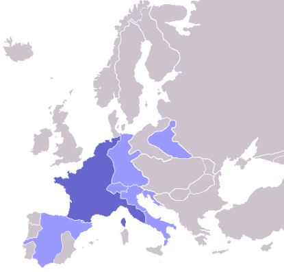
Map of the w:First French Empire and satellite states, with w:1811 borders. Created by User:OwenBlacker from Image:Europe blank map.png, therefore they are the source.
| 我,本作品著作权人,释出本作品至公有领域。这适用于全世界。 在一些国家这可能不合法;如果是这样的话,那么: 我无条件地授予任何人以任何目的使用本作品的权利,除非这些条件是法律规定所必需的。 |
derivative works
[编辑]
此文件衍生的作品: Europe map Napoleon 1811.svg
文件历史
点击某个日期/时间查看对应时刻的文件。
| 日期/时间 | 缩略图 | 大小 | 用户 | 备注 | |
|---|---|---|---|---|---|
| 当前 | 2022年10月11日 (二) 08:06 | | 415 × 397(62 KB) | Рагин1987(留言 | 贡献) | Extended map |
| 2020年7月23日 (四) 13:01 |  | 415 × 422(13 KB) | Leonel Sohns(留言 | 贡献) | Reverted to version as of 00:53, 16 October 2006 (UTC) | |
| 2020年7月23日 (四) 13:01 |  | 415 × 422(11 KB) | Leonel Sohns(留言 | 贡献) | Recovered old version from archive.org | |
| 2006年10月16日 (一) 00:53 |  | 415 × 422(13 KB) | Deltabeignet(留言 | 贡献) | Corrected status of Illyrian provinces. | |
| 2005年8月21日 (日) 00:51 |  | 415 × 422(11 KB) | OwenBlacker(留言 | 贡献) | Map of the w:First French Empire and satellite states, with w:1811 borders. Created by User:OwenBlacker from Image:Europe blank map.png {{GFDL}} {{cc-by-sa-2.0-uk}} |
您不可以覆盖此文件。
文件用途
以下14个页面使用本文件:
- Atlas of Belgium
- Atlas of European history
- Atlas of France
- Atlas of Galicia
- Atlas of Italy
- Atlas of Luxembourg
- Atlas of Spain
- Atlas of the early modern age
- Napoléon Bonaparte
- User:Magog the Ogre/Maps of conflicts/2020 July
- User:Magog the Ogre/Maps of conflicts/2022 October
- User:Minorax/SVG available/2022 October 7-12
- User:Thegranddesign31415
- File:Apogée Empire Napoleon 1811.jpg
全域文件用途
以下其他wiki使用此文件:
- arz.wikipedia.org上的用途
- ast.wikipedia.org上的用途
- ba.wikipedia.org上的用途
- be.wikipedia.org上的用途
- bg.wikipedia.org上的用途
- bn.wikibooks.org上的用途
- bs.wikipedia.org上的用途
- ca.wikipedia.org上的用途
- cs.wikipedia.org上的用途
- cv.wikipedia.org上的用途
- de.wikibooks.org上的用途
- en.wikipedia.org上的用途
- en.wikibooks.org上的用途
- eo.wikipedia.org上的用途
- fi.wikipedia.org上的用途
- Cisalppinen tasavalta
- Batavian tasavalta
- Hollannin kuningaskunta
- Napolin kuningaskunta
- Helvetian tasavalta
- Ligurian tasavalta
- Varsovan herttuakunta
- Malline:Napoleonin vasallit
- Etrurian kuningaskunta
- Alban tasavalta
- Reinin liitto (1806)
- Italian tasavalta (vasalli)
- Mainzin tasavalta
- Italian kuningaskunta (Napoleon)
- Cispadaaninen tasavalta
- Westfalenin kuningaskunta
- Illyrian provinssit
- Transpadaaninen tasavalta
- fr.wikipedia.org上的用途
- fy.wikipedia.org上的用途
- gl.wikipedia.org上的用途
- he.wikipedia.org上的用途
- hr.wikipedia.org上的用途
- hu.wikipedia.org上的用途
查看此文件的更多全域用途。