File:F. Müllhaupt's Militarische & Verkehrs-Karte der Deutsch-Französischen Grenze...jpg

原始文件 (8,150 × 6,978像素,文件大小:75.1 MB,MIME类型:image/jpeg)
说明
说明
| 警告 | 部分浏览器在浏览此图片的完整大小时可能会遇到困难:该图片中有数量巨大的像素点,可能无法完全载入或者导致您的浏览器停止响应。 |
|---|
| 描述 |
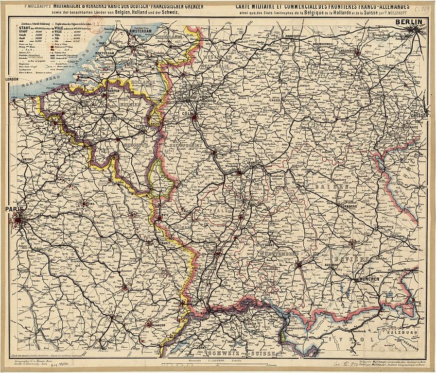
Titre : Deutsch: F. Müllhaupt's Militärische & Verkehr's-Karte der Deutsch-Französischen Grenzen (...) Français : Carte militaire et commerciale des frontières franco-allemandes ainsi que des Etats limitrophes de la Belgique, de la Hollande et de la Suisse / par F. Müllhaupt English: Map military and commercial Franco-German border and the neighboring states of Belgium, Holland and Switzerland
Auteur : Müllhaupt, Fritz (1846-1917) Éditeur : Müllhaupt Date d'édition : 1885 Sujet : Frontières Sujet : Allemagne, Empire d' -- Sud-Ouest -- Frontières Sujet : Belgique -- Est -- Frontières Sujet : Suisse -- Frontières Sujet : France -- Nord-Est -- Frontières Sujet : Pays-Bas -- Frontières Type : document cartographique,carte,image fixe Langue : Multilingue Format : 1 flle en coul. ; 680 x 580 Format : image/jpeg Droits : domaine public Identifiant : ark:/12148/btv1b53023072n Source : Bibliothèque nationale de France, département Cartes et plans, GE C-859 Relation : http://catalogue.bnf.fr/ark:/12148/cb405950294 Couverture : Belgique Couverture : Suisse Couverture : France Couverture : Pays-Bas Description : Échelle(s) : 1:1 250 000 Provenance : bnf.fr |
||||
| 日期 | |||||
| 来源 | F. Müllhaupt's Militarische & Verkehrs-Karte der Deutsch-Französischen Grenze | ||||
| 作者 | Müllhaupt, Fritz (1846-1917) | ||||
| 授权 (二次使用本文件) |
|
| Open this image as an overlay in Google Earth (Google Maps, Bing) | (Help|Source) |
本图像被选为2013年5月30日的今日图片。其说明如下: English: Map military and commercial Franco-German border and the neighboring states of Belgium, Holland and Switzerland 其他语言:
Deutsch: F. Müllhaupt's Militarische & Verkehrs-Karte der Deutsch-Französischen Grenze.... English: Map military and commercial Franco-German border and the neighboring states of Belgium, Holland and Switzerland Français : Carte militaire et commerciale des frontières franco-allemandes ainsi que des Etats limitrophes de la Belgique, de la Hollande et de la Suisse / par F. Müllhaupt Italiano: Mappa militare e commerciale del confine franco-tedesco e dei vicini stati di Belgio, Paesi Bassi e Svizzera, risalente al 1885. Magyar: Müllhaupt katonai-közlekedési térképe a német-francia határvidékről és környezetéről Nederlands: Militaire kaart van F. Müllhaupt met de Frans-Duitse grens met de nabijgelegen staten België, Nederland en Zwitserland. Slovenščina: Vojaški in trgovski zemljevid francosko-nemške meje ter sosednjih držav Belgije, Nizozemske in Švice / avtor: F. Müllhaupt Русский: Карта франко-германской границы и близлежащих государств. 1885 год. 中文: 法德边境以及邻国比利时,荷兰和瑞士军事和商业地图。 |
| 註解 | 該圖片含有註解:在維基媒體共享資源上查看註解 |
文件历史
点击某个日期/时间查看对应时刻的文件。
| 日期/时间 | 缩略图 | 大小 | 用户 | 备注 | |
|---|---|---|---|---|---|
| 当前 | 2013年4月4日 (四) 13:02 | | 8,150 × 6,978(75.1 MB) | ComputerHotline(留言 | 贡献) | {{LargeImage}} {{Information |Description= Titre : F. Müllhaupt's Militarische & Verkehrs-Karte der Deutsch-Französischen Grenze.... Carte militaire et commerciale des frontières franco-allemandes ainsi que des Etats limitrophes de la Belgique, de l... |
您不可以覆盖此文件。
文件用途
以下28个页面使用本文件:
- User:ComputerHotline/Archive 17
- User:Husky/POTY 2013 gallery
- User:Miya/sandbox/FP/2013/Galleries/Table
- User:Ö/Best/2013
- Commons:Featured picture candidates/File:F. Müllhaupt's Militarische & Verkehrs-Karte der Deutsch-Französischen Grenze...jpg
- Commons:Featured picture candidates/Log/April 2013
- Commons:Featured pictures/Non-photographic media/Maps
- Commons:Featured pictures/chronological/2013-A
- Commons:Picture of the Year/2013/Candidates
- Commons:Picture of the Year/2013/Galleries/Table
- Commons:Picture of the Year/2013/R1/Gallery/2013-A
- Commons:Picture of the Year/2013/R1/Gallery/ALL
- Commons:Picture of the Year/2013/R1/Gallery/M04
- Commons:Picture of the Year/2013/R1/Gallery/Maps
- Commons:Picture of the Year/2013/R1/Results/Candidates
- Commons:Picture of the Year/2013/R1/v/F. Müllhaupt's Militarische & Verkehrs-Karte der Deutsch-Französischen Grenze...jpg
- Template:Potd/2013-05
- Template:Potd/2013-05-30
- Template:Potd/2013-05-30 (de)
- Template:Potd/2013-05-30 (en)
- Template:Potd/2013-05-30 (fr)
- Template:Potd/2013-05-30 (hu)
- Template:Potd/2013-05-30 (it)
- Template:Potd/2013-05-30 (nl)
- Template:Potd/2013-05-30 (ru)
- Template:Potd/2013-05-30 (sl)
- Template:Potd/2013-05-30 (zh-hans)
- Template:Potd/2013-05 (zh-hans)
全域文件用途
以下其他wiki使用此文件:
- be-tarask.wikipedia.org上的用途
- bn.wikipedia.org上的用途
- crh.wikipedia.org上的用途
- cv.wikipedia.org上的用途
- hu.wikipedia.org上的用途
- ka.wikipedia.org上的用途
- ko.wikipedia.org上的用途
- krc.wikipedia.org上的用途
- lbe.wikipedia.org上的用途
- nl.wikipedia.org上的用途
- os.wikipedia.org上的用途
- pt.wikipedia.org上的用途
- ru.wikipedia.org上的用途
- ru.wikinews.org上的用途
- sah.wikipedia.org上的用途
- sq.wikipedia.org上的用途
- uk.wikipedia.org上的用途
- vi.wikipedia.org上的用途
- xal.wikipedia.org上的用途
- zh.wikipedia.org上的用途