File:Famine Map India.jpg
Jump to navigation
Jump to search

Size of this preview: 432 × 600 pixels. Other resolutions: 173 × 240 pixels | 346 × 480 pixels | 553 × 768 pixels | 737 × 1,024 pixels | 1,475 × 2,048 pixels | 3,169 × 4,400 pixels.
Original file (3,169 × 4,400 pixels, file size: 8.02 MB, MIME type: image/jpeg)
Captions
Captions
Add a one-line explanation of what this file represents
Summary
[edit]
| Description |
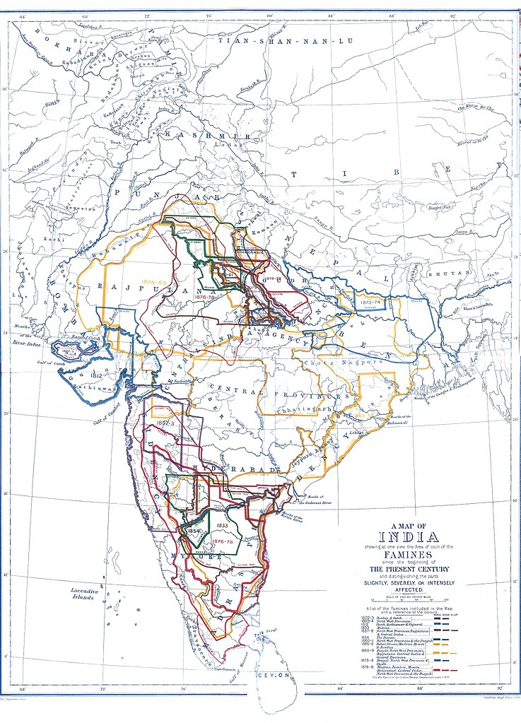
Famines map 1800-1878. Contrasted version of File:FaminesMapOfIndia1800-1885.jpg |
|||||||||
| Date | ||||||||||
| Source | File:FaminesMapOfIndia1800-1885.jpg | |||||||||
| Creator |
Stanford's Geog. Etab. London |
|||||||||
| Permission (Reusing this file) |
|
|||||||||
| Geotemporal data | ||||||||||
| Bounding box |
|
|||||||||
| Georeferencing | ||||||||||
File history
Click on a date/time to view the file as it appeared at that time.
| Date/Time | Thumbnail | Dimensions | User | Comment | |
|---|---|---|---|---|---|
| current | 12:28, 4 June 2020 | | 3,169 × 4,400 (8.02 MB) | Shyamal (talk | contribs) | {{Map |Description=Famines map 1800-1878. Contrasted version of File:FaminesMapOfIndia1800-1885.jpg |Source=File:FaminesMapOfIndia1800-1885.jpg |Date=7 January 1885 |Author=Stanford's Geog. Etab. London |Permission={{pd-old-70}} |other_versions= }} Category:Maps of India |
You cannot overwrite this file.
File usage on Commons
The following page uses this file: