File:Farmland near Doddershall House 3 - geograph.org.uk - 1250209.jpg
Jump to navigation
Jump to search
No higher resolution available.
Farmland_near_Doddershall_House_3_-_geograph.org.uk_-_1250209.jpg (640 × 480 pixels, file size: 75 KB, MIME type: image/jpeg)
Captions
Captions
Add a one-line explanation of what this file represents
Summary
[edit]| Description |
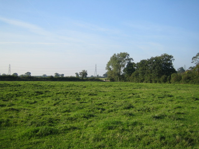
English: Farmland near Doddershall House 3. Looking west from the ancient quadrangular moat south-west of Doddershall House, the line of trees on the right marks the course of a stream that flows east to west. Other than the moat, and Binwell Farm on the southern edge, this grid square consists entirely of fields like this.
The pylons in the distance skirt Doddershall Wood which is in an adjacent grid square and is 2km from Doddershall House, see 931429. |
| Date | |
| Source | From geograph.org.uk |
| Author | Andy Gryce |
| Attribution (required by the license) | Andy Gryce / Farmland near Doddershall House 3 / |
| Camera location | | View this and other nearby images on: OpenStreetMap |
|---|
| Object location | | View this and other nearby images on: OpenStreetMap |
|---|
Licensing
[edit]
|
This image was taken from the Geograph project collection. See this photograph's page on the Geograph website for the photographer's contact details. The copyright on this image is owned by Andy Gryce and is licensed for reuse under the Creative Commons Attribution-ShareAlike 2.0 license.
|
This file is licensed under the Creative Commons Attribution-Share Alike 2.0 Generic license.
Attribution: Andy Gryce
- You are free:
- to share – to copy, distribute and transmit the work
- to remix – to adapt the work
- Under the following conditions:
- attribution – You must give appropriate credit, provide a link to the license, and indicate if changes were made. You may do so in any reasonable manner, but not in any way that suggests the licensor endorses you or your use.
- share alike – If you remix, transform, or build upon the material, you must distribute your contributions under the same or compatible license as the original.

_heading:270.00&language=en)
_heading:270.00&language=en)
File history
Click on a date/time to view the file as it appeared at that time.
| Date/Time | Thumbnail | Dimensions | User | Comment | |
|---|---|---|---|---|---|
| current | 19:53, 26 February 2011 | | 640 × 480 (75 KB) | GeographBot (talk | contribs) | == {{int:filedesc}} == {{Information |description={{en|1=Farmland near Doddershall House 3 Looking west from the ancient quadrangular moat south-west of Doddershall House, the line of trees on the right marks the course of a stream that flows east to west |
You cannot overwrite this file.
File usage on Commons
There are no pages that use this file.