File:FrankfurtOder asv2022-07 img37 Oderbrücke railway point.jpg
Aller à la navigation
Aller à la recherche

Taille de cet aperçu : 800 × 533 pixels. Autres résolutions : 320 × 213 pixels | 640 × 427 pixels | 1 024 × 683 pixels | 1 280 × 853 pixels | 2 560 × 1 707 pixels | 5 200 × 3 467 pixels.
Fichier d’origine (5 200 × 3 467 pixels, taille du fichier : 12,94 Mio, type MIME : image/jpeg)
Légendes
Légendes
Ajoutez en une ligne la description de ce que représente ce fichier
Description
[modifier]
| Description |
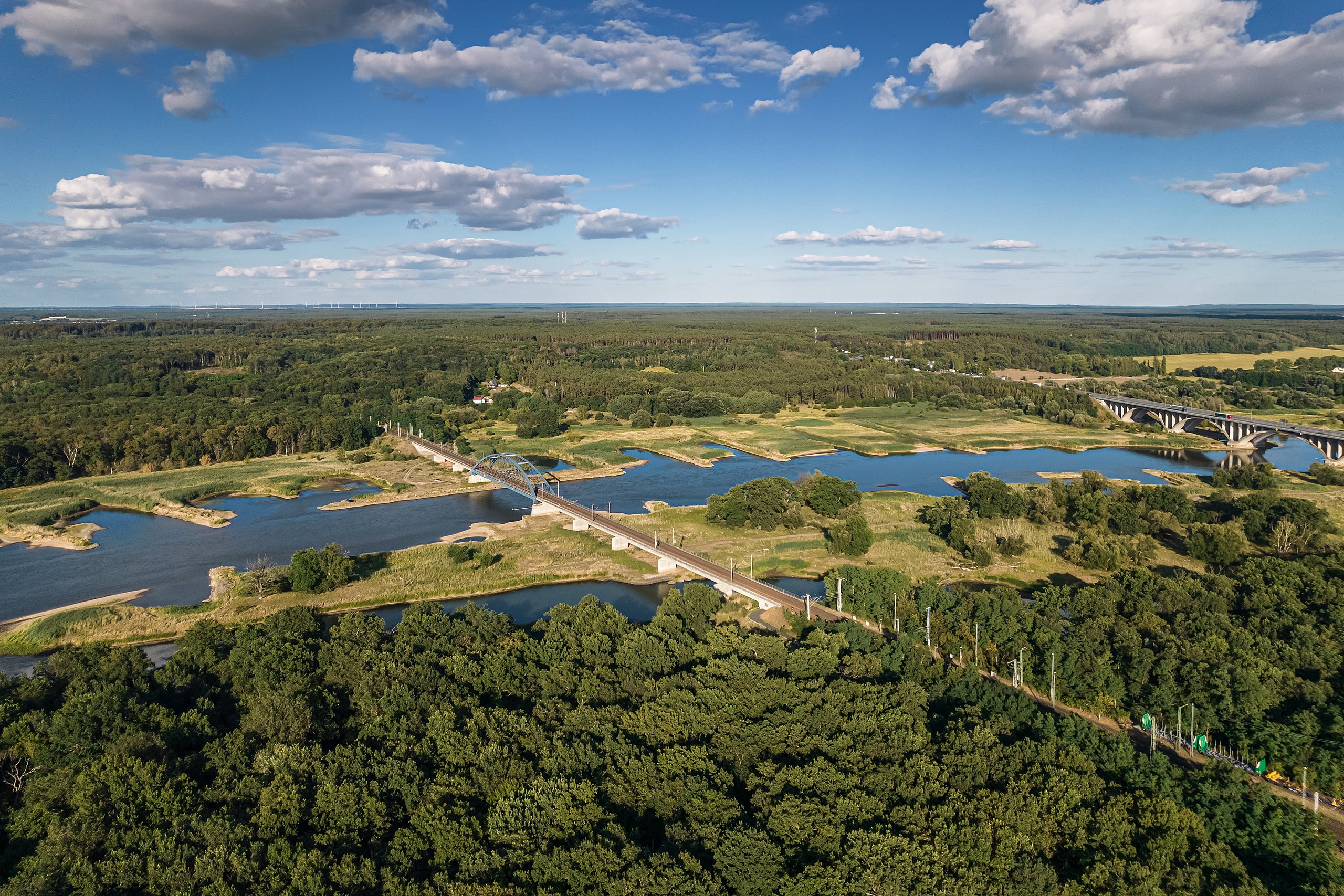
English: Aerial view next to Oder railway bridge in Frankfurt (Oder), Germany
Deutsch: Luftaufnahme nahe der Oder-Eisenbahnbrücke in Frankfurt (Oder), Deutschland; zu sehen ist der Grenzbahnhof Oderbrücke für Güterzüge, die Eisenbahnbrücke, sowie die Autobahnbrücke
Русский: Аэрофотосъёмка вблизи железнодорожного моста через Одер во Франкфурте на Одере, Германия |
| Date | |
| Source | Travail personnel |
| Auteur | A.Savin |
| Autorisation (Réutilisation de ce fichier) |
.svg) Just attribute the author: «A.Savin, Wikipedia»; if you have questions — Telegram, or e-mail to wikiphotospace@gmail.com..svg) Просто укажите в качестве автора: «А.Савин, Википедия»; если есть вопрос — телеграм, или эл.почта на wikiphotospace@gmail.com. Kennzeichnen Sie einfach als Autor: «A.Savin, Wikipedia»; falls Sie Fragen haben — Telegram, oder E-Mail an wikiphotospace@gmail.com.
Thank you. |
| Lieu de la prise de vue | | Voir cet endroit et d’autres images sur : OpenStreetMap |
|---|
|
Conditions d’utilisation
[modifier]
| Copyleft : cette œuvre d’art est libre ; vous pouvez la redistribuer ou la modifier selon les termes de la licence Art Libre. Vous trouverez un exemplaire de cette licence sur le site Copyleft Attitude ainsi que sur d’autres sites. |
Historique du fichier
Cliquer sur une date et heure pour voir le fichier tel qu'il était à ce moment-là.
| Date et heure | Vignette | Dimensions | Utilisateur | Commentaire | |
|---|---|---|---|---|---|
| actuel | 20 août 2022 à 15:21 | | 5 200 × 3 467 (12,94 Mio) | A.Savin (d | contributions) | {{User:A.Savin/F|L=0 |Description= {{en|Aerial view next to Oder railway bridge in Frankfurt (Oder), Germany}} {{de|Luftaufnahme nahe der Oder-Eisenbahnbrücke in Frankfurt (Oder), Deutschland; zu sehen ist der Grenzbahnhof Oderbrücke für Güterzüge, die Eisenbahnbrücke, sowie die Autobahnbrücke}} {{ru|Аэрофотосъёмка вблизи железнодорожного моста через Одер во Франкфурте на Одере, Германия}} |Year=2022 |Country=Germany |Month=07 |Day=27}} {{Location}} Category:Taken with DJI FC3411 [[Categ... |
Vous ne pouvez pas remplacer ce fichier.
Utilisations locales du fichier
Les 16 pages suivantes utilisent ce fichier :
- User:A.Savin/Archive/2022/2
- User:A.Savin/POTD
- User:Kacamata/Favorites
- Commons:Featured picture candidates/File:FrankfurtOder asv2022-07 img37 Oderbrücke railway point.jpg
- Commons:Featured picture candidates/Log/August 2022
- Commons:Featured pictures/Places/Architecture/Bridges
- Commons:Featured pictures/chronological/2022-B
- Commons:Featured pictures/chronological/August 2022
- Commons:Picture of the Year/2022/Candidates
- Commons:Picture of the Year/2022/R1/Gallery/2022-B
- Commons:Picture of the Year/2022/R1/Gallery/ALL
- Commons:Picture of the Year/2022/R1/Gallery/Infrastructure
- Commons:Picture of the Year/2022/R1/Gallery/M08
- Commons:Picture of the Year/2022/R1/v/FrankfurtOder asv2022-07 img37 Oderbrücke railway point.jpg
- Category:Germany-Poland border
- Category:Oderbrücke Frankfurt (Eisenbahn)
Utilisations du fichier sur d’autres wikis
Les autres wikis suivants utilisent ce fichier :
- Utilisation sur ca.wikipedia.org
- Utilisation sur de.wikipedia.org
- Utilisation sur en.wikipedia.org
- Utilisation sur eu.wikipedia.org
- Utilisation sur fr.wikipedia.org
- Utilisation sur mk.wikipedia.org
- Utilisation sur pt.wikipedia.org
- Utilisation sur www.wikidata.org
Métadonnées
Catégories :
- 2022 in rail transport in Frankfurt (Oder)
- July 2022 in rail transport in Brandenburg
- Aerial photographs of borders
- Aerial photographs of train stations in Germany
- Aerial photographs of rivers of Germany
- Aerial photographs of Frankfurt (Oder)
- Aerial photographs of Lubusz Voivodeship
- Bahnhof Frankfurt (Oder) Oderbrücke
- Oder Bridge (Frankfurt/Świecko)
- Clouds and blue sky in Brandenburg
- Clouds and blue sky in Poland
- Clouds in Germany in July 2022