File:Galignani's plan of Paris and environs - Norman B. Leventhal Map Center.jpg
Jump to navigation
Jump to search

Size of this preview: 798 × 599 pixels. Other resolutions: 320 × 240 pixels | 639 × 480 pixels | 1,023 × 768 pixels | 1,280 × 961 pixels | 2,560 × 1,923 pixels | 6,039 × 4,536 pixels.
Original file (6,039 × 4,536 pixels, file size: 6.54 MB, MIME type: image/jpeg)
Captions
Captions
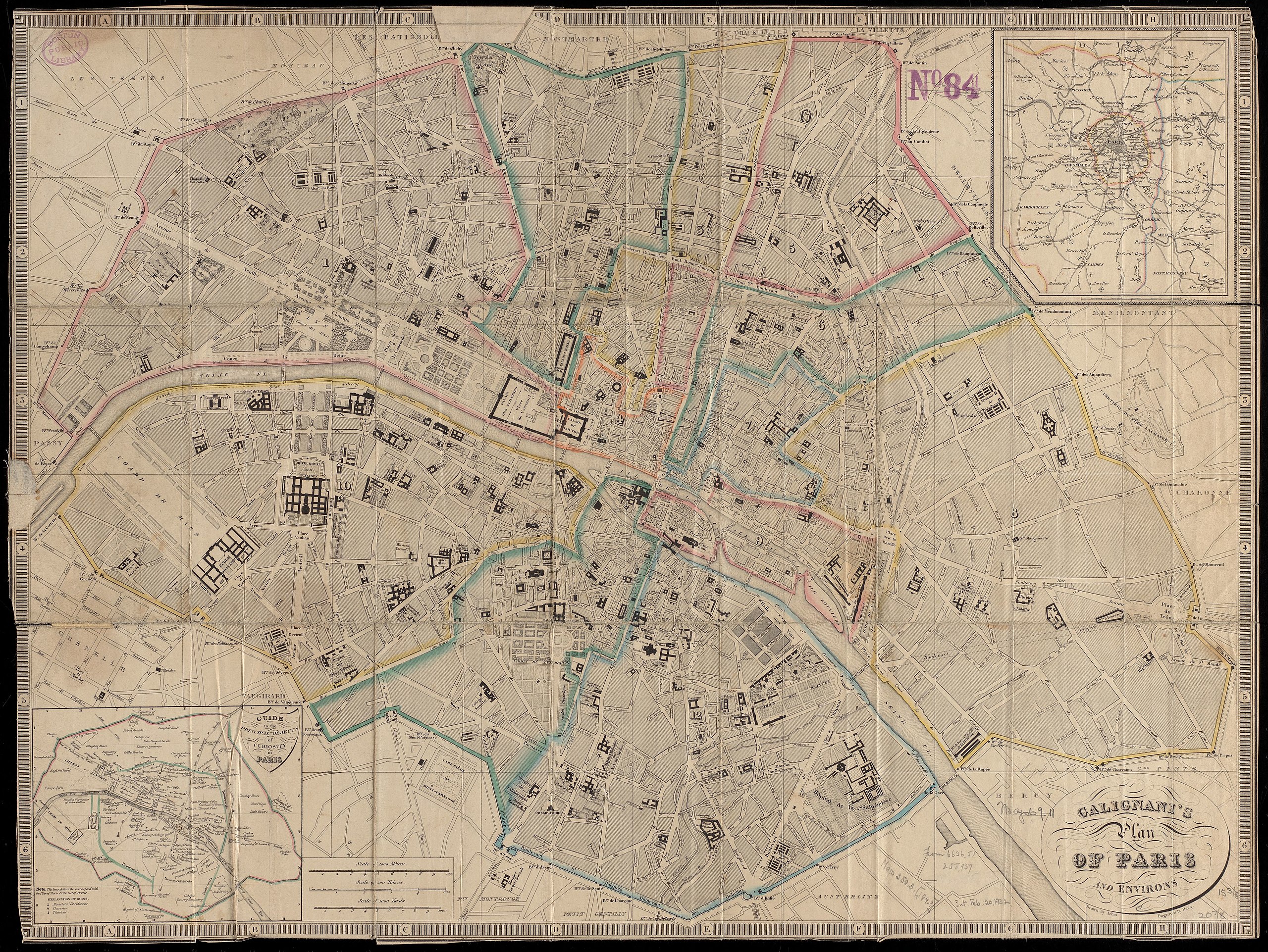
a map of Paris
Summary[edit]
| Title |
Galignani's plan of Paris and environs |
||||||||||||||||||||||||||
| Description |
English: An old map of Paris, France. |
||||||||||||||||||||||||||
| Date | [1840?–1849?] | ||||||||||||||||||||||||||
| Source | Norman B. Leventhal Map Center | ||||||||||||||||||||||||||
| Creator |
|
||||||||||||||||||||||||||
| Geotemporal data | |||||||||||||||||||||||||||
| Map location | Paris | ||||||||||||||||||||||||||
| Scale | Scale approximately 1:16,000 | ||||||||||||||||||||||||||
| Georeferencing | If inappropriate please set warp_status = skip to hide. | ||||||||||||||||||||||||||
| Bibliographic data | |||||||||||||||||||||||||||
| Language | English | ||||||||||||||||||||||||||
| Publisher |
[Paris] : [A. and W. Galignani and Co.] |
||||||||||||||||||||||||||
| Archival data | |||||||||||||||||||||||||||
| Collection |
|
||||||||||||||||||||||||||
| Dimensions | 40 x 53 cm | ||||||||||||||||||||||||||
| Medium | 1 map : hand-colored | ||||||||||||||||||||||||||
| Inscriptions | drawn by Achin ; engraved by Hacq. | ||||||||||||||||||||||||||
| Notes | Includes 2 inset maps: Guide to the principal objects of curiosity in Paris -- [Environs of Paris]. | ||||||||||||||||||||||||||

Licensing[edit]
|
This work is in the public domain in its country of origin and other countries and areas where the copyright term is the author's life plus 100 years or fewer. | |
| This file has been identified as being free of known restrictions under copyright law, including all related and neighboring rights. | |
File history
Click on a date/time to view the file as it appeared at that time.
| Date/Time | Thumbnail | Dimensions | User | Comment | |
|---|---|---|---|---|---|
| current | 10:53, 21 December 2019 | | 6,039 × 4,536 (6.54 MB) | Paris 16 (talk | contribs) | User created page with UploadWizard |
You cannot overwrite this file.
File usage on Commons
The following page uses this file: