File:German Empire 1914 adm location map.svg

Rozmiar pierwotny (Plik SVG, nominalnie 1425 × 1133 pikseli, rozmiar pliku: 761 KB)
Podpisy
Podpisy
Opis[edytuj]
| Opis |
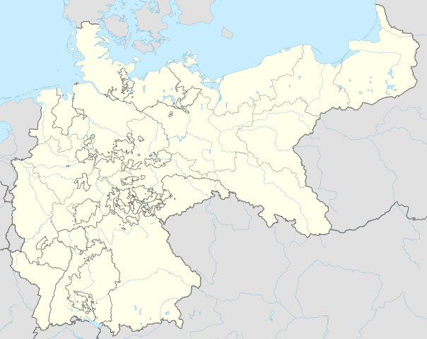
Deutsch: Positionskarte für das Deutsche Reich 1914
English: Location map of the German Empire 1914
|
||||||||||||
| Data | |||||||||||||
| Źródło |
Praca własna przy użyciu:
|
||||||||||||
| Autor | NordNordWest | ||||||||||||

|
Ta mapa została stworzona lub ulepszona w niemieckiej Kartenwerkstatt (Pracowni Kartograficznej). I Ty możesz zaproponować inne mapy do ulepszenia.
|
Licencja[edytuj]
Usage of this file with:

explanatory notes: Legally binding is only the full legalcode. For a free usage I recommend to respect the following licence conditions:
1. Provide my name as given above: NordNordWest,
2. a copy of, or the URI for, the applicable license: https://creativecommons.org/licenses/by-sa/3.0/de/legalcode,
3. the title of the work,
4. in the case of an adaptation, a credit identifying the use of the work in the adaptation.
This license and the rights granted hereunder will terminate automatically upon any breach by you of the terms of this license. Any of the above conditions can be waived if you get permission from the copyright holder. If you have questions or wish differing conditions, please contact me through nnwest or my discussion page ![]() t-online.de
t-online.de
- Wolno:
- dzielić się – kopiować, rozpowszechniać, odtwarzać i wykonywać utwór
- modyfikować – tworzyć utwory zależne
- Na następujących warunkach:
- uznanie autorstwa – musisz określić autorstwo utworu, podać link do licencji, a także wskazać czy utwór został zmieniony. Możesz to zrobić w każdy rozsądny sposób, o ile nie będzie to sugerować, że licencjodawca popiera Ciebie lub Twoje użycie utworu.
- na tych samych warunkach – Jeśli zmienia się lub przekształca niniejszy utwór, lub tworzy inny na jego podstawie, można rozpowszechniać powstały w ten sposób nowy utwór tylko na podstawie tej samej lub podobnej licencji.

Historia pliku
Kliknij na odpowiedniej dacie/czasie, aby zobaczyć wersję pliku z tamtego okresu.
| Data/czas | Miniatura | Wymiary | Użytkownik | Opis | |
|---|---|---|---|---|---|
| aktualny | 18:00, 15 cze 2015 | | 1425 × 1133 (761 KB) | NordNordWest (dyskusja | edycje) | c |
| 21:35, 13 cze 2015 |  | 1425 × 1133 (761 KB) | NordNordWest (dyskusja | edycje) | corr | |
| 08:08, 12 cze 2015 |  | 1425 × 1133 (761 KB) | NordNordWest (dyskusja | edycje) | c | |
| 20:00, 10 cze 2015 |  | 1425 × 1133 (763 KB) | NordNordWest (dyskusja | edycje) | c | |
| 09:05, 9 cze 2015 |  | 1425 × 1133 (754 KB) | NordNordWest (dyskusja | edycje) | c | |
| 08:54, 9 cze 2015 |  | 1425 × 1133 (762 KB) | NordNordWest (dyskusja | edycje) | == {{int:filedesc}} == {{Information |Description= {{de|1=Positionskarte für das Deutsche Reich 1914}} {{en|1=Location map of the German Empire 1914}} {{Location map series N |stretching=160 |top=56.0 |bottom=47.2 |left=5.5 |right=23.2 }} |Source={{Ow... |
Nie możesz nadpisać tego pliku.
Lokalne wykorzystanie pliku
Następujące strony korzystają z tego pliku:
- User:NordNordWest/Gallery/Location maps
- File:Deutschland Autobahnen.svg
- File:East-West-Germany-October 1949-July 1952.svg
- File:East Germany location map.svg
- File:German Empire 1914 adm-e location map.svg
- File:German Empire 1914 adm location map.svg
- File:Germany, Federal Republic of location map 23 May 1949 - 6 Oct 1949.svg
- File:Germany, Federal Republic of location map April 1952 - August 1955.svg
- File:Germany, Federal Republic of location map December 1950 - April 1952.svg
- File:Germany, Federal Republic of location map January 1957 - October 1990.svg
- File:Germany, Federal Republic of location map October 1949 - November 1950.svg
- File:Germany, Federal Republic of location map September 1955 - December 1956.svg
- File:Germany, German Democratic Republic location map January 1957 - October 1990.svg
- File:Germany, German Democratic Republic location map July 1952 - January 1957.svg
- File:Germany, German Democratic Republic location map October 1949 - July 1952.svg
- File:Germany, German Democratic Republic location map w·o FRG July 1952 - October 1990.svg
- File:Germany, German Democratic Republic location map w·o FRG October 1949 - June 1952.svg
- File:Germany, location map (SBZ perspective) 23 May 1949 - 6 Oct 1949.svg
- File:Germany2 location map.svg
- File:Germany location map.svg
- File:Germany location map 23 April 1949 - 22 May 1949.svg
- File:Germany location map 8 Jun 1947 - 22 Apr 1949.svg
- File:Germany location map April 1992 - July 1992.svg
- File:Germany location map August 1992 - June 1993.svg
- File:Germany location map July 1993 - December 2009.svg
- File:Germany location map October 1990 - March 1992.svg
- File:Germany location map labeled 8 Jun 1947 - 22 Apr 1949.svg
- File:Lage Freiberg in Deutschland.png
- File:Relief Map of Germany.png
- File:Relief Map of Germany.svg
- Template:Germany location map/other versions
_23_May_1949_-_6_Oct_1949.svg)
Globalne wykorzystanie pliku
Ten plik jest wykorzystywany także w innych projektach wiki:
- Wykorzystanie na bxr.wikipedia.org
- Wykorzystanie na de.wikipedia.org
- Wykorzystanie na es.wikipedia.org
- Wykorzystanie na fr.wikipedia.org
- Wykorzystanie na pl.wikipedia.org
- Bitwa pod Tannenbergiem
- Bitwa pod Stołupianami
- Bitwa pod Gąbinem
- Bitwa nad jeziorami mazurskimi (1914)
- Strajk dzieci wrzesińskich
- Sophienhof
- Bitwa pod Mülhausen
- Bitwa nad jeziorami mazurskimi (1915)
- Przejście graniczne Opawa-Malé Hoštice (kolejowe)
- Pomnik Ottona von Bismarcka w Opolu
- Pomnik Germanii w Gliwicach
- Powódź w Poznaniu (1888)
- Strajk szkolny w Poznaniu (1906)
- Katastrofa górnicza w kopalni Kleofas
- Strajk dzieci swarzędzkich
- Moduł:Mapa/dane/Niemcy
- Moduł:Mapa/dane/DEU
- Strzelanina w szkole w Bremie
- Most kolejowy w Racławicach Śląskich (1875–1903)
- Katastrofa tramwajowa w Poznaniu (1912)
- Katastrofa górnicza w kopalni Emma
- Katastrofa górnicza w Bochum (1912)
- Katastrofa sterowca LZ 18
- Dom Szymkowica w Tarnowskich Górach
- Wykorzystanie na pl.wikibooks.org
- Wykorzystanie na zh.wikipedia.org