File:Germany (+districts) location map.svg
Jump to navigation
Jump to search

Size of this PNG preview of this SVG file: 506 × 600 pixels. Other resolutions: 202 × 240 pixels | 405 × 480 pixels | 648 × 768 pixels | 864 × 1,024 pixels | 1,728 × 2,048 pixels | 1,073 × 1,272 pixels.
Original file (SVG file, nominally 1,073 × 1,272 pixels, file size: 2.21 MB)
Captions
Captions
Add a one-line explanation of what this file represents
Summary
[edit]_location_map.svg&action=edit§ion=1)
| Description |
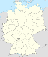
Deutsch: Positionskarte von Deutschland mit Grenzen der Regierungsbezirke und Landkreise
Quadratische Plattkarte, N-S-Streckung 150 %. Geographische Begrenzung der Karte:
English: Location map of Germany with waterbodies
Equirectangular projection, N/S stretching 150 %. Geographic limits of the map:
|
| Date | |
| Source |
Own work This W3C-unspecified vector image was created with Adobe Illustrator. This SVG file was uploaded with Commonist. This vector image includes elements that have been taken or adapted from this file: This vector image includes elements that have been taken or adapted from this file: |
| Author |
TUBS |
| Other versions |
_-_de_-_colored.svg) |
Licensing
[edit]_location_map.svg&action=edit§ion=2)
I, the copyright holder of this work, hereby publish it under the following licenses:
This file is licensed under the Creative Commons Attribution-Share Alike 3.0 Unported license.
- You are free:
- to share – to copy, distribute and transmit the work
- to remix – to adapt the work
- Under the following conditions:
- attribution – You must give appropriate credit, provide a link to the license, and indicate if changes were made. You may do so in any reasonable manner, but not in any way that suggests the licensor endorses you or your use.
- share alike – If you remix, transform, or build upon the material, you must distribute your contributions under the same or compatible license as the original.

|
Permission is granted to copy, distribute and/or modify this document under the terms of the GNU Free Documentation License, Version 1.2 or any later version published by the Free Software Foundation; with no Invariant Sections, no Front-Cover Texts, and no Back-Cover Texts. A copy of the license is included in the section entitled GNU Free Documentation License. |
You may select the license of your choice.

|
I'd greatly appreciate, that you attribute this media file to Wikimedia Commons, if used outside Wikipedia or Commons. For use in publications such as books, newspapers, blogs, websites, please insert here the following line:
|
_location_map.svg)
File history
Click on a date/time to view the file as it appeared at that time.
| Date/Time | Thumbnail | Dimensions | User | Comment | |
|---|---|---|---|---|---|
| current | 12:40, 14 May 2022 | | 1,073 × 1,272 (2.21 MB) | TUBS (talk | contribs) | erlangen + höchstadt - double borders |
| 12:18, 14 May 2022 |  | 1,073 × 1,272 (4.18 MB) | TUBS (talk | contribs) | Reverted to version as of 09:22, 14 February 2020 (UTC): reverted. Did more harm than good (esp. concering islands in the Baltic and North See) and double/ghost borders. Will deal with the Franconian issue later. | |
| 08:49, 7 December 2021 |  | 1,073 × 1,272 (4.15 MB) | TUBS (talk | contribs) | erlangen + höchstadt vereint | |
| 09:22, 14 February 2020 |  | 1,073 × 1,272 (4.18 MB) | TUBS (talk | contribs) | pushed LK Kehlheim to the right Bezirk. ((This is not an update. Some districts have merged by now, e.g. Göttignen/Osterode. Some borders have changed as of February 2020. Don't have the time to redraw the map.) | |
| 13:01, 29 October 2013 |  | 1,073 × 1,272 (3.17 MB) | TUBS (talk | contribs) | ||
| 12:52, 29 October 2013 |  | 1,073 × 1,272 (1.61 MB) | TUBS (talk | contribs) | real loc map | |
| 18:44, 28 October 2013 |  | 1,073 × 1,272 (5.82 MB) | TUBS (talk | contribs) | == {{int:filedesc}} == {{Information |Description={{de|Karte der politischen Gliederung Deutschlands in Länder, Regierungsbezirke, Landkreise und krsfr. Städte}} {{en|Map of administrative divisions of Germany. States, government districts, districts... |
You cannot overwrite this file.
File usage on Commons
The following 32 pages use this file:
- File:Deutschland Autobahnen.svg
- File:East-West-Germany-October 1949-July 1952.svg
- File:East Germany location map.svg
- File:Germany, Federal Republic of location map 23 May 1949 - 6 Oct 1949.svg
- File:Germany, Federal Republic of location map April 1952 - August 1955.svg
- File:Germany, Federal Republic of location map December 1950 - April 1952.svg
- File:Germany, Federal Republic of location map January 1957 - October 1990.svg
- File:Germany, Federal Republic of location map October 1949 - November 1950.svg
- File:Germany, Federal Republic of location map September 1955 - December 1956.svg
- File:Germany, German Democratic Republic location map January 1957 - October 1990.svg
- File:Germany, German Democratic Republic location map July 1952 - January 1957.svg
- File:Germany, German Democratic Republic location map October 1949 - July 1952.svg
- File:Germany, German Democratic Republic location map w·o FRG July 1952 - October 1990.svg
- File:Germany, German Democratic Republic location map w·o FRG October 1949 - June 1952.svg
- File:Germany, administrative divisions (+districts) - de - colored.svg
- File:Germany, location map (SBZ perspective) 23 May 1949 - 6 Oct 1949.svg
- File:Germany2 location map.svg
- File:Germany (+districts +municipalities) location map.png
- File:Germany (+districts +municipalities) location map 2013.svg
- File:Germany (+districts +municipalities) location map current.svg
- File:Germany location map.svg
- File:Germany location map 23 April 1949 - 22 May 1949.svg
- File:Germany location map 8 Jun 1947 - 22 Apr 1949.svg
- File:Germany location map April 1992 - July 1992.svg
- File:Germany location map August 1992 - June 1993.svg
- File:Germany location map July 1993 - December 2009.svg
- File:Germany location map October 1990 - March 1992.svg
- File:Germany location map labeled 8 Jun 1947 - 22 Apr 1949.svg
- File:Lage Freiberg in Deutschland.png
- File:Relief Map of Germany.png
- File:Relief Map of Germany.svg
- Template:Germany location map/other versions
_23_May_1949_-_6_Oct_1949.svg)
_location_map.png)
_location_map_2013.svg)
_location_map_current.svg)
File usage on other wikis
The following other wikis use this file:
- Usage on de.wikipedia.org
_location_map.svg&oldid=655989313)