File:Ghana location map.svg
Jump to navigation
Jump to search

Size of this PNG preview of this SVG file: 443 × 599 pixels. Other resolutions: 177 × 240 pixels | 355 × 480 pixels | 568 × 768 pixels | 757 × 1,024 pixels | 1,514 × 2,048 pixels | 964 × 1,304 pixels.
Original file (SVG file, nominally 964 × 1,304 pixels, file size: 244 KB)
Captions
Captions
Add a one-line explanation of what this file represents
Summary[edit]
| Description |
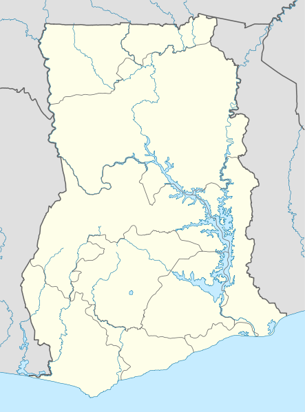
Deutsch: Positionskarte von Ghana
Quadratische Plattkarte. Geographische Begrenzung der Karte:
English: Location map of Ghana
Equirectangular projection. Geographic limits of the map:
|
| Date | |
| Source |
Own work (Original text: own work, using)
|
| Author | NordNordWest |
| Other versions | Derivative works of this file: Regions of Ghana.svg |

|
This map has been made or improved in the German Kartenwerkstatt (Map Lab). You can propose maps to improve as well.
|
Licensing[edit]
NordNordWest, the copyright holder of this work, hereby publishes it under the following licenses:

|
Permission is granted to copy, distribute and/or modify this document under the terms of the GNU Free Documentation License, Version 1.2 or any later version published by the Free Software Foundation; with no Invariant Sections, no Front-Cover Texts, and no Back-Cover Texts. A copy of the license is included in the section entitled GNU Free Documentation License. |
This file is licensed under the Creative Commons Attribution-Share Alike 3.0 Unported license.
Attribution: NordNordWest
- You are free:
- to share – to copy, distribute and transmit the work
- to remix – to adapt the work
- Under the following conditions:
- attribution – You must give appropriate credit, provide a link to the license, and indicate if changes were made. You may do so in any reasonable manner, but not in any way that suggests the licensor endorses you or your use.
- share alike – If you remix, transform, or build upon the material, you must distribute your contributions under the same or compatible license as the original.
You may select the license of your choice.
File history
Click on a date/time to view the file as it appeared at that time.
| Date/Time | Thumbnail | Dimensions | User | Comment | |
|---|---|---|---|---|---|
| current | 20:09, 15 March 2010 | | 964 × 1,304 (244 KB) | NordNordWest (talk | contribs) | upd |
| 21:05, 24 July 2008 |  | 483 × 653 (254 KB) | NordNordWest (talk | contribs) | {{Information |Description= {{de|Positionskarte von Ghana}} Quadratische Plattkarte. Geographische Begrenzung der Karte: * N: 11.4° N * S: 4.5° N * W: 3.6° W * O: 1.5° O {{en|Location map of Ghana}} Equirectangular projecti |
You cannot overwrite this file.
File usage on Commons
The following 12 pages use this file:
- User:NordNordWest/Gallery/Location maps
- File:Ghana - Ashanti.svg
- File:Ghana - Brong-Ahafo.svg
- File:Ghana - Central.svg
- File:Ghana - Eastern.svg
- File:Ghana - Greater Accra.svg
- File:Ghana - Northern.svg
- File:Ghana - Upper East.svg
- File:Ghana - Upper West.svg
- File:Ghana - Volta.svg
- File:Ghana - Western.svg
- File:Regions of Ghana.svg
File usage on other wikis
The following other wikis use this file:
- Usage on af.wikipedia.org
- Usage on am.wikipedia.org
- Usage on arz.wikipedia.org
- Usage on ba.wikipedia.org
- Usage on bg.wikipedia.org
- Usage on bn.wikipedia.org
- Usage on ce.wikipedia.org
- Usage on ckb.wikipedia.org
- Usage on de.wikipedia.org
- Usage on de.wikivoyage.org
- Usage on ee.wikipedia.org
- Usage on en.wikipedia.org
- Usage on eo.wikipedia.org
- Usage on es.wikipedia.org
- Usage on eu.wikipedia.org
- Usage on fr.wikipedia.org
- Usage on he.wikivoyage.org
- Usage on hsb.wikipedia.org
- Usage on io.wikipedia.org
- Usage on it.wikivoyage.org
- Usage on kaa.wikipedia.org
- Usage on kbd.wikipedia.org
- Usage on kk.wikipedia.org
- Usage on ku.wikipedia.org
- Usage on lv.wikipedia.org
- Usage on mk.wikipedia.org
- Usage on ml.wikipedia.org
- Usage on mn.wikipedia.org
- Usage on mr.wikipedia.org
- Usage on ms.wikipedia.org
- Usage on or.wikipedia.org
- Usage on os.wikipedia.org
- Usage on pa.wikipedia.org
- Usage on pt.wikipedia.org
- Usage on sco.wikipedia.org
- Usage on sk.wikipedia.org
View more global usage of this file.